National Geographic
Australia, Antarctica, and Oceana
Go on a traveling adventure throughout Australia, Oceana, and Antarctica! This textbook excerpt offers a full unit of study that can easily be supplemented by extra projects or research materials. Learners study maps, read about native...
Florida Center for Reading Research
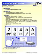
Phonemic Awareness: Phoneme Segmenting, Phoneme Counting Sort
Pre-readers use the provided cards to say and sort based on the number of phonemes in each word.
Curated OER
Understanding Geography
Students create a map of their own neighborhood to show the relationships between the geography of the neighborhood and its economy and culture. They view and discuss an introductory video on how geographers study an area then go out...
Curated OER
Establishment of Plainfield
Eighth graders analyze documents and maps of Plainfield, CT from different time periods, then, working in a small group, create a map for a giventime. In this Plainfield lesson, 8th graders read primary and secondary sources from local...
Curated OER
Where in the World Is Mexico?
Students practice map-reading skills as they locate Mexico and its cities on a world map. By creating a puzzle out of a map of Mexico, students engage in a meaningful hands-on activity to help them explore that country's geography.
Curated OER
The Big Circle
Students explore geography by participating in a mapping activity. In this concentric ring lesson, students utilize a poster board, string and markers to identify their current location within the entire world. Students write about their...
Curated OER
What Are Maps For?
Young scholars create a story about a problem someone could have which could be solved by the use of a map. They complete a worksheet that guides them through the features of a map of Chicago. Then they calculate story problems using...
Curated OER
Where Am I? Navigating Around the Globe
Third graders review spatial sense learned in grades one and two. They measure distances using map scales. They use atlases, and on-line sources to find geographical information.
Curated OER
Trading Up?
Students explore the benefits and drawbacks of free trade from the perspective of the United States, Canada, Brazil, Argentina, Venezuela, Chile and Mexico. For homework, they each write a letter to the editor expressing their personal...
Curated OER
Stellar Navigation
Middle schoolers are introduced to the concept of stellar navigation. Inside a portable digital planetarium they identify various stars that were used as a navigational tool. They go through several activities in which they attempt to...
Penguin Books
The Curriculum Guide for The Secret Hum of a Daisy by Tracy Holczer
The death of a parent can turn a child's world upside down. A curriculum guide for The Secret Hum of a Daisy explores defining moments in the main character's life, including the loss of her mother. Chapter-by-chapter discussion...
Curated OER
How to Make a College Plan
Log on and create learner accounts on the Big Future website, then let the lesson begin! Pupils log onto the website to explore college options. They use the tools provided to create a step-by-step college plan. This will help relieve...
Carnegie Mellon University
Renewables Workshop
Youngsters examine resource maps to find out which states are using solar and wind power and discuss as a class various other renewable energy sources. They use a provided data table to record pros and cons to each technology, build and...
Annenberg Foundation
The New Nation
The conclusion of the American Revolution brought about a new conflict—choosing the stye of government for the newly formed United States. Using the views of both Federalists and Anti-Federalists, learners work in pairs and groups to...
Curated OER
The Kansas-Nebraska Act of 1854: Popular Sovereignty and the Political Polarization over Slavery
Why did Stephen Douglas support the Kansas-Nebraska Act of 1854? Why did Abraham Lincoln oppose it? Young historians examine how the Kansas-Nebraska Act of 1854 affected the political balance between free and slave states and explore how...
Curated OER
Foliage Tracker
Young scholars discuss the change of leaf colors and the role that climate and elevation play in those changes. They then track leaf changes, input data, and graph foliage changes with a free online tool.
Mojang
Minecraft – Pocket Edition
You don't have to be a Minecraft wiz to know that this app has great playability for your learners! As afterschool programs and classroom projects around the world demonstrate, this game goes well beyond placing blocks and traditional...
Curated OER
Newport Weather Project
Students study weather and climate patterns using computer and Internet resources. They collect temperature information and share it with other classes via e-mail using graphs
Curated OER
The Monkey's Paw
In this reading comprehension worksheet, students complete a variety of activities which demonstrate understanding of the book The Monkey's Paw .
Curated OER
Comparing Countries
Students compare facts about different countries. In this comparing lesson plan, students collect information about the US and another country and compare them. Students locate countries on the map and make a hypothesis about the lives...
Curated OER
Slavery and the Underground Railroad
Fourth graders study slavery escape routes of the Underground Railroad on maps, read an account of an escape and then write narrative essays about a fictional slave's escape.
Curated OER
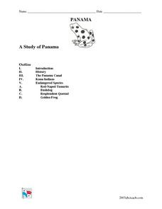
A Study of Panama
In this worksheet on Panama, students read an introduction about Panama, then read about its history, The Panama Canal, the Kuna Indians and the Endangered Species of Panama. After each selection, students answer a set of related questions.
Curated OER
The Earth, Sun, Moon, And Stars
Fifth graders explore the solar system. In this solar system unit, 5th graders investigate numerous projects while rotating through learning centers. Students write about space and construct a space shuttle model. Students practice map...
Curated OER
Sequential Directions
Learners demonstrate how to give clear directions when drawing a map to a specific location. In this map skills lesson, students create a map to a location, such as their school, and write down clear directions to the destination.


