Curated OER
Journey of Discovery and Rivers
Young scholars investigate the rivers encountered and mapped by the Corps of Discovery. They analyze maps, outline and label rivers on a blank map, complete a chart, and answer discussion questions while watching a National Geographic...
Curated OER
GPS Treasure Hunt for Knowledge
Students examine themselves as being part of a global community. In this global community lesson, students investigate GPS systems. Students gain knowledge on how the device works. Students discover that satellites provide information...
Curated OER
Alexander Hamilton and the Roots of Federalism
Explore the origin of political parties in the United States. Learners work in groups to read and analyze copies of the "Report on Manufactures" written by Alexander Hamilton. Then, they complete a worksheet comparing the Federalists to...
Curated OER
What's Russia To Do?
Students watch a PowerPoint presentation on the Gulag system in Russia. In groups, they use the internet to create maps on climate and population pyramids for the country of Russia. They must use this information and develop a plan to...
Curated OER
Dalai Lama
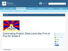
Sixth graders use skills and knowledge that they gained from their Tibet unit to formulate a final product of their Tibet journey. This study covers topics such as Tibet's geographical location, religious beliefs, customs, dress, and way...
Curated OER
Around the World At 30o North Latitude
Reinforce the use of an atlas and reference materials with writers. They discover how geographic location can make living easier or harder. They draw an assigned journey on a map, categorize survival needs, and prioritize options during...
Curated OER
Silk Road Caravan
Young scholars determine how the geographic features of the Silk Road trade route contributed to the economic development and diffusion of culture in both Eastern and Western Civilizations.
Curated OER
The Geography - Writing Connection
Students examine and describe the four physical systems of the Earth. Using two of the systems, they practice their writing skills and use vocabulary associated with the different types of landforms. They predict the types of shelters...
Curated OER
Weather Pals
Students study maps of the United States to locate weather pals from a list of schools. They communicate with Weather Pal schools through the use of closed circuit TV. Using weather data collected in their area, they exchange the...
Curated OER
Africa: Introduction, Geography and Mapping
Students study the geography of Africa through the use of maps. They locate, distinguish, and describe the relationships among varying regional and global patterns of geographic phenomena such as landforms, climate, and natural resources.
Curated OER
Splish Splash
Students study drinking water. In this environment lesson, students draw the path of drinking water from the place of precipitation to the tap after researching a map and information from the United States Geological Survey water...
Curated OER
Passport to Africa
Students begin the lesson by reading a novel about the diversity of geography in Africa. They are to create an oral report based on information they research. They also communicate with someone through email about the situation in Africa.
Curated OER
Animals
Students become familiar with the need for categorizing scientific information, in this case, animals. They categorize the 5 groups of animals in a collage and answer questions about each.
Curated OER
Civil Rights and the Michigan Supreme Court II
High schoolers view a PowerPoint presentation on the Michigan Supreme Court Historical Society's Civil Rights and/or the Native American Rights. They write a reaction paper and prepare for a class discussion. They work in groups and...
Curated OER
Roll-A-Story
Students combine the use of geographical information and writing. They write a story and create a visual aid to be used when presenting to the class. They move to different stations deciding which topic they want to further research. ...
Curated OER
The Census of Marine Life
Students explain diversity and abundance in marine life. In this oceanic biology lesson, students collect information for various geographical areas to collect a census of marine life.
Curated OER
It’s a Big, Big World
Students examine the role of the explorers. In this explorers and conquistadors, students create word puzzles (Wordles) regarding the time period in history. Students conduct research regarding a particular explorer and create foldables...
Curated OER
Graphing and Analyzing Biome Data
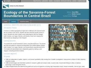
Students explore biome data. In this world geography and weather data analysis instructional activity, students record data about weather conditions in North Carolina, Las Vegas, and Brazil. Students convert Fahrenheit degrees to Celsius...
Curated OER
Expanding Children's Geographic and Economic Worlds
Students learn their addresses and gain a sense of connection between their neighborhood and the rest of the world and the universe.
Geophysical Institute
Latitude and Longitude with Google Earth
Travel the world from the comfort of your classroom with a lesson that features Google Earth. High schoolers follow a series of steps to locate places all over the earth with sets of coordinates. Additionally, they measure the distance...
Curated OER
Native Americans of the Chesapeake Bay: Using Primary vs. Secondary Sources
Discover the rich Native American culture that existed at the time of early European exploration into the Chesapeake region through analysis of several primary and secondary sources.
Curated OER
Fluctuations in the Price of Oil
Learners examine the fluctuating gas prices and the effect it has on the Canadian economy by reviewing an online database that contains information on the retail price of gas for Canada's largest cities.
Curated OER
Behold the Wonder of Creation
Fifth graders explore and become familiar with U.S. National Parks. They research several parks and compile the information they find into a spreadsheet. They plan and write a report/booklet about one of the U.S. National parks.
Curated OER
Where in the World is Mr. Fultz?
Students use maps and other geographic resources to learn about their world while problem solving. They read clues each day and use classroom resources to narrow down where the prize is located.
Other popular searches
- Gis Data
- Gis Map
- Gis Software
- Gis Environment
- Gis and Gps Technology
- Gis Gps
- Gis and Remote Sensing
- Gis Data Map
- Geography, Gis
- Gis Lesson Plans
- Gps/gis
- Gis Water


