Curated OER
How Can We Organize Study of a Given Place?
Seventh graders embark in discovery of basic facts about an assigned continent and are asked to organize their information into categories. The Five Themes model is taught and students reshuffle their information appropriately.
Curated OER
Omaha Immigration Case Study
Eleventh graders explore the immigration patterns in the United States. In this American History lesson, 11th graders study the push and pull factors that caused immigration. Students research one group of individuals and...
Curated OER
The Global Grapefruit - Representing a 3-Dimensional Globe on a 2-Dimensional Map
Students compare and contrast world maps and globes. They convert a 3-dimensional globe to a 2-dimensional map. They are introduced to the Mercator map projection. They observe map distortions of shape, area, distance, directions and angle.
Curated OER
Latitude and Longitude
Fifth graders study latitude and longitude. They estimate the latitude and longitude of their hometown and find the latitude and longitude of other cities using a map. They use a website to find out the cities' actual latitude and...
Curated OER
Water and Land 207
Students examine maps of different projections, mathematically calculate distortions, and note the advantages and disadvantages of each map. They study the different maps and transfer the map to graph paper.
Curated OER
Mapping the West
Students determine how Americans' perception of the geographical features of the West changed following the Lewis and Clark expedition. They analyze historical maps of the West.
Curated OER
Lets Put Delaware On The Map
Learners compare and contrast historical and modern maps of Delaware. Through class discussion and group activities, students analyze maps and make comparisons. Each group participates in a game to aid in discerning the similarities...
Curated OER
Studies of the Eastern Worlds: Cultural Maps
Seventh graders look for similarities and differences in the culture of Eastern World countries by looking at the art from each country. They test their hypothesis and assumptions through further research in the media center. Finally...
Curated OER
THE GULF STREAM
Students explore how to describe the Gulf Stream, how Benjamin Franklin charted it, and correctly plot it on a map.
Curated OER
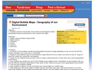
Geography of Our Environment
Learners explore geographical elements. In this geographical elements lesson, students create a map showing the geographical elements in their area. Learners take pictures of these elements to glue to their map and present it to the class.
Curated OER
Making Sense Of A Round World On A Flat Surface
Young scholars engage in a instructional activity that is concerned with the development of geography skills. They take part in a number of activities that center around finding and traveling to different locations. The instructional...
Curated OER
WANTED EXPLORERS
Learners create their own country and explore other unknown lands. Students identify past explorers and complete the included case of the missing trunks webquest. Learners research resources and geographical features for their created...
Curated OER
Our 50 States
Students identify the location of the 50 states using an interactive map. They practice geography skills by playing a fun game. Pupils become familiar with the state abbreviations for the US states. Students become familiar with the...
Curated OER
We've got the whole world in our hands
Students explore spatial sense in regards to maps about the globe. In this maps lesson plan, students label oceans, locate the continents and poles, follow directions, and explain the symbols on a map.
Curated OER
Metrics And Measurements
Middle schoolers engage in a study of measuring distances between geographical locations on a map. They are able to define and use the map scale in conjunction with the metric system. For this lesson plan they make their own maps and...
Curated OER
Capitals, Oceans, And Border States
Students investigate geography by completing games with classmates. In this United States of America lesson, students examine a map of North America and identify the borders of Mexico and Canada as well as the Pacific and Atlantic....
Curated OER
Having a Hot Time on Mars!
In this cosmic radiation on Mars worksheet, students study a radiation map of Mars taken by the MARIE instrument on the Odyssey spacecraft. Students answer 4 questions using the radiation map and they answer questions about the exposure...
Curated OER
Klondike Fever
Students consider the geographical aspects of the gold rush. For this gold lesson, students research just what gold is and where it has been found. Students create maps that highlight the regions of the world where gold has...
Curated OER
Site and Situation: Right Place at the Right Time
Students analyze geographic details. For this research skills lesson, students research maps as well as primary and secondary sources to analyze growth, population, and manufacturing in Altoona, Pennsylvania...
Curated OER
Geography Booklet
Sixth graders explore geography terms. Students use resources to find real examples of landforms in the world. They create a map showing the landform. students label the surrounding features, countries and states. Students use each...
Curated OER
Making a Travel Brochure of a Louisiana Parish
Although the attachments for this travel brochure project are no longer linked, you can still use the idea here and create your own assignment sheet and rubric. Learners choose a parish in Louisiana (or a city in your state) to research,...
Curated OER
Urban Geo Worksheet
In this urban geography worksheet, students respond to 20 short answer questions about urban geography after they have read a related article. The article is not included.
Curated OER
Finding Latitudes and Longitudes
Middle schoolers analyze Columbus' rationale for sailing west, and find the latitude and longitude of modern and ancient place names.
Curated OER
Mapping Your Community
Students define the boundaries of their community by comparing the community's official boundaries with other historical, political, physical, and perceived boundaries of the area and create a community map.


