Curated OER
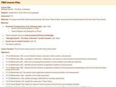
Aldridge Sawmill - The Story in Numbers
Seventh graders practice math skills while becoming familiar with Texas' "Boom & Bust" economy and the natural history of the east Texas Piney Woods. They utilize worksheets and websites imbedded in this plan.
Curated OER
Classroom Triangles
Students use bearing measurements to triangulate and determine objects' locations. Working in teams of two or three, students must put on their investigative hats as they take bearing measurements to specified landmarks in their...
Curated OER
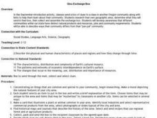
Geo-Exchange Box
Students send a box of clues to a class in another Oregon community along with hints to help them study about their community. Students research their own geographic area, determine what they send in their box, then collect and assemble...
Curated OER
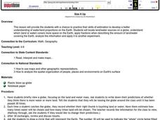
Size It Up
Pupils practice their math skills in determining the water/land proportions of the Earth. Using globes, they locate the seven continents and oceans and determine which covers more space. They use this information to participate in...
Curated OER
Off to See the World!
Second graders use games that use the atlas and the globe. Students take a ride (journey). Students place their chairs as if they are riding in a car. The Teacher is the driver. As the students travel along they point out different sites...
Curated OER
Wisconsin Snapshots
Fourth graders study Wisconsin's culture and heritage. They research the state's symbols and identify leaves common to the Wisconsin area. They create a leaf booklet and visit the state park. They visit local farms and create nature maps...
Curated OER
Science: Rock On!
Fourth graders explore the traits of rocks and minerals in their local area. After creating a rock and mineral legend, they color maps based on their legends. Once students examine rock and mineral specimens, they draw pictures of them.
Curated OER
Shore is Windy!
Students consider what a hurricane is and how it impacts both land and people, explore the speculations surrounding Hurricane Isabel, research potential target sites and create maps illustrating how Isabel may affect them.
Curated OER
Wolf Pack in a Bottle
Young scholars participate in an activity of a mock electrophoresis using paper chromatography to study DNA and genetic restriction mapping.
Curated OER
Anolis Lizards of the Greater Antilles
Students "take a trip" to the Greater Antilles to observethe Anolis lizards. They study the body structures and habitat of different species, then plot this data on a map to look for patterns in their distribution. From the patterns they...
Curated OER
Regions of the US: Gulf Stream, States and Their Capitals
Fifth graders identify one way of dividing the US into geographical regions and then consider alternate ways of doing the same. They locate each of the fifty states and their capitals on a map. They research the Gulf Stream region.
Curated OER
Town Development
Students use a map of Kansas in the 1800s to discuss town development and issues related to slavery. They create fictitious towns to promote to outsiders.
Curated OER
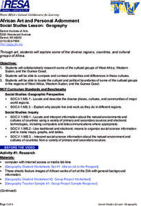
Geography
Students work together in groups to research the cultural groups of West Africa, Sudan and the Guinea Coast. They compare and contrast each culture and locate the political and cultural boundaries on a map.
Curated OER
Watershed Investigations
Students find maps of the region to show rock formations and soil types and use GIS to compare radon levels. They describe three types of radioactive decay, interpret graphs, and follow steps to develop a nuclear bomb or energy.
Curated OER
Lewis and Clark
Fourth graders research the Lewis and Clark expedition and the Corps of Discovery. They explore a variety of websites and complete a WebQuest, analyze maps, and answer comprehension questions. Students also write journal entries and...
Curated OER
Banpo Village: Gone, But Not Forgotten
Sixth graders plan a trip to China and prepare yourself for the Banpo excavation site competition by studying prehistoric and ancient Chinese history.
Curated OER
Wright Brothers Centennial: North Carolina, Creation and Development of the State
Eighth graders examine technological advances and how they influenced the quality of life in North Carolina. Using maps, they locate the city of Kitty Hawk and discuss why it was chosen for the first flight. They read primary source...
Curated OER
Environment: Going Places
First graders learn directional words and apply this skill to map making. They record their steps on paper.
Curated OER
Water, Water Everywhere, and Nary a Drop to Drink!
Students sing the continent song and locate oceans between the continents on a map. They read "They Earth is Mostly Ocean" and copy notes into their journals. They watch a demonstration of water and saltwater evaporated to see what is...
Curated OER
Spanish Colonization: The Anza Expedition
Learners research the Spanish explorations and North American geography. They create web pages based on their study.
Curated OER
Touchstones
Young scholars locate monuments in their neighborhoods and sketch them. They are shown slides of two modern monuments, the Vietnam Memorial and the Holocaust Monument in Edgewood Park. They read the article in National Geographic, Vol....
Curated OER
The Kanaka Village at Fort Vancouver: Crossroads of the Columbia River
Young scholars study the interaction between Native American and European cultures in the Pacific Northwest in the 1800s. They focus their study on the Hudson's Bay Company and Fort Vancouver.
Curated OER
Cultural America
Seventh graders investigate the cultural differences that can be found in America. They discuss what it means to be called an American. The patterns of migration to America are discussed with the use of maps and geographical terms....
Curated OER
Don't oZone Out
Students study the ozone and measure its concentration in different areas. Students use Ecobadge strips and other equipement for measurement. Then they share their results on an on-line forum. Also, students study environmental problems.


