Curated OER
What in Our World Affects the Way People Live
Sixth graders study various maps that show geographical features and population. They compare the maps and make inferences about how various geographical features influence the population and human activities of an area.
Curated OER
Geography With Dr. Seuss
Students read the book, The King's Stilts by Dr. Seuss and discuss the geographical information given in the book. Then they discuss and locate on a map the physical features that make up the continent of Africa. They create an original...
Curated OER
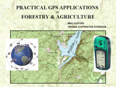
Practical GPS Applications in Forestry & Agriculture
An explanation of the Global Positioning System (GPS) and the Geographic Information System (GIS) is given in this presentation. Uses and applications are considered. How it works and sources of error are also touched upon. A large...
Curated OER
Where in the World is Hawaii?
Students compare a globe and a two-dimensional world map and explore how they both represent the planet Earth. They locate the Hawaiian Islands on the globe or the world map and describe how the geographical position is unique.
Curated OER
The Mind Map
Learners form a mental map of their residence in relation to school and recreate it on paper showing distance, direction, location and symbols. This lesson is designed to introduce young scholars to geographic thinking.
Curated OER
Compass Rose for the New Millennium
Sixth graders are introduced to the concepts of a compass rose and how it used in relationship to reading maps in geography. The instructional activity is meant to build upon prior knowledge and skills.
Curated OER
Weather Pals
Learners study maps of the United States to locate weather pals from a list of schools. They communicate with Weather Pal schools through the use of closed circuit TV. Using weather data collected in their area, they exchange the...
It's About Time
The Changing Geography of Your Community
Lead your class in exploring their local communities as well as the general environment. As they determine continental distributions by investigating minerals, rocks, and fossils located in their local region, pupils construct...
Happy Housewife
State Notebooking Pages
When learning about US geography, it can hard to remember facts about 50 different states. Help your young scholars organize all of this information with a collection of easy-to-use note-taking guides.
Curated OER
Maps, Charts, and Graphs
Students define key geographic terms and track a hurricane on a map. They examine various types of maps and find locations on them,including rivers, cities and mountains.
Curated OER
What do Maps Show?
Eighth graders practice the skill of reading maps. In this geography lesson, 8th graders participate in a classroom lecture on how to read a map.
Curated OER
Silk Roads Big Map
Students create an oversized map from Europe to East Asia. They include information such as Silk Roads, geographical features, major cities and cultural information on their map.
Curated OER
Mapping Roxaboxen
Fourth graders read Roxaboxen and draw a map of the Roxaboxen community. In this language arts and geography lesson, 4th graders use specifications given, adding features to the map as described in the book and creating a legend.
Curated OER
North America Outline Map
In this blank North America outline map worksheet, students study the political boundaries of the continent. This outline map may be used for a variety of geographic activities.
Curated OER
Yo Ho, Yo Ho, A Pirate's Map for Me: An Original Story
Students read Blackbeard and brainstorm their knowledge of maps. For this language arts and geography lesson, students use landmarks on their playground to review north, south, east and west and discuss the compass rose. Students read...
Curated OER
Geography: Continents
First graders identify basic geographical facts about the world they live in and distinguish between land and water on a globe. They research the continents and information associated with each one focusing on building their map skills.
Curated OER
Cartographer on Assignment: Creating a Physical Map of Africa
Students use geographic information to make an outline map of Africa, then demonstrate their understanding of the physical landscape of Africa by using a variety of materials to create a physical map of Africa
Curated OER
A Feature Presentation - Geographic Landforms
Students investigate, identify and compare the various geographic terms that can be used to describe the landforms occurring in the Hawaiian islands.
Curated OER
Mapping the Prairie
Fifth graders study maps of the Chicago area looking at defining characteristics and place names. They investigate settlement patterns by looking at the maps.
Curated OER
The Vietnam War: Geopolitical map and US Involvement
Students identify the important geographic and political locations on a map of Vietnam, Laos, and Cambodia. They draw and label 19 items of geographic and political importance. Students are introduced to the Vietnam War through power...
Curated OER
Mapping Your Way Around
First graders identify a map, symbols on a map, and locate places on a map. Finally, they construct a map
Curated OER
Things That Stick Out Or: How To Find Your Way Around on a Map
Learners explain the meaning of and recognize the map outlines of a peninsula, an isthmus, and a cape.
Curated OER
You Can Find It!
Students, in groups, use longitude and latitude to locate various places on a map.


