Curated OER
Weather Pals
Learners study maps of the United States to locate weather pals from a list of schools. They communicate with Weather Pal schools through the use of closed circuit TV. Using weather data collected in their area, they exchange the...
Curated OER
The Affects of Environment on Native American Culture
Students research the culture of the Native Americans. For this U.S. History lesson, students are given the major geological areas where the Indians lived prior to the arrival of the Europeans, then they create a notebook that...
Curated OER
Where is the Trail? The Journey of Lewis and Clark
Learners explore the trail followed by Lewis and Clark on their journey across the United States. In this United States History lesson, students complete several activities to establish the Lewis and Clark Expedition, including a class...
Curated OER
Build the Tallest Building
Students examine the design and construction of skyscrapers. They use the internet to research information about different types of skyscrapers. They create their own building and defend it to the class.
Curated OER
"The Drum"
Second graders read and discuss the folktale "The Drum" from India. They also answer story comprehension questions, complete an adjectives and verb worksheet, and label a map of India. Students sequence events from the story and make...
Curated OER
Weather Watchers
Students identify basic weather instruments and how they are used to record weather data. Students define several vocabulary terms as stated in lesson. Students use basic instruments to record weather data in their area. Students use the...
Curated OER
NIGHT AND DAY: DAILY CYCLES IN SOLAR RADIATION
Students examine how Earth's rotation causes daily cycles in solar energy using a microset of satellite data to investigate the Earth's daily radiation budget and locating map locations using latitude and longitude coordinates.
Curated OER
THE GULF STREAM
Students explore how to describe the Gulf Stream, how Benjamin Franklin charted it, and correctly plot it on a map.
Curated OER
Hawk in Flight
Students use information gathered by satellites to explore the migration of the Swainson's hawk from the western border of Minnesota to the southern portion of South America.
Curated OER
America the Beautiful
Students listen to a read-aloud discussing the landmarks of the United States. In pairs, they use the internet to research a landmark of their choice. They create a visual aid to be given with a presentation sharing the information...
Curated OER
Where Is Hoku?
Young scholars are introduced to map making and reading. Using maps, they identify the cardinal directions and discuss the importance of a legend. They analyze the human characteristics of the classroom and create overhead view maps of...
Curated OER
Malia
Fourth graders begin their examination of the Hawaiian Islands. Using their island bookmarks from a previous instructional activity, they work together to put the information into a book. They identify the physical and human...
Curated OER
Cartographer on Assignment: Creating a Physical Map of Africa
Students use geographic information to make an outline map of Africa, then demonstrate their understanding of the physical landscape of Africa by using a variety of materials to create a physical map of Africa
Curated OER
Spice Up Your Life
Second graders identify major spices found in the world. They link spices with countries they are grown in and the uses for these valuable items.
Curated OER
Sandscapes to Landscapes
Students explore landscapes and create their own in a creative project.
Out of Africa Wildlife Park
A Thematic Learning Guide to Lions
Written as an accompaniment to a field trip to the Out of Africa Wildlife Park in Arizona, this is an interdisciplinary, themed lesson on lions. Even if you cannot take your upper-elementary kids to this attraction, there are a few...
Curated OER
What Do Maps Show?: Lesson 1 Introduction to Maps
Students brainstorm a list of the different types of maps they have seen or used. Using the activity sheet, they look through a social studies book to find all the maps and to determine what they are used for. Using a poster, they review...
Curated OER
Where Does It Come From?
Learners explore where agricultural commodities used in snack foods are grown. They choose a snack food and locate the top five states that produce the food that the snack is made from.
Curated OER
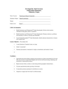
Exploring and Oregon Commodity
A fun (and delicious!) lesson teaches measurement to your third graders. They work in small groups to first predict, then to measure the weight, circumference, and number of seeds found in a watermelon. Everyone gets to eat watermelon...
Curated OER
How Does the Earth's Energy Budget Relate to Polar Ice?
Students use satellite data to see how radiation budget relates to the ice that is present in the North. In this energy lesson students correlate data to see a relationship.
Curated OER
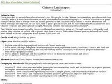
Chinese Landscapes
Learners explain some of the topographical features of China's landscape. They view a Chinese landscape and discuss their view of the harmony between man and nature, then create their own karst mountain scene.
Curated OER
California Native American Basket Weaving
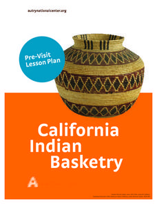
Fourth graders consider the role that baskets play in the traditional lives of Native Americans in California. Students investigate types of baskets and their various uses and then weave their own baskets.
Curated OER
Learning About the Kumeyaay Indians
Third graders research the Native American nation of Kumeyaay. Scholars use the internet to research past history. Through email, 3rd graders communicate with a Kumeyaay child to discover life on a present day reservation. They create a...
Curated OER
Weather and Water in Ghana
Students research the rainy and dry season to investigate Africa's weather. In this African weather lesson, students use the given websites to research the rainy and dry seasons of Ghana in Africa. Students then read stories about life...


