Curated OER
Understanding Canadian Weather Extremes
Students research and analyze the causes and sources of Canada's extreme weather conditions. They conduct an experiment, complete a worksheet and predict the most likely locations for extreme weather conditions.
Curated OER
A Trip Around the World
Students role play the role of a travel agent. In groups, they must plan a trip around the world making stops in a different biome. They use the internet to discover the characteristics of each biome and create a travel brochure for...
Curated OER
The First Americans
Students participate in theatre activities to study American history. In this American history and theatre lesson, students work in groups to research a specific Native American group to investigate their lifestyle. Students then create...
Curated OER
The Mountain Community: Why Flagstaff?
Students identify geographical features that hindered or promoted settlement in the city of Flagstaff, Arizona. In this settlement lesson plan, students write a summary of what they learned and identify geographical features on a map.
Curated OER
Lesson Plan on Australian Aborigines
Fourth graders investigate the nomadic lifestyle of the Aborigines both before and after the arrival fo the Europeans. They identify the roles of men and women, languages and number of tribes. They act out skits based on the lesson.
Curated OER
What and Where is Puerto Rico?
Students explore Puerto Rico. They create K-W-L charts of their prior knowledge of Puerto Rico and observe maps of Puerto Rico. They code the map for measurements and land and water forms. They explore websites to gain background on...
Curated OER
The Ghost Catcher
Second graders read the story The Ghost Cather and complete activities related to the book. In this language arts lesson plan, 2nd graders complete comprehension questions, art projects, and more.
Curated OER
Biomes and Ecosystems
Students study biomes and ecosystems. They watch videos on rainforests and the food web and select a country of ancestry or interest to research. They write a report on the flora and fauna of their selected country. They present to...
Curated OER
The Challenges Ahead
Students examine the physical obstacles that the Lewis and Clark expedition encountered on its journey. They report what challenges these physical obstacles might have posed. They review a modern-day map and explain if the obstacles...
Curated OER
From Bolls to Bolts
Fifth graders explore the economic effects of the colonization of North America. In this Social Studies lesson, 5th graders examine the economic and cultural results that occurred due to North America entering the market. Students...
Curated OER
Weather in the USA
Students identify the different types of weather conditions that occur in the United States. They discover how to adapt to weather and explain forecast and warning signals.
Curated OER
Seasonal Cloud Cover Variations
Learners recognize different cloud types. They determine the seaonality of various types of clouds. They graph the data and determine if a correlation exists between season, cloud cover and type of clouds most prevalent during each season.
Curated OER
Arctic Animals of Alaska
Students explore the natural history of arctic Alaska through lecture and discussion. They write poems and complete research papers about Arctic animals.
Curated OER
Does Humidity Affect Cloud Formation?
Students use NASA's S'COOL database to identify factors that affect cloud formation.
Curated OER
To Walk the Sky Path
Fifth graders use maps of Florida. They locate places from a list on their map. Students use the places mentioned in the book, "To Walk the Sky Path," and locate them on the map. Students should have labeled a minimum of 10 places, and...
Curated OER
Materials: Hidden Costs, Mapping the Source and Cost of Raw Materials.
Students map connections among raw materials. In this environmental stewardship lesson, students design strategies to minimize the use of raw materials and discuss how to use more sustainable materials.
Curated OER
Exploring Nations
Pupils, in groups, research countries in East and Southeast Asia. The group designs an oral presentation and PowerPoint slideshow to showcase research on landforms, political and economic issues, global interaction and special-purpose maps.
Curated OER
How to Celebrate the 800th Anniversary of the Mogol Empire
Students research information on the Mongolian Empire from various readings and online videos of primary sources and create a poster for oral presentation. Students connect history with the current day, while incorporating geographical,...
Curated OER
A Picture Is Worth A Thousand Words
Students complete a population pyramid for a city they are studying. They may complete a population pyramid for their city and another one for the country in which the city is located. They compare and contrast the results of the two...
Curated OER
Planning a Healthy City
Ninth graders create a scaled model city. They create a blueprint that provides for the economic and cultural needs of a community. They identify where essential elements of the city should be located and explain the rationale for the...
Curated OER
Indiana Tornado Project
Students become familiar with the use of GIS for research, natural phenomena in Indiana, and analyzing collected information.
Curated OER
When Travelers Meet
Students research life in Colonial America then write and stage a play about life in Colonial times. creating a variety of characters who might have lived at that time. They, in groups, generate seperate lists of characters who would...
Curated OER
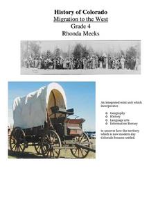
History of Colorado-Migration to the West
Fourth graders identify reasons for people moving to the Colorado Territory and examine how moving in the 1800's is different than moving today. They also practice reading maps and gathering information from maps, as well as, describe...


