Curated OER
Where's the Barbecue?
Learners identify the major landforms, regions and rivers on a map of South Carolina. They compare the locations of the major Native American groups in the state as well. They chart where barbecue restaurants are located and write...
Curated OER
"Across Oregon On The 45th N Parallel" A Transect of Oregon
Students explore the physical geography of Oregon. In groups, students collect weather and elevation information on Oregon. They organize the data and create maps and graphs of the information. Afterward, students compare the...
Curated OER
Saskatchewan's Population Distribution
Young scholars explore landforms, vegetation, climate and population distribution in Saskatchewan. After discussing an atlas of Saskatchewan, students create their own relief map and climagraphs of Saskathewan. Using specified...
Curated OER
Dreaming of a Healthy City
Ninth graders design a healthy city. They identify the essential elements of a city and describe how climate and geography can determine the layout of a city. They create a blueprint of their design and share in small groups.
Curated OER
Species and Spaces - At Risk at Home
Eleventh graders explore and compare Canadian biomes and investigate species at risk. They describe population growth and eco-regions in terms of climate and geography. They research and create presentations about the natural history and...
Curated OER
Stream Gages and GIS
students interpret recent regional-scale climate events based on current stream flow, monitor changes in time, and to consider additional interpretations that could be derived if other data were in map form.
Curated OER
Geographical Area Analysis
Students complete this instructional activity before visiting the National Museum of the Pacific War. They examine the patterns and characteristics of landforms, climates, ecosystems and cultures as they interact on areas or regions...
Curated OER
Metropolitan Areas in the USA
Fifth graders explore why people live in certain regions of the United States. They investigate information on specific metropolitan areas such as temperature, population, natural resources, precipitation and landforms. In groups, 5th...
Curated OER
Let Me Tell You About My State
Students develop an awareness of the concepts of the United States through the Amateur Radio communication services by verbally sharing information about their state such as cultures, current events, geography, history and much more.
Curated OER
Comparing Cities
Students research the characteristics of cities in two different geographical areas. Using the internet, they take notes on the information they collect and record their observations on the two cities. They discover how the location...
Curated OER
Geographical Area Analysis
Student explore the patterns and characteristics of major landforms, climates, ecosystems and cultures as they interact upon specific areas or regions. They prepare a geographic analysis of a given area.
Curated OER
Wappo Indians of Napa County
Third graders describe the American Indian nation in their local region long ago and in the recent past in terms of national identities, religious beliefs, customs, and various folklore traditions. They synthesize their findings into a...
Curated OER
Tooling Around Arizona: Reading Arizona Maps
Students study geography. For this Arizona maps lesson, students develop their map reading skills. They have class discussions and work independently with various copies of Arizona maps to practice those skills. This lesson mentions...
Curated OER
Where Does the Water Go?
High schoolers identify how the geography of the island of Maui influences the sources of water, identify/categorize the users of water on Maui after reading a series of news articles and construct a map of Maui displaying their findings.
Curated OER
The End of an Era
Pupils explore the American-Mongolian paleontology expedition of Cretaceous fossil beds at Ukhaa Tolgod in the Gobi Desert. They present information about the life forms, tectonics, climate and geology of this time.
Curated OER
Discovering Asia, Past and Present
Students research a specified country. Using the internet, Inspiration software, tourist information, and their textbooks, students create a multimedia report containing information on the climate, natural resources, the economy, and...
Curated OER
Rain Forests: A Disappearing Act?
Students examine and locate rainforests on maps, and research the patterns of their destruction. They develop a bar graph of rainfall and temperature data, write a journal entry, and research the people, animals, and plants/products of...
Curated OER
The Fabric of Our World
Young scholars discuss cultural diversity, and examine how the community reflects the cultural background of the inhabitants. They read the book, People, take a community walk, create a rainbow chart, and research other states for...
Curated OER
Cyberspace Safari
Middle schoolers go on an information gathering hunt on the Internet to study West African empires. They work in teams; meteorologists, bankers, writers, and archaeologists. They collect data on all sorts of topics related to West...
Curated OER
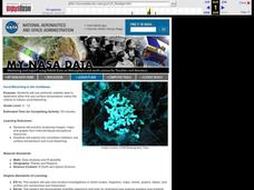
Coral Bleaching in the Caribbean
Students use authentic satellite data on the NASA website to determine when the sea surface temperature meets the criteria to induce coral bleaching.
Curated OER
The Gift of the Nile: Egypt and its River
Students begin with a piece of a puzzle that shows an artifact from ancient Egypt. They find others who have pieces that go with their puzzle piece. Students work in these groups to construct a relief map of the Nile River Valley.
University of California
The Civil War: The Road to War
The United States Civil War resulted in the highest mortality rate for Americans since the nation's inception. Delve deeper into the causes for the drastic separation of states with a history lesson plan that features analysis charts,...
Curated OER
U.S. and Canada: How are We the Same? How are We Different?
Get high school geographers to compare and contrast Canada and the United States. They begin by drawing a freehand map of North America, then complete readings to gain insight into Canada. The text is not provided; however, another text...
Curated OER
The Silk Road, An Ancient Internet
Students examine how goods and ideas moved along an ancient trade route between China and Europe. They make charts of items, ideas, etc. that were transported along the Silk Route.


