Curated OER
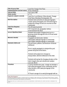
Land Use Change Over Time
Students use historical aerial photographs and current aerial photographs to compare the change over time to the land. In this land changing lesson plan, students analyze, compare, contrast, and list the land change in their own community.
Alabama Learning Exchange
The Sun and the Earth
Third graders study and diagram the positions of the Earth and sun during the four seasons. They predict weather for cities in the northern and southern hemispheres.
Curated OER
Wolves: Friend or Foe?
Students study wolves and their habitat in Yellowstone. In this environment and behavior lesson students create an interactive map of wolves in Yellowstone.
Curated OER
Journey to Gettysburg
Students use latitude and longitude to map the path of the Battle of Gettysburg.
Curated OER
Topographic Connections: Earth's Surface Shapes Streams; Streams Sculpt the Earth
Young scholars identify physical characteristics of developing streams and infer changes in the landscape by creating a river model.
Curated OER
Solving the Puzzle
Students create a map showing the United States borders at a specific period in history and produce three questions to be answered by examining the map. They also write a productive paragraph explaining who, what, when, where, how/why a...
Curated OER
How would an oil spill affect a Marine Sanctuary?
Students explore the concept of environmental stewardship. In this science lesson, students discover how scientists assess damages to the environment following oil spills. Students conduct a simulation of a public meeting in order to...
Curated OER
Fractile vs. Equal
Students compare and contrast methods of categorizing data. In this data collection lesson, students complete worksheet activities that require them to note the differences between equal and fractile intervals. Students also discuss...
Museum of Tolerance
And Justice for All? Slavery Not Just in the Past
Slavery in India, Sudan, and Mauritania? What about in the United States? Groups research modern slavery in these four countries, collecting factual evidence (What), determine their feelings about this evidence (So what), and consider...
Curated OER
Scarcity of Land Throughout the World and in Hawaii
Students discuss the importance of "land." They review the four types of land classification--urban, rural, agricultural and conservation--and participate in an activity involving an apple that demonstrates the use of land in Hawaii....
Curated OER
Trembling, Spewing Earth: Impacts on Human Activity
Seventh graders study to identify patterns in earthquake activity and impacts on human behavior. They also develop plans to cope with such natural disasters.
Curated OER
Cartogram of the Great Compromise
Students create cartograms of populations during 1790.
Curated OER
The Magic of Cranberries
Young scholars research climatic and soil conditions for growing cranberries and illustrate how cranberries grow. They research how cranberries are used past and present and create an a-b-c book on cranberries.
Curated OER
African Country Report
Sixth graders describe the relationship between the people of Africa and their environment. They examine the climate, economy and inhabitants of this land. Using maps graphic organizers and writing a report, 6th graders demonstrate how...
Curated OER
How Mountains Shape Climate
Learners use raw data to make a climatograph; they explain the process of orographic precipitation and the concept of a rain shadow.
Curated OER
What Are We Going To Do About Baby Six Billion?
Students formulate and evaluate suggestions about government policy using demographic examples and projections. They examine websites and utilize worksheets imbedded in this plan.
Curated OER
Habeas Corpus and“Enemy Combatants”
Students explore the implications of habeus corpus. For this habeus corpus lesson, students participate in reader's theatre activity regarding the origin of habeus corpus. Students then investigate the Hamdi v. Rumsfeld case and...
Curated OER
"Where in the World is my School?"
Learners learn new vocabulary and discuss what GPS is and does. They locate their school using the equipment.
Curated OER
What Is That Bubblin¿¿¿ In My Back Yard?
Students create a map plotting local sites the Environmental Protection Agency has on its EPA Regulated Sites list. They discuss the need for citizens to, at a minimum, be aware of potential pollution hazards in their community.
Curated OER
Land Use Over Time
Students view aerial photos and topographic maps of their local area. They compare and contrast major land use patterns over time by comparing these images to maps that are at least 50 years old. They analyze them using the four land use...
Curated OER
How Can We Locate Specific Places On Earth?
Second graders discover how to use longitude and latitude to locate specific sites on Earth. They compare old and new ways of locating specific places, and discover how latitude and longitude coordinates are used to locate places on Earth.
Curated OER
"Tsunamis"
High schoolers visit a PBS Website about tsunamis to consider their causes, effects and steps countries have taken to try to defend against them. They answer questions and create a brochure explaining tsunami facts and procedures to...
Curated OER
Site vs. Situation: Location! Location! Location!
Students examine places with a similar latitude to Alabama, and discuss the importance of a location's site versus its situation. They analyze maps, create a chart, and write a paragraph on the difference between site and situation.


