Midnight Martian
Mars Globe HD
Explore the surface of Mars without leaving the comforts of your home or classroom! Learn about volcanoes, missions to the red planet, view the topography, and more.
Curated OER
Exploring Ancient Greece
Sixth graders use play dough to create a relief map of Greece and through personal investigation and class discussion, draw conclusions about the impact of the geography of Greece on daily life and culture in Ancient Greece.
Curated OER
The Challenges Ahead
Students examine the physical obstacles that the Lewis and Clark expedition encountered on its journey. They report what challenges these physical obstacles might have posed. They review a modern-day map and explain if the obstacles...
Curated OER
Uncharted Territory
Students examine what were preconceived perceptions of the areas Lewis and Clark explored. They compare and contrast past and modern maps of North America. They accurately place route and site information on the map.
Curated OER
I Know Where You Are!
High schoolers study what a GPS is and use it to challenge themselves and find positions on a map. In this investigative lesson students find various points on a map using a GPS system and answer questions on a worksheet.
Curated OER
BOUND TO BE NEW HAMPSHIRE
Pupils identify neighborhood, town, and state boundaries. They distinguish between natural and man-made boundaries. They identify major state geological features and explain how NH boundaries have changed over time.
Curated OER
"Professional" Settlement of Arkansas
Eighth graders examine the physical geography of Arkansas played and instrumental role in the settlement of the state.
Curated OER
Introduction to the Barnegat Bay Estuary
Students research estuaries. In this estuaries lesson, students discuss the differences in a bay and an ocean. Students watch a PowerPoint of the properties of the estuaries and geography of Barnegat Bay. Students complete a worksheet...
Curated OER
Hidin' Out
Fourth graders draw three major Underground Railroad routes crossing Indiana on an outline map and include habitats and towns. They produce an oral history involving at least three natural habitats and one human habitat.
Curated OER
Floodplains in the field (with GIS)
Students measure a topographic and geologic cross-section across a floodplain by simple surveying and auguring techniques. They consider the spatial context of the field observations, use GPS measurements, and desktop GIS analyses.
Science Matters
Seismic Activity and California Landforms
By the 19th instructional activity in the 20-part series, scholars realize volcanoes and earthquakes are related to plate boundaries. The instructional activity extends and applies the knowledge by having individuals create a bumper...
Curated OER
Cherishing the Water of Life
Learners work in small groups to brainstorm a list of all creatures, plants, natural, and artificial processes that use or depend on fresh water. The class views an aquarium filled with water representing all the water in the world. The...
Curated OER
Barnegat Bay Watershed
Students design a model watershed. In this watershed lesson, students learn the needed parts of a watershed and how they work. Students evaluate how watersheds effect communities.
Curated OER
Development on the Edge of a City
Students explore and analyze examples of changing relationships between patterns of settlement and land use in the state of Minnesota. They view different avenues of transportation, cities, suburbs, city planners and suburbanization.
Curated OER
The History of Conflict in the Middle East
The history of the Middle East can be a fascinating and relevant topic for students.
Curated OER
Aquifers and Groundwater
Young scholars understand the purpose of an aquifer. In this aquifer and groundwater lesson plan, students build a model aquifer find its relationship to water usage. Young scholars record observations as they build the layers of the...
Curated OER
Food Webs in the Barnegat Bay
Students investigate the food webs in the Barnegat Bay. In this organisms activity, students use a graphic organizer to illustrate the types of consumers in the bay. Students use reference books to continue to research the animals found...
Curated OER
Water Cycle
Students explore the water cycle. In this water cycle lesson, students examine water as a resource as they create a water cycle poster and create a water cycle model. Water cycle game instructions are included as well.
Curated OER
Make a Community Almanac
Pupils gather geographic information about their community. They work together to create a community almanac.
Curated OER
Can You Control Floods
Students assume the role of an engineer or planner. As an engineer or planner they must come up with ideas that can be put into place to control floods. They produce a working model of flood control.
Curated OER
Exploring Our Watershed System
Students study watersheds and examine how they are composed. In this watershed system lesson students explain how water enters a watershed and the concept of stream order.
Curated OER
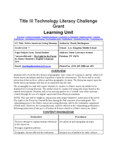
Native American Living Museum
Seventh graders complete a unit of lessons on Native Americans. They analyze Native American cultures, create a Native American artifact for a Living Museum, and develop a tour of the museum using a digital camera and a Powerpoint...
Curated OER
Water Issues on Puerto Rico and Oahu: A Comparison of Two Islands
Fifth graders explore how the tow islands receive and use fresh water. They also address some of the threats to the fresh water supply on each island. Students explore the lesson objectives through water cycle models and experiments.
Curated OER
Avalanche And Landslide Hazards in Canada
Students explore where the natural disasters, avalanche and landslides, are most frequent in Canada and investigate their associated causes and effects. They navigate the Atlas of Canada Web site for natural hazards.


