Curated OER
What You Can Learn From a Map
Students discover how to interpret maps. In this geography skills lesson plan, students explore geographic themes as they complete worksheet activities regarding road maps, shaded relief maps, and topographic maps.
Curated OER
Canadian Symbols
Students discover the ideals of Canada by analyzing its symbols. In this Canadian culture lesson, students identify the symbols that established the U.S. as its own nation and compare them to important Canadian symbols. Students visit...
Curated OER
Geography Terms
Pupils identify different landforms and fill out a worksheet where they explain what each landform is. In this geography lesson plan, students fill in a landform map and then use landform words as they describe the landforms.
Curated OER
Plotting Slave Population Density in Connecticut in the 1700's
Tenth graders explore slavery in the U.S. by researching the web. In this U.S. history lesson, 10th graders identify the geography of Connecticut and the overall involvement the state had in the slavery process. Students view data of the...
Curated OER
Nevada, A to Z
Fourth graders explore U.S. Geography by reading a timeline. In this Nevada history lesson, 4th graders identify the geographic location of Nevada and discuss the history. Students read the book S is for Silver: A Nevada Alphabet and...
Curated OER
Agriculture Cares for the World
Students explore world geography by analyzing agriculture. In this dietary habits lesson, students discuss the role parents play in their children's diet and where the food comes from. Students write agricultural research paragraphs and...
Curated OER
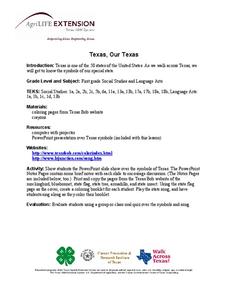
Texas, Our Texas
Students explore U.S. geography by completing a coloring activity in class. For this Texas history lesson, students utilize the web to locate Texas on a map of the U.S. Students view a PowerPoint presentation which showcases the state...
Curated OER
Political Geography of Europe
Fifth graders listen to a lecture that traces the political geography of Europe from 814 through 1997. They incorporate these themes into a research project on Western Europe.
Curated OER
World Map and Globe
Young scholars explore symbols. In this beginning map instructional activity, students identify common picture symbols. Young scholars place post-it notes with symbols drawn on them in the appropriate place on a map.
Curated OER
Geography of the Wasatch Front
Students examine and discuss urban geography and land-cover types along the Wasatch Front. They analyze thermal images, create collages, and predict surface and air temperatures from aerial photos in the Salt Lake City Valley.
Curated OER
World Map and Globe - Four Main Directions
Students study the four main directions on a map. In this map lesson, students locate the North and South pole, and learn the four cardinal directions. They use the compass rose on a map to help with the directions. (Map is not included...
Population Connection
A Demographically Divided World
Did you know that birth and life rates vary across the world? The resource, the second in a six-part series, discusses just how demographics differ across countries and why it might be the case. Scholars complete worksheets, watch...
Geophysical Institute
Latitude and Longitude with Google Earth
Travel the world from the comfort of your classroom with a instructional activity that features Google Earth. High schoolers follow a series of steps to locate places all over the earth with sets of coordinates. Additionally, they...
Space Awareness
Navigation in the Ancient Mediterranean and Beyond
Ancient texts, like Homer's Odyssey, mentions navigating ships by observing constellations. Pupils learn about the link between history and astronomy as they relate to navigation in the Bronze Age. Scholars complete two hands-on...
Space Awareness
The Sun Compass of the Vikings
Evidence shows the Vikings likely navigated by using a simple sundial to find their course. Videos, a short story, and discussion help bring this time period to life as they study European history with a hands-on experiment. Scholars...
California Academy of Science
California's Climate
The United States is a large country with many different climates. Graph and analyze temperature and rainfall data for Sacramento and Washington DC as you teach your class about the characteristics of Mediterranean climates. Discuss the...
Curated OER
World Geography - Climate Notes
A challenging activity helps young geographers explore the temperatures around the world! They study how the Earth's land temperatures are affected by their proximity to an ocean, as well their latitude and their altitude. A very...
Curated OER
A Ticket to Japan
Fourth graders discover similarities and differences in the lifestyles and geography of Utah and Japan. They use a Venn Diagram to compare and contrast daily life and geography in Utah with daily life and geography in Japan. They make...
Curated OER
Oh, the Places You'll Go!
Students read about and discuss the fifty-three recommended travel destinations for 2008 from the Travel section of The New York Times. They list three places they would each like to visit, read and discuss the news article, and create...
Curated OER
Out of Old England in the 1630s-Flat Me Project
Students write letters to penpals. In this geography/literacy lesson plan, students become penpals with a classroom in England to learn about customs and society across the ocean. Flat Stanley by Will Holton is read aloud, and students...
Curated OER
Site and Situation: Right Place at the Right Time
Students put their geography skills to work. For this geography skills lesson, students research maps and other primary and secondary sources to simulate the site selection process for the Pennsylvania Railroad Shops post World War II....
Curated OER
Asia's Global Influence
Students explore Hong Kong. In this geography skills lesson, students watch "Asia's Global Influence," and then research the culture, landmarks, and geographic features of Hong Kong. Students use their research findings to design travel...
Curated OER
Introduction to the Civilization of Ancient Greece
Students explore Greece. In this introduction to ancient Greece instructional activity, students locate and circle the names of the bodies of water surrounding Greece, then underline the names of important cities in Greece on a world map...
Curated OER
Finding Your Way On the Farm
Third graders explore the food industry by viewing a presentation about farming. In this farming geography lesson, 3rd graders view globes and maps while identifying the prime geographical locations for fertile land. Students view a...
Other popular searches
- Five Themes of Geography
- U.s. Geography
- China Geography
- Africa Geography
- Mexico Geography
- Canada Geography
- Asia Geography
- France Geography
- Japan Geography
- World Map
- Ireland Geography
- Geography Studies


