Curated OER
North American Cultures
Middle schoolers take a closer look at the geographic theme of place. For this geography skills lesson, students research their city and create murals that highlight its history, residents, landmarks, and resources.
Curated OER
City Life In Europe
Middle schoolers explore Paris. In this geography skills lesson, students watch "City Life in Europe," and conduct further research on the city of Paris and the country of France. Middle schoolers create postcards that feature Parisian...
Curated OER
What Do You Know About Scotland?
Students investigate global geography by researching the country of Scotland. In this cultural investigation instructional activity, students view images of Scotland on a computer and listen to audio interviews about Scottish citizens....
Curated OER
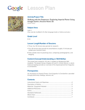
Walking with the Emperors: Exploring Imperial Rome
Students travel Rome. In this geography skills lesson, students explore famous places in Rome with Google Earth tools. Students research the city of Rome and create touring videos that feature their findings.
Curated OER
Molas from South America
Third graders research world geography by creating a class presentation. In this South American instructional activity, 3rd graders read assigned text regarding the customs and traditions of different Indian communities in South America....
Curated OER
GPS Treasure Hunt
Students explore geography by participating in a treasure hunt activity. In this Global Positioning System lesson, students define the terms latitude and longitude while utilizing an electronic GPS device. Students view a PowerPoint...
Curated OER
Natural Forces
Students assess the damage natural forces have caused Maryland's geographic features. In this state geography and ecology lesson, students work in a group to research ways in which weathering, erosion, and deposition have affected the...
Curated OER
Where Am I - Navigation and Satellites
Young scholars explore geography by completing a navigation activity in class. In this satellite positioning lesson, students define terms such as orbit, satellite, GPS and triangulation. Young scholars view diagrams of the Earth's orbit...
Curated OER
This is America
Students explore world geography by viewing a documentary film in class. In this national parks lesson plan, students view the Ken Burns documentary about the subject and identify the contributions of individuals in support of the parks...
Curated OER
Growth of a River
Students evaluate geography by drawing an image in class. In this river lesson, students identify a list of vocabulary terms associated with bodies of water. Students identify how a river is formed and draw a picture of one including the...
Curated OER
States and Capitals, Mountains and Rivers
Students identify geographical locations in the midwestern United States. In this geography instructional activity, students identify 12 states and capitals and geographical features in the region by using U.S. maps. Students use blank...
Curated OER
Discovering the Physical Geography of Washington
Pupils develop a mental map of the state of Washington and draw it on paper. Using the Virtual Atlas, they identify the physical features of the state and draw them on their map. They also examine the populations and diversity of the...
NOAA
Into the Deep
Take young scientists into the depths of the world's ocean with the second activity of this three-part earth science series. After first drawing pictures representing how they imagine the bottom of the ocean to appear, students...
Curated OER
Utah History & Geography
Fourth graders calculate and determine the distances between counties in Utah. Using a map of Utah, they determine the distance between three county seats, the total distance round trip, and label a map with the distances.
Curated OER
Geography - Mapping the Holocaust
Eighth graders map the important locations of the Holocaust. In this Holocaust lesson, 8th graders research the location of countries involved in the Holocaust as well as the location of concentration camps. Students mark the locations...
Curated OER
Geography of the Roman Empire
Students explore the Roman Empire. For this ancient Rome lesson, students research regions of the Roman Empire and present their finding to their classmates. Students also use an interactive map to practice placement of the regions...
Curated OER
Using the Four Main Directions in the Classroom
Students use the four main directions to locate features in the classroom. In this direction lesson, students review the 4 main directions using a world map. Students use a magnetic compass to locate the north wall in their classroom and...
Curated OER
50 States: New England States
Students discover where certain states are located and what the look like. They look for their information on a web site. Each student is assigned a state which they must research then present to the entire class.
Curated OER
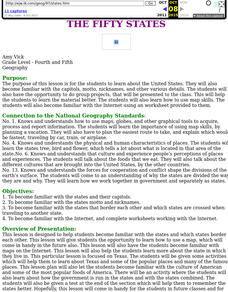
The Fifty States
Students become familiar with the states. They study capitols, mottos, nicknames, and other various details. They create group projects that be presented to the class.
Curated OER
Abigail Adams: Integrating Social Studies and Language Arts
Third graders increase reading strategies while learning about Abigail Adams and her role in history. In this Abigail Adams lesson, 3rd graders read about the American Revolution and Abigail Adams using all the balanced literacy...
Curated OER
Utah History & Geography
Fourth graders practice large digit addition. Students become familiar with column addition. Students develop knowledge of counties and county seats.
Curated OER
Fruits of the Rain Forest
Sixth graders research rain forests and complete activities for the topic. For this rain forest lesson, 6th graders learn vocabulary about rain forests and research online for rain forest facts. Students research the layers of the rain...
Curated OER
Geography, Energy, and the Twenty-First Century
Students examine the past and present effects of energy sources on geography in the 21st century. They compare/contrast energy consumption and production in the U.S. and the world, make predictions for future energy consumption, and...
Curated OER
Latitude on World Maps
Sixth graders examine the purposes of maps. In this Geography lesson, 6th graders practice using latitude and longitude on a map.
Other popular searches
- Five Themes of Geography
- U.s. Geography
- China Geography
- Africa Geography
- Mexico Geography
- Canada Geography
- Asia Geography
- France Geography
- Japan Geography
- World Map
- Ireland Geography
- Geography Studies


