Curated OER
Geography: Lengths, Perimeter, and Area of Similar Objects
Sixth graders explore characteristics of similar objects. Using attribute blocks, they explore the ratios of the perimeter, area and side length in similar shapes. They calculate and compare the area of shapes.
Curated OER
Geography- KS4-
Middle schoolers categorise the changes in the iron and steel industry in S Wales. They use literacy or paragraph techniques to strucuture and apply the information. Students given paragraph template to brainstorm and order key points...
Curated OER
State Capitals Quiz- Social Studies Geography Lesson Plan Grades 3-6
Pupils take an online multiple choice quiz on the state capitals. There are fifty multiple choice questions. After the quiz is over, students can print out the results.
Curated OER
World Map and Globe - Lesson 1 Introduction to the Globe
Students explore the earth with maps and globes. In this map instructional activity, students use maps and globes to locate oceans and continents.
Curated OER
Geography: Why Is the Sacremento Valley a Good Place to Grow Rice?
Third graders locate the Sacramento Valley in California where rice is grown. In this rice growing location lesson plan, 3rd graders locate the Sacremento Valley, California on a map, and color the mountain ranges and terrain that is...
Curated OER
Introduction to World Religions: Islam
Sixth graders explore religion by viewing a presentation in class. In this global culture instructional activity, 6th graders define the Islam religion and the stories that accompany it. Students read the story "Muhammad" by Demi and...
Population Connection
Meeting Human Needs
How to meet the needs of people around the globe—a question many ask. The fifth in a six-part series about human population and its effects on the globe, the eye-opening lesson plan includes discussion, a homework activity, and an...
Population Connection
Where Do We Grow from Here?
Did you know that the population is expected to grow to 11 billion by 2100? The resource serves final installment in a six-part series on the global population and its effects. Scholars interpret data from the United Nations about the...
Population Connection
The Carbon Crunch
Carbon is in the air; should we care? Teach the class why it is important to pay attention to carbon levels and how the world population and various countries across the globe affect the carbon levels in the atmosphere. High schoolers...
Population Connection
The Peopling of Our Planet
How many people live on the planet, anyway? The first resource in a six-part series covers the topic of the world population. Scholars work in groups to conduct research and make population posters after learning about the global...
EduGAINs
Migration—Push and Pull Factors
What causes people to move from one place, one city, or one country to another? Using the provided migration questionnaire, learners interview family members about the factors that cause them to be pushed from an area or pulled to...
Space Awareness
Let's Map the Earth
Before maps went mobile, people actually had to learn how to read maps. Pupils look at map elements in order to understand how to read them and locate specific locations. Finally, young cartographers discover how to make aerial maps.
Space Awareness
Where on Earth Am I?
Almost every phone has GPS installed, but a large number of teens don't know how the technology works. An initial activity illustrates how GPS determines a location on Earth. Scholars then apply trilateration procedures to a...
Scholastic
Perfect Postcards: California
It's time to hear about some adventures in travel! The Transcontinental Railroad changed life and travel in the United States during the 1800s. Practicing online research skills, pupils discover the features they would like to visit on...
Curated OER
Lesson: Culture & Change
Can a palace door be art? Can it facilitate an understanding of people and places? It certainly can! Using a palace facade as a lesson catalyst, kids will discuss geometric patterns, the kingdom of Swat, and geopolitical themes. They...
EngageNY
Reading Maps: Locating the Countries We Have Been Reading About
Show your class how to read a map and decipher all of the markings and features. Start out by connecting maps to their homework from the night before and their current reading, in this case That Book Woman, and a related informational...
Curated OER
The Seven Continents Scavenger Hunt
Who doesn't enjoy an engaging scavenger hunt? Here, scholars listen to, and discuss, the informative text, Where is my Continent? by Robin Nelson. They then explore the seven continents and four major oceans using...
Society for Science & the Public
Easter Islanders Made Tools, Not War
When studying artifacts, especially tools, how do archaeologists determine what the devices were used for? In what ways might researchers' previous experiences influence their perception of an artifact? An article about researchers'...
Curated OER
Ozark Karst: A Fragile Landform
Young geologists become familiar with the Karst Topography in the Ozark Mountains. They study how human activity has affected the cave ecosystem. They conduct a simulation in which a large development is proposed in the area, and they...
Curated OER
Conejito
Third graders read the story "Conejito" and write a descriptive story about the rainforest in Panama. They answer story comprehension questions, complete worksheet questions about a map of Panama, and rewrite a paragraph changing the...
California Academy of Science
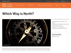
Which Way is North?
Who needs a compass to find cardinal directions? Just place a stick in the ground and record the movement of its shadow over the course of a day. Then, measure the shadow lengths in order to determine a north-south line. A simple...
Curated OER
Geographically Speaking
Young scholars play a matching game to reinforce the retention of vocabulary words. In this geography lesson, students watch a PowerPoint to define vocabulary words associated with geography, play a memory game with the words, and...
Curated OER
Beyond Demographics
Students study the culture of the Dominican Republic. In this Peace Corps lesson, students watch, "Destination: Dominican Republic." Students also examine primary source materials on the nation and discuss their findings.
Indian Land Tenure Foundation
Maps and Homelands
You are never too young to learn about maps. To better understand the concept of a homeland, students work together to construct a map of their local area out of paper puzzle pieces. They'll put the maps together and then add details by...
Other popular searches
- Five Themes of Geography
- U.s. Geography
- China Geography
- Africa Geography
- Mexico Geography
- Canada Geography
- Asia Geography
- France Geography
- Japan Geography
- World Map
- Ireland Geography
- Geography Studies


