Curated OER
Off to College
Students jog to where their classroom teacher went to college using a scale that best fits their situation. They log miles on a chart until students reach their destination. Students use the colleges mascot as the graph indicator as to...
Curated OER
Old World and New World - Why Contact Took So Long
Learners use a globe to determine why contact between the old world and the new world took a long time. In this map skills lesson, students analyze routes between regions to determine why it took so long for the old world and the new...
Curated OER
Alberta And Saskatchwan: the View in 1905
Young scholars analyze the differences between maps 1905 and current maps of Alberta and Saskatchewan. They use maps from the Canadian Council for Geographic Education to complete a guided inquiry. This lesson also has many extension...
Curated OER
Microsoft Publisher Country Brochure
Students explore geographic information. In this geography and technology lesson, students choose a county and answer related questions on a Webquest. Students create a word web and design a country brochure.
Curated OER
THE TRAVELS OF BABAR: An Adventure in Scales
Students locate and identify the seven continents. They use longitude and latitude in establishing a location. Students enhance the knowledge of geographical location with cultures. Individuals or small groups research multiple aspects...
Curated OER
Exploring the Hudson in 1609
Learners follow the journey of Henry Hudson down the river with his name. Using journal entries and maps, they learn about its exploration. They use maps to identify stages of the journey, and practice converting distances into miles.
Curated OER
Geography: Islands and Alcatraz
Students, in groups, create maps of islands including map keys and compass roses. They compare and contrast their island communities with that of the island prison, Alcatraz. Students select from a series of projects, including writing...
Curated OER
The Geography of Aboriginal Languages in Canada
Students study the relationship between geography and the Aboriginal language communities.
Curated OER
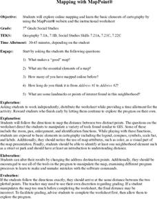
Mapping With MapPoint
The class is engaged through a discussion of mapping. They determine what they believe makes a good map and what the essential elements of a map are. Students work independently to complete a worksheet on mapping. They follow clear...
Curated OER
Scenario challenge
Fifth graders become familiar with the geography of New Hampshire and the importance of specific sites in history. In this New Hampshire lesson, 5th graders create a brochure including points of interest and showing distances between...
Curated OER
Find a Cave
Students locate their own communites and the nearest caves on a United States map. They calculate the distance to the nearest cave using rough scale.
Curated OER
Plotting A Hurricane Using latitude and Longitude
Students explore map and plotting skills by tracing the movement s of hurricanes through the Earth's systems. a hurricane map is developed from daily media reports.
Curated OER
Welina's World
Students living in Hawaii draw a picture of themselves in their neighborhood. They draw their neighborhood in relation to their district and then in relation to the island they are from. They compare their pictures to their classmates'...
Curated OER
Where is Everybody?
Students collect data from different grade levels at their school and develop thematic maps which show population density, and determine how this might affect the school and themselves in the future.
Curated OER
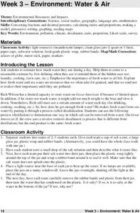
Environment: Water & Air
The introduction to the lesson mentions a sailor's limited capacity to store drinking water on his ship. Pupils then set up an overnight experiment to remove freshwater from salt water by distillation. There is a math and map activity to...
Curated OER
African Country Report
Sixth graders describe the relationship between the people of Africa and their environment. They examine the climate, economy and inhabitants of this land. Using maps graphic organizers and writing a report, 6th graders demonstrate how...
Curated OER
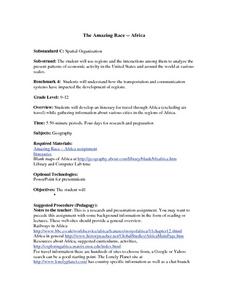
The Amazing Race -- Africa
High schoolers conduct research and gather information regarding various cities in Africa. They discover what it would take to travel to and through Africa and plan a trip through various regions of the continent. They present their...
Curated OER
Students Become Mapmakers
Students practice making a map of a continent and correctly plotting five cities on that map. They place latitude and longitude lines on a map, determine the need for various map projections and explain why map scales are necessary.
Curated OER
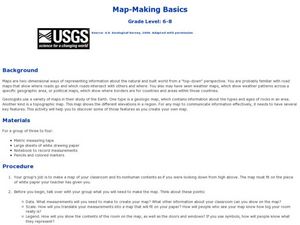
Map-Making Basics
Students study maps. In this geography and art lesson, students create their own map of the classroom.
Science 4 Inquiry
Edible Plate Tectonics
Many people think they can't observe plate tectonics, but thanks to GPS, we know that Australia moves at a rate of 2.7 inches per year, North America at 1 inches per year, and the Pacific plate at more than 3 inches per year! Scholars...
Curated OER
Blowing in the Wind
Students identify and interpret maps, graphs, charts, tables and political cartoons. Students identify what a compass rose is and review its meaning in relation to standard directions. Students design their own weathervanes. Students...
Curated OER
Running Water/Rivers-Life Cycle
Young scholars explore the parts of a river system and use topographical maps to determine the stage of the river.
Curated OER
Using Venn Diagrams to Compare Two Ecosystems
Students explore the distribution of two ecosystems on a global scale; and map the distribution of tropical and temperate rain forests throughout the world. They use a Venn Diagram to describe these ecosystems and the differences between...
Curated OER
Africa Unite!
Learners work in pairs to research assigned African countries. They compile their research to label a continent map of Africa, present their research to the class and design a game of trivia using their findings.


