Curated OER
The Roman Empire-Map Activity
In this Roman Empire worksheet, students complete a map activity in which they label and color civilizations, countries and physical features as instructed. There are no maps included.
Curated OER
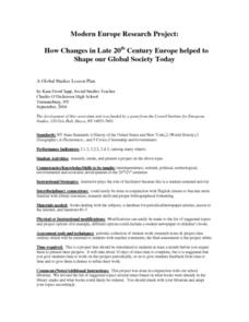
Modern Europe Research Project: How Changes in Late 20th Century Europe Helped To Shape Our Global Society Today
Students research a topic relevant to the late 20th century. They create a project while following the conditions explained in the rubric.
Curated OER
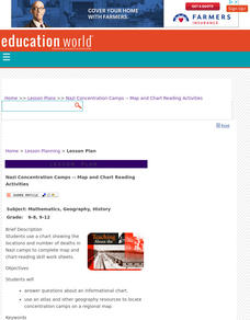
Nazi Concentration Camps -- Map and Chart-Reading Activities
Young scholars use an informational chart about Nazi concentration and death camps to complete a mapping activity and a chart-reading activity.
The New York Times
Kiev in Chaos: Teaching About the Crisis in Ukraine
Provide a historical context for the political unrest between Russia and Ukraine that began in late 2013. Learners review their prior knowledge and chronicle new understandings with a KWL chart, watch a video explaining the Ukrainian...
Carolina K-12
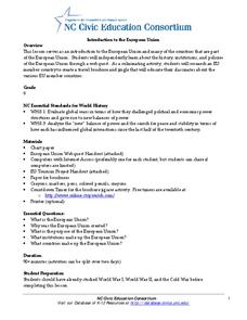
Introduction to the European Union
What is the purpose of the European Union, and what institutions and countries comprise it? Check out this resource in which class members participate in a student-led WebQuest activity designed to offer an overview of the European...
American Immigration Law Foundation
No Pretty Pictures
Here is a nice set of activities and discussion questions to accompany your class reading of No Pretty Pictures, a memoir of a young girl's experiences and struggle for survival during the Holocaust.
American Museum of Natural History
Global Grocery
A walk through the grocery store is like a walk around the world. An interactive activity shows popular grocery items and where the ingredients originate. Perfect as a remote learning resource, the lesson connects groceries to the...
Curated OER
Mapping and Personifying Nations
Eleventh graders analyze the geography, actions, and relationships of countries involved in World War II. They create a map of Europe, Northern Africa, and the Pacific, and analyze and evaluate their self-made map of Europe and the...
Curated OER
The European Union
Students complete an in-depth exploration of the European Union using the five themes of geography as a guide. In small groups, students use traditional and technological resources to answer questions about the European Union, with each...
Curated OER
European Union Map Quest
Sixth graders identify countries of the European Union. They locate countries of Europe on a map and pair with a student to complete a blank map of Europe. They label each country and complete worksheets for the European Union. They...
Curated OER
Continents
Young scholars investigate World Geography by researching the different continents. In this Asian Geography lesson, students discuss the continent of Pangaea and color a worksheet of the continents. Young scholars locate China on the map...
Curated OER
Western Europe
Young scholars engage in a variety of activities to comprehend more about the region of Western Europe. They use maps to read and highlight important information. The different countries are looked at individually highlighting...
Curated OER
Living In the UK
In this geography worksheet, students complete activities on 16 worksheets pertaining to the geography and culture of the countries of the United Kingdom. This is intended for ESL students.
Curated OER
The Seven Continents Scavenger Hunt
Who doesn't enjoy an engaging scavenger hunt? Here, scholars listen to, and discuss, the informative text, Where is my Continent? by Robin Nelson. They then explore the seven continents and four major oceans using...
Curated OER
Where Is Rome?
Third graders discover Ancient Rome through maps and worksheets. In this world history lesson, 3rd graders locate Rome on a world map and identify the scope of the Roman Empire. Students label an entire map of Italy after...
Curated OER
Where Do I Come From?
Learners research immigration from Europe to the United States. In this immigration lesson, students read the book, The Long Way to a New Land. Learners use a world map to locate Sweden and other countries in Europe. Students pretend...
Curated OER
African Safari
Seventh graders examine different countries in Africa to research. They choose one to concentrate their research on using the five themes of geography. They design a multimedia presentation that will make up the African safari.
Curated OER
Traveling Cat Flown Home to Family
Learners locate Wisconsin and Belgium on a world map, then read a news article about a cat that stowed away on ship from the U.S. to Europe. In this current events lesson plan, the teacher introduces the article with map and vocabulary...
Curated OER
The Vikings: Sea Raiders, Land Raiders
The geography of northern Europe, as well as the technological advancements in the nautical world, allowed the ferocity of the Vikings to arrive on the shores of faraway countries. Pupils study Viking history in an instructional activity...
Curated OER
Teacher Notes
Gathering information, distinguishing between arguments, preparing an oral presentation; these skills are fostered as 10th graders explore aspects of global trade and politics. They use the Internet to gather information about NATO, The...
Core Knowledge Foundation
Thanksgiving with the Pilgrims
Teach kindergartners about the First Thanksgiving with a series of lessons about the Pilgrims' journey to the New World. As they practice handwriting, CVC words, reading comprehension, and fun Thanksgiving songs, they learn about what...
Curated OER
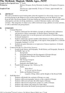
The Mythical, Magical, Middle Ages...NOT!
Students complete worksheets and roleplay feudal simulations as they are immersed in the daily life of the Middle Ages. They study geography of Europe and the origins of European tribes. They outline and write a biographical essay and...
Curated OER
Identifying, Mapping, and Personifying Countries Involved in WWII
Get artsy with this WWII group activity, starting with a whole-class assignment. Create a map of Europe, Northern Africa, and the Pacific using geometric shapes cut from construction paper and placed on the floor. Consider splitting the...
Curated OER
Countries Involved in World War II
Learners create their own floor map of Europe, Northern Africa, and the Pacific. They locate, identify, and speak for one of the countries involved. In addition, they classify the country they represent as an Axis Power or as an Allied...


