Curated OER
How Many Ways Can You Say Merry Christmas?
Students create a multicultural holiday bulletin board map! students research and study saying Merry Christmas in different languages. They correctly locate the countries on a world map.
Curated OER
Making Sense Of A Round World On A Flat Surface
Students engage in a lesson that is concerned with the development of geography skills. They take part in a number of activities that center around finding and traveling to different locations. The lesson has resource links that can be...
Curated OER
BOUND TO BE NEW HAMPSHIRE
Pupils identify neighborhood, town, and state boundaries. They distinguish between natural and man-made boundaries. They identify major state geological features and explain how NH boundaries have changed over time.
Curated OER
Getting to Know the Seven Continents
Students are introduced to basic map and globe skills. Using the internet, they identify and locate the seven continents and complete a blank map to reinforce the names of the continents. They also distinguish between land masses and...
Curated OER
Around the World in 17 Days
Students examine geography while studying the 2006 Winter Olympics. Students keep track of the winners of each Olympic event by finding the results using the Internet or by reviewing the newspaper and discuss the country the medalist...
Mesa Public Schools
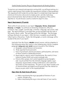
Country Project
Give your young learners the chance to discover more about countries in their world community with a research project. Class members write reports on an assigned country and include such major features as geography, important historical...
Curated OER
The Mekong River
Junior geographers explore the region through which the Mekong flows, its pathway, the landscape, how people depend on the Mekong, and future uncertainties. They apply the five themes of geography to examine the region. They create a...
Curated OER
French and Family
Where is France? Interest young learners in exploring France, French language, and French culture. They identify similarities and differences between French and American families, speak the French words for family members, analyze maps,...
Curated OER
Western Civilizations, Chapter 2: Gods and Empires in the Ancient Near East
Ancient Hebrew history comes to life through this online western civilizations tool, which follows history in detail from ancient origins to modern-day. Chapter two covers ancient eastern cultures, including beginnings of Hebrew...
Curated OER
From Sheep to Rug
Ever wonder where wool comes from? How it is used to make a woven rug? Introduce the Native American craft of rug making to your preschool or kindergarten class with a discussion. Learners examine and discuss images of a Native American...
Curated OER
Explore the Written Word with National Postcard Week
Develop writing and analysis skills with a celebration of the postcard pastime.
Curated OER
Australian Aboriginal Art and Storytelling
Young explorers investigate Australian Aboriginal culture by listening to traditional Dreamtime stories and examining dot paintings created by Aboriginal artists. In addition, they locate the country on maps, discuss the geography of...
National Endowment for the Humanities
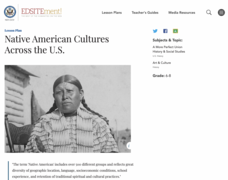
Native American Cultures Across the U.S.
Students examine how American Indians are represented in today's society. They read stories, analyze maps, and complete a chart and create an illustration about a specific tribe.
Curated OER
Connections Between World Events, Geography and the Human Quest for Knowledge
Learners examine the relationship between innovations in geography and world events. Using maps, they report different information from a spatial perspective. They develop hypothesis about how man's quest for knowledge has impacted the...
Curated OER
Geographics in Arkansas
Third graders discuss where Arkansas is located on the United States map. They use geographic tools to participate in activities.
Curated OER
Where in the World is Utah Wheat?
Students examine the role of climate and landforms in the use of Utah's land. In this geography lesson, students analyze the relationship between geography and agriculture in the state as they examine data regarding wheat production in...
Curated OER
Geotagging in school
Students create a digital photo map of the world. In this digital photo map lesson plan, students pick topics such as the Olympics, natural disasters, or trip planning and create a photo map on the computer.
Curated OER
Amazon Rainforest Unit
Students study the Amazon Rainforest. In this geography skills lesson, students complete assigned textbook reading on the region and then complete an Internet activity that requires them to identify countries in the region as well as...
Curated OER
Plotting A Hurricane Using latitude and Longitude
Students explore map and plotting skills by tracing the movement s of hurricanes through the Earth's systems. a hurricane map is developed from daily media reports.
Curated OER
Telecommunications and the Whole Language Program
Young writers use technology and other media to research information on a chosen topic. They explore countries where keypals and e-mail friends are located. Using their writing skills, they correspond with their e-mail friend and...
Curated OER
Brazilian Animals
Students research the animals of Brazil. For this animal science lesson, students locate Brazil on a map and discuss the types of animals that can live in its tropical climate. They research a Brazilian Carnaval and see the roll the...
Curated OER
Colonial Geography: To and From Canada
Students identify the major geographic features of colonial New England. They explain the essential parts to a map and interpret journals to plot a journey. They discover the connection between geography and life.
Curated OER
Geography
Second graders study and review geographical terms for features. They classify those features and locate them on a map. They review geographical features of Tall Tales.
Curated OER
Lost at Sea: The Search for Longitude
Students research and chart the shortest course to circumnavigate the globe.


