Curated OER
Colonial Geography: To and From Canada
Students identify the major geographic features of colonial New England. They explain the essential parts to a map and interpret journals to plot a journey. They discover the connection between geography and life.
Curated OER
Geography
Second graders study and review geographical terms for features. They classify those features and locate them on a map. They review geographical features of Tall Tales.
Curated OER
Lost at Sea: The Search for Longitude
Students research and chart the shortest course to circumnavigate the globe.
Curated OER
Scenario challenge
Fifth graders become familiar with the geography of New Hampshire and the importance of specific sites in history. In this New Hampshire lesson, 5th graders create a brochure including points of interest and showing distances between...
California Academy of Science
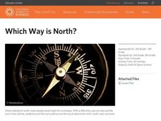
Which Way is North?
Who needs a compass to find cardinal directions? Just place a stick in the ground and record the movement of its shadow over the course of a day. Then, measure the shadow lengths in order to determine a north-south line. A simple...
Curated OER
Valentine Village
Students build a small city by using a half-gallon milk or juice carton to "build" a miniature home. They decorate their buildings with construction paper, yarn, beads, or whatever they have and become mailmen, delivering Valentine's to...
Curated OER
Memorial Day
As a way to understand Memorial Day, build citizenship, practice vocabulary, and discuss current international conflicts, learners create their own Memorial Day. They design their own memorial after learning about the various types of...
Curated OER
Around the World At 30o North Latitude
Reinforce the use of an atlas and reference materials with writers. They discover how geographic location can make living easier or harder. They draw an assigned journey on a map, categorize survival needs, and prioritize options during...
Curated OER
Defining Success
The class defines what it means to be successful by examining the achievements of Rich Wilson. They create headlines for a mock paper, discuss achieving personal goals, and create a scrapbook of his journey. Tip: Use this resource when...
Curated OER
Where Life Is Too Short
Students predict how a pandemic would affect aspects of South Africa's society. In this world issues and geography lesson plan, students read a letter outlining the problems affecting South Africa. Students discuss and analyze how...
Curated OER
"Where in the World is my School?"
Students learn new vocabulary and discuss what GPS is and does. They locate their school using the equipment.
Curated OER
Korea Cultural Lesson Plan
Students engage in a study of geography and maps of Korea. They examine charts and graphs. Students are expected to interpret the information accurately and completely. The geography skills can be used on other countries as well.
Curated OER
Geography
First graders recall names and placement of 7 continents. They recall cardinal directions. They identify and locate 3 oceans.
Curated OER
A Geography and Ecology Lesson for Grades 4-7
Students explore many of the unusual geographical features of the Amazon River region, and explain the importance of preserving the tropical rainforest.
Curated OER
New Hampshire and the Five Themes of Geography
Young scholars explore the location, place, human-environmental interactions, movement, and regions of the New Hampshire landscape through the use of visual representations.
Curated OER
Oregon Trail Maps
Fourth graders explore the Oregon Trail. In this Oregon Trail lesson, 4th graders collaborate to conduct Internet research regarding states along the Oregon trail route. Students present their findings to their peers.
Curated OER
Follow That Ship!
Students in this exercise are introduced to the distinct ways of measuring distance (nautical miles) and speed (knots) at sea, as well as the concepts of latitude and longitude for establishing location.
Curated OER
Carbondale: The Biography of a Coal Town
Students use a brief history of the growth and decline of the anthracite region in the state to create a photograph and map "peak shaped" time line. They practice map and photo analysis strategies to "read" photographs and maps.
Curated OER
Dreaming of a Healthy City
Ninth graders design a healthy city. They identify the essential elements of a city and describe how climate and geography can determine the layout of a city. They create a blueprint of their design and share in small groups.
Curated OER
Map-Making Basics
Students study maps. In this geography and art lesson, students create their own map of the classroom.
Curated OER
How Do You Know Where You Are?
Seventh graders are introduced to geographic thinking, setting the stage for the creation of a map showing distance, direction, location and symbols from their residences to school.
Curated OER
Making the Invisible Visible
Students evaluate the various ways in which cyberspace is beginning to be mapped by geographers, cartographers, artists, and scientists and use their understanding of the information these new maps can convey to create their own maps of...
Curated OER
Earthquakes And Fault Lines
Students discuss major causes of earthquakes and identify famous fault lines, access and map information about ten largest earthquakes in world from 1989 to 1998, and theorize about location of these earthquakes as they relate to Earth's...
Curated OER
International Festival: Venezuela
Students become familiar with the Venezuelan culture and geography. In this Venezuelan Festival lesson, students compare and contrast themselves to the people of Venezuela. Students participate in activities to understand the culture...


