Curated OER
Destination Investigation!
Students interpret a map or Atlas. They determine latitude, longitude, and absolute location and create and evaluate a travel itinerary. They identify the benefits and drawbacks of an itinerary and conduct online research as a means to...
Curated OER
Social Studies For Elementary School
Fourth graders become familar with maps and work in groups to get an overview of what Europe is like. The real assignment is in the form of students creating their own trip if it could really be taken.
Curated OER
Settling Nroth America: Improvisation and Playwriting
Students map the classroom by marking the movement of the first Americans' migration from Alaska down into North America. To improve their skills in map-reading and sense of direction, students identify physical features of the map and...
Curated OER
Where Do Animals Come From?
Students use library search engines to research an animal and its origin. In this animal research lesson, students research their assigned animal using ProQuest. Students then find the country of origin of the animal using a library...
Curated OER
"Region" Out to Everyone: Geographic Regions Defined
Students define the term region. They collect data about New England after watching a short video. They organize the information into a regional concept map. They draw conclusions based upon their data collection and analysis.
Curated OER
Get Ready for the Great Outdoors!
Young scholars discuss what is a map and what they already know about maps. They brainstorm together to compile a list of responses for the board and observe a map of the United States, including states, capitals, and some of the...
Curated OER
Oregon Rainshadows
Students brainstorm list of possible highest locations in Oregon, identify and label places from list on map using color code, and discuss and identify causes of a rain shadow.
Curated OER
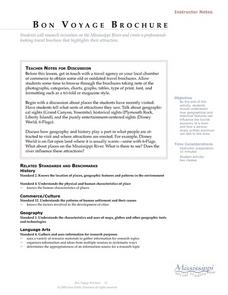
Language Arts: Mississippi River Brochure
Students create brochures about recreational activities along the Mississippi River. Focusing on points of interest, they research attractions and create maps of the surrounding area. Once students write descriptions of their...
Curated OER
Boundaries
Students are introduced to the term of mental mapping. Individually, they develop their own mental map of Washington state and discuss as a class what makes a boundary. They draw their mental map on paper and compare it with their...
Curated OER
The Expansion of The United States, 1846-1848
Young scholars interpret historical maps,identify territories acquired by the United States in the 1840s. Also they identify states later formed from these territories. The primary sources for the lesson are the maps found in the...
Curated OER
Hit The Road Jack(or Jill)
Students find the approximate area of the court order on a current map of Delaware. They draw a layout of their school and decide where a new hallway or outside pathway would be most needed.
Curated OER
Lesson L - Hit The Road Jack (or Jill)
Students discuss forms of transportation in Delaware during 18th Century, find approximate area of court order on current map of state, draw layout of their school, and decide where new hallway or outside pathway would be most needed.
Curated OER
World Religions
Seventh graders identify major tenets and the distributions of world religions. In this world religions lesson, 7th graders work with a group to research a religion using the given website. Students complete a graphic organizer for the...
Curated OER
Displaying The Data
Students engage in a research project to find information about one's personal family heritage. They collect information by conducting family interviews. Students use the data to create a graph, map, and timeline. Then students take part...
Curated OER
Land Bridge Theory
Fifth graders observe a map that includes where the land bridge was located and that its name was Beringia and look in the Social Studies books to read about the Land Bridge Theory. The class then brainstorms reasons why they think...
Curated OER
San Francisco Bay Watershed
Students examine relief maps of California and discuss the San Francisco Bay watershed. Discussion continues with the class helping complete a journey of water through seasons in a "finish my sentences" style lecture. They label rain...
Curated OER
Cultural Exchange (Salem)
Students view the photo of the The Tea Trade Painting and discuss what they see. They will then discuss what went into the beginning of a major sea voyage. Next they explore routes traveled by the New England traders. They study sailing...
Curated OER
Desert Postcards
Young scholars research characteristics of deserts. They present their findings in small groups to the class. Students utilize information learned about desert biomes, geography of the route of the Niger, and expeditions in their writing.
Curated OER
Mystery Pen Pal
Learners investigate different cities and states in the USA, and practice their letter writing skills while corresponding with a pen pal.
Curated OER
Australian Travel Adventure
Seventh graders are introduced to the states and territories within Australia. Using the internet, they bookmark sites and take notes on what they want to share with their classmates. They also complete a map study on the country to...
Curated OER
Introduction to African Folklore
Young scholars are read "Anansi the Spider" to begin their discussion on continents. Using a map, they locate the continent of Africa and the country of Ghana. They discover who the Ashanti people are and view examples of their artwork....
Curated OER
Legends of the Navajo People
Second graders are read a story in which they begin to examine Native American legends. Using different legends, they discuss how they affected the future people of native peoples. They write a short story on the information they gathered.
Curated OER
Where Do You Shop?
Learners examine shopping patterns in another community to develop a hypothesis on why there are more opportunities for goods and services in some neighborhoods while others lack these goods and services.
National Gardening Association
Migration Mishaps
Elementary ecologists pretend to be migratory hummingbirds. They fly between wintering and nesting grounds, trying to reach a habitat haven. In a musical-chair fashion, some birds will miss out, and are removed from the game. To further...


