Curated OER
Regions and Habitats
Fourth graders identify the different habitats found in the seven regions of the United States. In this ecology lesson, 4th graders write an essay about how humans affect the ecosystem and vice versa. They discuss how changes on one...
Curated OER
A World in a Grain of Sand
Students go exploring Britain's beaches. In this geography activity, students visit selected websites to learn about specific beach habitats and the history of cleaning those beaches.
Curated OER
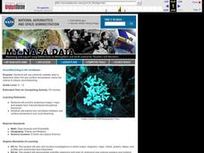
Coral Bleaching in the Caribbean
Students use authentic satellite data on the NASA website to determine when the sea surface temperature meets the criteria to induce coral bleaching.
Curated OER
Health, Pollution, and Safety: Why Should We Care?
Students examine the impact of reducing the carbon dioxide emissions. They identify ways alternative fuels can lessen the effect of emissions on communities. Working in teams they conduct research from various community and Internet...
Curated OER
"Julie of the Wolves"
Fifth graders research life in Alaska and compare life there to their lives in this lesson. They read "Julie of the Wolves." They research through the novel and other reference books facts about the Alaskan climate and geography. They...
Curated OER
Hot, Wet, and Cold
Pupils research climate data for a city in each of the 5 major geographic sections of Texas. They use data to describe the climate and what influence the geography of that section has on the weather.
Curated OER
The Secret Garden
Students research the culture and geography of India and England while reading "The Secret Garden". Using this information, they write at least three predictions about what they believe might happen in the story. Using the Internet,...
Curated OER
China
Sixth graders become more aware of how land features, climate, and vegtation affect civilization. Students are divided into groups and research one of China's regions. They make a relief of their designated area.
Curated OER
Era of Self-Sufficiency - Pre-1890
Students investigate the relationship between physical geography and Utah's settlement. In this Utah land lesson, students view a PowerPoint about Utah land and work in groups to answer questions about the uniqueness of Utah's Mormon...
Curated OER
Prehistory Web Quest
Sixth graders identify how geography and climate determine the lives of early hominids, the characteristics of hunter-gatherer societies, how animals affected the lives of early hominids, and how hominids overcame their physical...
Curated OER
The Cox and Gossner Family Histories
Eleventh graders investigate the relationship between physical geography and Utah's settlement , land use, and economy. In this Geography lesson, 11th graders examine the interrelationship between Utah's climate. Students...
Curated OER
Native American Village Days
Students research the tribes of American Indians in Virginia and settled, agricultural tribes in other regions of America. They explain how geography and climate influenced the way various Indian tribes lived, and evaluate the impact of...
Curated OER
Failing Ecosystems: Haiti and the Caribbean
Ninth graders study the impact that climate has on the land. They discuss how deforestation leads to erosion and soil damage and how trees and vegetation help to stabilize the land. They draw a large map of the Caribbean and show Haiti...
Curated OER
What's Holding Up the Water?
Students read about the history and locate dams in Arizona. In this Arizona dams lesson plan, students write a summary about what they read focusing on word choice, ideas, conventions, and geography content.
Curated OER
Environment: How'd That Pollution Get There?
Students examine how global wind and water patterns aid in the spread of worldwide pollution. In groups, they read articles about the domino effect of pollution and create posters displaying its journey. On blank world maps, students...
Curated OER
European Explorers of North and South America
Sixth graders explore the connection between the geography of America and the migration of the Native Americans to the American continents to the future conquering of the continents by the Europeans. They discuss the causes and effects...
Curated OER
Clothesline Sleuth
Fifth graders investigate the effect of North American colonization on human history. In this colonization lesson, 5th graders explore the global impact of colonization of North America. Students investigate the impact of geography on...
Curated OER
Populations in the Path of Natural Hazards
Students read "Geographical Mobility: 1995-2000." They examine the maps in the handouts and compare them with maps from an atlas. In the second part of this lesson, students read "In Harm's Way." They receive three more handouts, one a...
Curated OER
Turn of the Century
Middle schoolers explore the transformation of America's economy in response to the Industrial Revolution in terms of patterns of agricultural and industrial development relating to climate, natural resource use, markets and trade.
Curated OER
Max Knows Mexicao, United States and Canada
Students utilize their map skills to explore the regions of North America. They explore the physical characteristics and climates of the regions. Students label their map and prepare a presentation of their findings.
Curated OER
Getting to Work and Making Money
Students explain how geography and climate play a role in the professions that are unique to their city. They explain how geography and climate influence the forms of transportation in their city.
Curated OER
"Across Oregon On The 45th N Parallel" A Transect of Oregon
Students explore the physical geography of Oregon. In groups, students collect weather and elevation information on Oregon. They organize the data and create maps and graphs of the information. Afterward, students compare the...
Curated OER
Japan and Art
Students discuss the art of Japan as it relates to Japanese culture and geography and then create individual postcards reflecting the information learned from the lesson. This lesson includes possible enrichments.
Curated OER
Stream Gages and GIS
students interpret recent regional-scale climate events based on current stream flow, monitor changes in time, and to consider additional interpretations that could be derived if other data were in map form.


