Curated OER
Water, Water Everywhere?
Students discover the relationship between water availability and population growth. They change variables in a computer model using a worksheet to guide their hypotheses and conclusions. In small groups they choose a country undergoing...
Curated OER
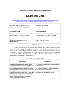
A Visit to Mexico City: An Introduction to World Communities
Third graders complete a variety of activities as they take an imaginary trip to Mexico City, complete with passports, maps, and Spanish dictionaries. They write postcards to send home and create items to sell at the market. The unit...
Curated OER
Microclimates of Our School
Students read the story "Weslandia" by Paul Fleischman, define the term microclimate, gather and record data in various places on school grounds to establish the presence of difference microclimates, analyze and compare microclimates,...
Curated OER
Exploring the Variety of World Markets
Learners examine the various types of world markets and analyze the differences between developed and developing countries. They watch a PowerPoint presentation and take notes, participate in a role-play that demonstrates supply and...
Curated OER
Paint My Counties: Map Coloring the Counties of Arizona
Fourth graders identify the counties of Arizona. In this social studies lesson, 4th graders color a county map of Arizona using the fewest number of colors possible. Students write a persuasive paragraph.
Curated OER
Understanding Canadian Weather Extremes
Students research and analyze the causes and sources of Canada's extreme weather conditions. They conduct an experiment, complete a worksheet and predict the most likely locations for extreme weather conditions.
Curated OER
Energy Efficient Home Design
Students investigate the applications of energy efficient homes. They conduct Internet research, complete a worksheet, evaluate the energy efficiency of a home design, and complete a research report on energy efficient homes.
Curated OER
Chart the Weather for Cities Around the World
Students orally describe Northern and Southern hemispheres, identify 7 continents, and point out specific countries and cities. They locate and record weather information.
Curated OER
Deforestation
Students identify the different tropical rainforests in the world using a map. In this ecology instructional activity, students describe the different methods of deforestation. They create a memo and present it to class.
Curated OER
SC Populations Along Major Interstates
Students examine the population among the interstates in South Carolina. Using the internet, they identify the counties and roads and compare it with their own drawing.
Curated OER
Metropolitan Areas in the USA
Fifth graders explore why people live in certain regions of the United States. They investigate information on specific metropolitan areas such as temperature, population, natural resources, precipitation and landforms. In groups, 5th...
Curated OER
Where's the Barbecue?
Learners identify the major landforms, regions and rivers on a map of South Carolina. They compare the locations of the major Native American groups in the state as well. They chart where barbecue restaurants are located and write...
Curated OER
Water You Can Use from the Air Conditioner
Learners work together to research water quantity, quality and safety standards. They complete a lab to discover how to use the water from an air conditioner. They write a paper to show their findings.
Curated OER
Fair Trade: Chocolate Can Be Good For You
Students discover the process of chocolate production. They read stories from boys in Ghana and Brazil who work on cocoa plantations. They illustrate the principles of fair trade.
Curated OER
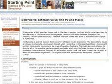
Daisyworld: Interactive On-line PC and Mac
Students use a JAVA interface to explore the Daisy World model to illustrate a mechanism through which - according to the Gaian hypothesis - biota might optimize their abiotic environment by means of negative feedback.
Curated OER
Lewis and Clark
Ninth graders study the plants and animals Lewis and Clark discovered on their expedition. There is a plant illustrator, a plant recorder, an animal illustrator, and an animal recorder. They research the plants and animals and the ...
Curated OER
WorldWatcher Activity: Using Data to Investigate Issues and Solutions
Learners use the WorldWatcher program to identify the issues affecting their country they have been using for these activities. In groups, they identify each issue and identify the solution or develop their own. They present their...
University of Texas at Austin
University of Texas: Human Environmental Interactions [Pdf]
Inspired by Hemispheres' 2004 Teachers' Summer Institute, People and Place: Human-Geographic Relations, this curriculum unit was designed to address human adaptation to and modification of the environment. How have humans adjusted to...


![University of Texas: Human Environmental Interactions [Pdf] Lesson Plan University of Texas: Human Environmental Interactions [Pdf] Lesson Plan](https://d15y2dacu3jp90.cloudfront.net/images/attachment_defaults/resource/large/FPO-knovation.png)