Curated OER
Axis and Allies World War II Simulation
Students investigate World War II through the computer game Axis and Allies. They discuss the basics of World War II before playing the game, spend eight weeks playing the game that is a simulation of World War II, and write a report...
Curated OER
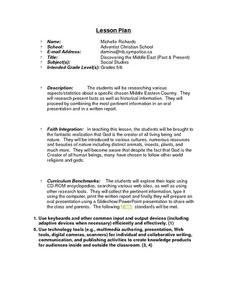
Discovering the Middle East (Past & Present)
Students, after being assigned a specific Middle Eastern Country, research various aspects/statistics as well as historical information on their country. They combine their acquired information in an oral presentation and written report....
Curated OER
Landforms And The Oregon Trail
Fourth graders investigate the historical context for the founding of The Oregon Trail. They conduct research to put together the events that led to the geographical route that was taken. The lesson also strengthens geography skills with...
Curated OER
The Lesson: Disaster
Students study natural disasters. In this Chinese and Burmese disasters lesson, students visit selected websites to discover information about earthquakes and cyclones and their devastating effect on the 2 countries. Students...
Curated OER
Put Me in My Place: Using Alphanumeric Grids to Locate Places
Students practice locating points on a large wall grid and create and label a neighborhood map. In this geography lesson, students spell and discuss places as the teacher places them on the map. They discuss the concept of an...
Curated OER
Australia: the Land Down Under
Students give a solid history and geographic explanation of the country of Australia and explain why it is important. They use some creativity in designing their own island, by using the physical features of this particular country.
Curated OER
Culture, Climate, and Current Events
Students decide on a country to research as a class, keeping a list of the countries already being researched. Using the internet, they research the culture, climate and current events of the country. They end the lesson by compiling a...
Curated OER
Greetings!
Students investigate the ways in which people greet each other. They read a book about greetings, participate in a role-playing game about greetings, interview family members about greeting styles and report their observations to the class.
Curated OER
Holocaust Map Studies
Students analyze maps and answer discussion questions related to WWI. In this geography lesson, students analyze historic maps to determine causes and effects of WWI in Europe. Students read testimonies of Holocaust survivors and label...
Curated OER
Ireland
Second graders discuss Ireland including its politics, education system, agriculture, etc . . . They locate Ireland on a map, and list facts about the country. They compare Irish money to American money.
Curated OER
Exploring Ancient Greece
Sixth graders use play dough to create a relief map of Greece and through personal investigation and class discussion, draw conclusions about the impact of the geography of Greece on daily life and culture in Ancient Greece.
Curated OER
Brazil and the Amazon
Sixth graders examine the features of the country of Brazil. In this Geography lesson, 6th graders complete a graphic organizer on the geography of Brazil.
Curated OER
Child Soldiers
Pupils investigate the military recruitment that exists in many foreign countries. They research the occurrence of using children in the military and its social implications. For research the lesson plan contains a great variety of...
Curated OER
Hush! A Thai Lullaby
Students listen as the teacher reads a story from their textbooks about a tradition in Thailand. They locate Thailand on a map and discuss that it is a tropical country. They discuss various cultural aspects included in the story and...
Curated OER
Flat Earth Society
Students explore map distortion. In this geography lesson plan, students compare Mercator projection maps to globes in order to understand the strengths and weaknesses of projection maps.
Curated OER
Macbeth Madness
Students participate in various social studies activities in correlation to William Shakespeare's Macbeth. In this Macbeth lesson, students study maps of Scotland, England, and Norway to identify locations mentioned in Macbeth. Students...
Curated OER
Africa South of the Sahara Today
Students describe and analyze cultural exchange projects that link students in all parts of the world. They write a report about the Ghana project of Morgan City High School.
Curated OER
"Tsunamis"
High schoolers visit a PBS Website about tsunamis to consider their causes, effects and steps countries have taken to try to defend against them. They answer questions and create a brochure explaining tsunami facts and procedures to...
Curated OER
Great Questions
Fourth graders research and create questions about a famous person. They create questions in a game format, create a computer generated brochure, and develop rubrics for their finished projects.
Curated OER
Environment: The Haves and the Have Nots
Students examine consumption habits in developed and developing countries and determine their effects on natural resources. In groups, they assess graphs on the Living Planet Report and observe the connection between consumption and...
Curated OER
Around The World
Students identify the capitals of the target countries. They locate the target countries on a world map. Students describe one major issue facing the inhabitants of each of the target countries.
Curated OER
Compare & Locate via the Internet
Seventh graders compare the location of their home city/town with a town in another country (non U.S.) that they have selected and researched utilizing the Internet. They create a binder of their reports for future research.
Curated OER
Around the World in 17 Days
Students examine geography while studying the 2006 Winter Olympics. Students keep track of the winners of each Olympic event by finding the results using the Internet or by reviewing the newspaper and discuss the country the medalist...
Curated OER
Where Did That Come From?
Fourth graders participate in a scavenger hunt. They locate specified items, finding the country origin. Students collect and organize the data, marking each country on a map. After researching the results, 4th graders write an analysis...


