Curated OER
Get to Know Your City
Third graders research the history of their home city and how it's development was influenced by different groups of people. They present their research information to the class.
Curated OER
Canada...a Visual Journey
Students, in groups, research Canada's six natural regions (ecozones). They create a visual representation of each region on a large wall map of Canada and present it to the rest of the class.
Curated OER
Canada...A Visual Journey
Learners work together to analyze the six natural regions of Canada. Using this information, they create a visual representation of each region on a large wall map and present it to the class. They must identify five key points of each...
Curated OER
Oceans and Weather
Students analyze the impact the ocean and its currents have on weather. In this oceans and weather lesson plan, students analyze data comparing inland and coastal weather, and analyze satellite data for evidence of El Nino.
Curated OER
Places and Production
Learners investigate the economy and the market value of goods. In this algebra lesson plan, students differentiate between domestic goods value and international good value. The define and identify the importance of GDP or Gross...
Curated OER
Making Mummies
Middle schoolers examine how mummies are made. In this ancient mummification lesson plan, students discover types of mummies and discuss the environments naturallly preserve bodies. Middle schoolers research noteable mummy...
Curated OER
NASA's Mars Gamble Pays Off Part 2
Tenth graders explore the planet of Mars. In this Earth Science lesson, 10th graders read articles on the make up of Mars. Students complete a worksheet on their reading.
Curated OER
Mapping Electricity
Students complete Internet research and use their map reading skills to learn about how the United States creates and uses electricity in different states. In this energy sources activity, students study the mini map of energy usage...
Curated OER
Our Country's Environment
In these environment worksheets, students complete several multiple choice questions that teach them about the Earth's landforms and water.
Curated OER
Landforms All Around
Students create a "Landform Dictionary". They develop an overlay map and participate in hands-on activities to identify the key characteristics of landforms. They discuss the plant and animal life of these areas. Handouts for the lessons...
Curated OER
Writing a Secret Message
Students study a specific area in which to research. They research their area and find descriptive facts about their geographical area. Students write a secret message about their area. They present their message to the class and the...
Curated OER
Discovering the Past Using the Future: Remote Sensing and the Lost City of Ubar
Students use a video, maps, worksheets and Internet research to explore the role that sensing played in locating Ubar - the lost city of Arabia.
Curated OER
Watermelons
Students discover the origins and different uses of watermelons. Using the internet, they find photographs of the fruit and reading about them in primary source documents. As a class, they plan a community activity in which they use a...
Curated OER
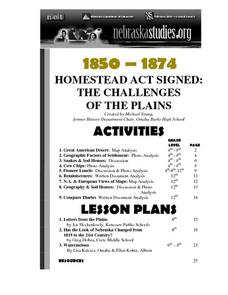
Letters from the Plains
Eighth graders read and analyze primary source documents dealing with Nebraska history. In a role-play, they present the information they gathered to their classmates. They examine what live was like for people settling in Nebraska.
Curated OER
Has the Look of Nebraska Changed from 1819 to the 21st Century?
Eighth graders examine and analyze maps of early Nebraska. Using the maps, they compare and contrast them to those of today and identifying how the area has changed over time. They complete a worksheet over the differences in the maps...
Curated OER
Crossing China By Sampan
Sixth graders determine the geographic features that facilitate and prevent communication and commerce between parts of China. They recognize a sampan, the traditional flat-bottomed boat used in Southeast Asia.
Curated OER
Trekking to Timbuktu
Students view a television show to provide a context for conducting research into the location and culture of Timbuktu. The students complete a report on the subject in the form of a research paper.
Curated OER
On the Trail with Lewis and Clark
Eighth graders use the Internet to conduct research on the Lewis and Clark journals and work cooperatively in planning and delivering a presentation.
Curated OER
Regions: Meet the Experts Presentation
Students gather information and create a web site on prairies and plains using a variety of resources, including the internet.
Curated OER
Making a Region Map of a State
Fourth graders create salt maps of a state and indicate its regions. They include topographical elements including mountains, valleys, lowlands and major water bodies and a compass rose.
Curated OER
The Arctic and Taiga Ecozone of Canada
Students discover the differences in the Arctic and Taiga regions of Canada. They identify physical and human characteristics of both region. They also practice using an atlas.
Curated OER
The Arctic and Taiga Ecozone of Canada
Students examine the various sub-regions of the Arctic and Taiga zones in Canada. Using the online Canadian Atlas, they locate and describe the characteristics of each zone. They organize their information into a chart and share it with...
Curated OER
Colors Crackle, Colors Roar
First graders engage in a reading of poems in colorful language. They become with the interrelation of using Spanish and English words interchangeably in a text. The lesson also builds multicultural appreciation for young students.
Curated OER
What Was It Like?
Students use the Internet to gather historical facts about the county in which they live. Using the information, they discover how to check it for accuracy and present their findings to the class. They write an essay about the history of...
Other popular searches
- Deserts in Geography
- Geography Deserts Landform
- Geography Deserts Land Form
- Deserts in Geography Bible


