Travel Document Systems
Tds: Djibouti: Geography
A brief description of the geography and physical environment of Djibouti. Information is from the CIA World Fact Book.
Science Struck
Science Struck: Facts About the Sahara Desert
Discusses the physical geography of the Sahara Desert, the climate, its landforms, the plants and animals that live there, and some of the people who live there or visit.
The History Cat
The History Cat: Geography: People: Taureg Nomads of the Sahara
Read about the characteristics of the Taureg, a nomadic people who inhabit the Sahara region. Their lifestyle is described and what they do to survive in the extreme heat of the desert.
The History Cat
The History Cat: Geography: Environment: Fighting Desertification
Lists reasons we should be concerned about desertification and discusses how the Sahel region south of the Sahara Desert is becoming desertified.
Channel 4 Learning
4 Learning: Geography Essentials, Weather Around the World
This resource offers in-depth information on weather and different types of climate including desert, tropical rain forests, and more. Also provides worksheets (Word documents) and images relating to weather.
Travel Document Systems
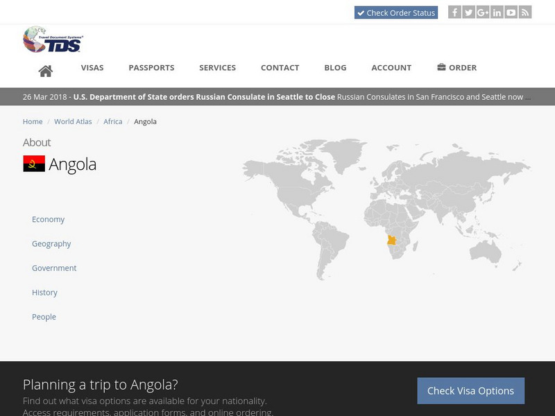
Tds: Angola: Geography
A brief look at the geography of Angola. Find out about the terrain, climate, and oil reserves. Information is from the CIA World Fact Book.
The History Cat
The History Cat: Geography: Places: Atacama Desert
Describes the Atacama region of Chile and why this area is so dry.
Ducksters
Ducksters: Kids History: Geography of Ancient China
Explore how the Yellow and Yangtze Rivers, mountains, and deserts impacted the early Chinese culture on this site.
Houghton Mifflin Harcourt
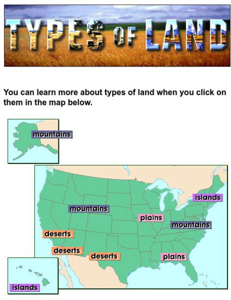
Harcourt: School Publishers: Types of Land
This clickable map of the United States defines different geographic features such as mountains, plains, islands, and deserts.
InterKnowledge Corp.
An Introduction to Namibia
Brief description of Namibia, including people and geography, with an emphasis on parks and wildlife preserves; includes photographs.
Geographic
Photius: Bahrain Geography and Population
Read about Bahrain's topography. Made up of several islands, you can find out how the country is connected by causeways from one island to the next.
Other
Harper College: South Asia Physical Geography
This is a map quiz of the physical features of South Asia. It contains lists of land bodies, rivers, and water bodies to be matched to a map of South Asia. It can be used as a study tool.
Curated OER
National Park Service: Big Bend
Deemed more than just a desert, Big Bend is indeed that! Find excellent narrative on the history and culture of this incredible park as well as notes on nature and science. Be sure to click on Visitor Photo Gallery for stunning views.
PBS
Pbs Learning Media: Observe Images of Different Climate Zones
Interact with this world map from McDougal Littell/TERC to highlight different climate zones and see a photograph of each one. Ten climate zones are represented, including tundra, desert, humid subtropical, and others.
Curated OER
National Park Service: Organ Pipe Cactus National Monument
Organ Pipe Cactus National Monument in the Sonoran Desert, in Arizona, was declared a national monument to preserve the ecological wonders it houses. Peruse the history, culture, nature and science. Teachers, be sure to check out the...
Other
Introduction to the Biosphere: Characteristics of the Earth's Terrestrial Biomes
From Chapter 9 of a textbook on physical geography that covers the biosphere. Important vocabulary is highlighted and linked to a glossary. It explains the characteristics of a biome, and describes the features of the eight different...
Curated OER
National Park Service: Guadalupe Mountains
For over 10,000 years folks have been drawn to the Guadalupe Mountains in western Texas originally for its beauty, resources, and in more recent years its history. One of the most fascinating features to this national park is that in the...
Curated OER
National Park Service: Guadalupe Mountains
For over 10,000 years folks have been drawn to the Guadalupe Mountains in western Texas originally for its beauty, resources, and in more recent years its history. One of the most fascinating features to this national park is that in the...
National Earth Science Teachers Association
Windows to the Universe: The Andes Mountains
Satellite photography and brief outline information describe the Andes mountains and provide links to specific features within the landscape - Atacama desert, or evidence of volcanic activity for example.
Travel Document Systems
Tds: South Africa: Geography
A graphic showing the various aspects of the physical environment of South Africa including its climate, terrain, and natural resources. information is from the CIA World Fact Book.
Travel Document Systems
Tds: Namibia: Geography
A graphic showing the various aspects of the physical environment of Namibia. Find out about the climate, terrain, and natural resources. Information is from the CIA World Fact Book.
Travel Document Systems
Tds: Qatar: Geography
This information on the physical environment of Qatar is from the CIA World Fact Book. Especially interesting is the note about Qatar's strategic location.
Travel Document Systems
Tds: Botswana: Geography
A graphic showing the various aspects of Botswana's physical environment. Information is from the CIA World Fact Book.
Travel Document Systems
Tds: Sudan: Geography
A graphic showing aspects of the physical environment of Sudan. Find out its area, climate, terrain, natural resources, and environmental concerns. Information is from the CIA World Fact Book.
Other popular searches
- Deserts in Geography
- Geography Deserts Landform
- Geography Deserts Land Form
- Deserts in Geography Bible


