Curated OER
How We Get From Here to There
Students recognize various types of movement people rely on to get from one place to another, locate the forms of movement on a map and choose one form of movement and research its path.
Curated OER
Mapping the Village
Young scholars measure, weigh, and document the amount of trash and garbage generated by the school for one day. They brainstorm solutions for trash in the area and assist with the school-wide recycle program.
Curated OER
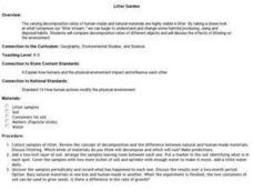
Litter Garden
Students discuss what man-made and natural materials are visible in litter. Using a sample of litter, they review the concept of decomposition between the two types of materials. They examine the two samples once and a while and record...
Curated OER
Quick-Sketch Artist Tips on Mind Mapping the Urban Landscape
Students interpret maps. They also create mental maps of regions in which they are studying. Students then explain the historical or cultural significance of map features orally or in written form. Students take a walking field trip...
Curated OER
Saving Hawaii
Students engage in a lesson about the a proposal for a sanctuary in the Northwestern Hawaiian Islands. They write a letter to the President of The United States in opposition to the proposal based upon classroom activities and research.
Curated OER
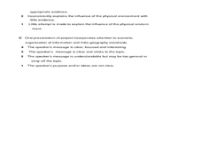
Building a Healthy City (Final Project)
Pupils construct a scaled model of a city that provides for the economic and cultural needs of a community while maintaining high quality air and water to protect the public health. They articulate, in a presentation, the locations of...
Curated OER
Clean Kansas Water
Students gain an understanding of ways we can be responsible custodians of our water supply. Students explore the governor's clean water initiative involving the Lower Kansas/Republican river basin and the pollutants present there.
Curated OER
Growth in A City Neighborhood
Students take the "role" of city planner. They overlay a map of one area of the city in the past, present, and projected future project. Students discuss reasons for selecting the special features of the area. The activity refers...
Curated OER
VAcations in Northern California
Students explore the natural resources and National Parks of Northern California that are commonly visited by people traveling in the United States. They use maps to locate various sites, plan a highway travel route and use the internet...
Curated OER
Can You Give Me Directions To the Game?
Learners become familiar with the use and capabilities of GIS and use it for research and mapping purposes. They heighten their ability to estimate travel times by incorporating distance, mode of travel and urban congestion into the...
Curated OER
The Abolitionist Movement
Eleventh graders examine a petition presented by the Quakers to the Delaware General Assembly in 1785 and an anti-slavery broadside published in 1836.
Curated OER
Our Way of Life
Students interview Native American Elders about animal migration, traditional food gathering, and subsistence. They research endangered animals, draw a game cycle, and create maps of local migration of animals.
Curated OER
What Is That Bubblin' In My Back Yard?
Students are introduced to the GIS system. They create a map plotting local sites the Environmental Protection Agency has on its EPA Regulated Sites list. They identify a list of schools that are near potentially hazard sites.
Curated OER
Making Sense of the Census
In this unit of lessons, students make sense of the Census. They examine why a census is taken and participate in activities.
Curated OER
Fish Now or Later
Students describe the effects of over-harvest on a salmon population. They explain the importance of salmon to many communities in Alaska. They manage harvest levels to maintain a sustainable population.
Curated OER
Science: Trouble in the Troposphere
Students research a NASA Website and record information about an assigned city's tropospheric ozone residual monthly climate. In groups, they graph the information for the past year. They form new groups and compare their city's...
Curated OER
Geological Development of Indiana and the Movement of Peoples Across the State
Fourth graders examine the geological development of the state of Indiana. Using the internet, they interact with the United States Geological Survey. They identify earthquake zones and energy resources in the state. They work...
Curated OER
Scenes from Cameroon
Students examine art by a Peace Corps volunteer in Cameroon. Using the artwork, they identify three physical land features. They use sand and other materials to create their own day or evening scene in Cameroon. They share their...
Curated OER
Physical Location; How a Border Town Might Develop
Students speculate how a location can develop into a large town. They investigate the physical resources and how populations can grow. There are guiding questions to help students through the research and class discussion. Students make...
Curated OER
Helping Hands: Promoting Gloval Awareness
Eleventh graders explore Canadian support for foreign aide. In groups, 11th graders discuss Canadian aide policies and express their opinion of each. Students brainstorm methods of contributing to developing nations. They complete...
Curated OER
Geological Development of Indiana and the Movement of Peoples Across the State
Learners are introduced to the geological development of the state of Indiana. Using the internet, they visit the U.S. Geological Survey and locate the earthquake zones in the state. In groups, they locate and identify the energy...
Curated OER
Environmentalism: Then and Now
Tenth graders examine the history of the conservation movement and how it relates to contemporary issues. In this Environmental Science activity, 10th graders research the roots of the environmental and conservation movement and...
Curated OER
Give Me The C and D Canal!!!
Students estimate the distance from Baltimore to Philadelphia via the water route before the Chesapeake and Delaware Canal was built. Students study canals and how transportation and economic necessities dictate the building of a canal.
Curated OER
People and Parks in the U.S.A.
Fifth graders explore the National Parks in the United States. After locating specified states, 5th graders predict which states have the most National Parks. Given the population of each state, students determine the average acre per...


