Curated OER
Where is the Trail? The Journey of Lewis and Clark
Students explore the trail followed by Lewis and Clark on their journey across the United States. In this United States History lesson, students complete several activities to establish the Lewis and Clark Expedition, including a class...
Curated OER
Welcome to Paradise
Fifth graders listen to Lynne Cherry's novel, The River Ran Wild. They work in two groups one of whom represents the native people and the other represents the English settlers from the book. They look at the geography of the settlement...
Curated OER
Maryland’s Chesapeake Bay Landscape Long Ago and Today
Combine a fantastic review of primary source analysis with a study of Captain John Smith's influence on the Chesapeake Bay region in the seventeenth century. Your young historians will use images, a primary source excerpt, and maps...
Curated OER
Dos mapas de Florida, el Caribe y parte de Sur America
What can maps tell us about the past? Find out with a Spanish lesson that incorporates geography. After examining maps individually, comparing two old maps of Spanish Florida and writing notes in the provided Venn diagram, pupils pair up...
Curated OER
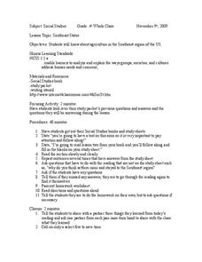
Southeast States
Fourth graders acquire knowledge about the settlement of the southeast region of the United states. In this united states geography lesson, 4th graders learn to analyze and understand the ways in which groups in society have marked...
Curated OER
European Climates
Ninth graders study the climate regions of Europe. In this geography skills lesson plan, 9th graders determine how weather and climate are influenced as they research the climate zones of specific locations and write about the ways that...
Curated OER
The Cultural Geography of Australia, Oceania, and Antarctica
Students use information from the Australian Department of Immigration and Multicultural Affairs Web site to explore multiculturalism and immigration in Australia. They create graphs and charts from immigration data.
Curated OER
Critical Analysis Leads to Global Action
Learners discover the interconnectedness of the world. In this global studies lesson, students identify challenges the world faces and craft solutions to the problems they identified. Learners present their findings in a PowerPoint...
Curated OER
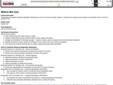
Where We Live
Students analyze Canada's population distribution. They access online information to gather demographic information about two Canadian cities. They compare and contrast the quality of life in the two cities and present their findings.
Curated OER
A Sense of West Virginia
Students consider their perceptions of the world through their 5 senses while visiting the West Virginia State Museum. In this West Virginia history lesson, students discover how knowing about the past helps with their understanding of...
Curated OER
World Cities of 5 Million or More
Students consult online resources to identify and map the world's largest cities and metropolitan areas. They analyze birth rates, settlement patterns and other demographic data and make predictions for the future. They write essays...
Curated OER
HUMAN/ENVIRONMENT INTERACTIONS: CLIMATE
Students explore the various global climates and apply cultural adaptations of the peoples in various zones due to climate.
Curated OER
"Water is Life" Global Water Awareness
Students examine and calculate the percentage of potable water remaining on the earth. In this ecology and geography lesson plan, students brainstorm the main factors affecting water distribution. Students use mathematical problem...
Curated OER
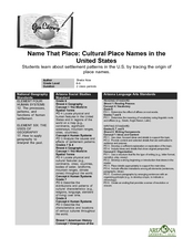
Name That Place: Cultural Place Names in the United States
Students examine the origin of the people that settled in the United States. In this United States History instructional activity, students work in small groups to complete several activities that explore early settlement, such as a...
Curated OER
Location of Cities 201
Students work in pairs to locate the ancient cities on a world atlas using the longitude and latitude measurements. They examine the physical and human futures that explain their locations.
Curated OER
Learning About Location: Charting the Path of the George W. Elder
Students acquire a working knowledge of the geographical concepts: absolute location, relative location, longitude and latitude. They analyze primary sources that shows the physical and human characteristics of the places along the 1899...
Curated OER
Physical Features
Students draw physical land features using ClarisWorks or Kid Pix, write their definitions, create slideshow, and create class geography book.
Curated OER
Postcards From Mars
Fifth graders research and explore what life would be like for human colonists on Mars. They explore various websites, read and discuss newspaper articles, develop a chart of the hardships and conditions that would be faced by colonists...
Curated OER
"ART ZOO 'Blacks in the Westward Movement', 'What Can You Do with a Portrait', and 'Of Beetles, Worms, and Leaves of Grass'"
Students study black history, examine portraits and portrait making and create their own portraits, and investigate their natural environment. This humanities instructional activity provides a text that can be used to teach lessons in...
Curated OER
Bison on the Plains
Fifth graders explore U.S. geography by reading assigned text about American Indians. For this migration lesson, 5th graders identify the differences between Native Americans and European settlers who traveled through middle America in...
Curated OER
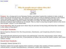
Why do people mover where they do?
Young scholars read factual stories of migration to Hawaii, analyze and explain push and pull factors, interview parents about their cultural heritage, identify countried of origin of their ancestors, graph migration patterns on an world...
Curated OER
Journeys...The Voices of Change
Young scholars trace the immigration patterns of their ancestors. They plot information on a world map, develop a timeline of target immigration patterns, research and write a report on immigration and participate in a class play.
Curated OER
Community Map of The Giver
Middle schoolers read "The Giver" after finishing the unit on inventions and inventors. Using the information in the novel, they develop a geographic map illustrating the community in the story. They identify human and physical features...
Curated OER
Mapping Community Values
Students discuss the origin of various maps focusing on the values behind them. Students also explore how human needs and geography influence community settlement patterns. Students extend learning by creating and mapping their own ideal...


