Curated OER
Mapping the News
Students explore cartography. In this map skills and map making lesson, Students work in groups to create wall size world maps including legends, compass roses, latitude and longitude, and physical features. Students collect current...
Mr. Head's 6th Grade Classroom
Absolute Location
How do we know where we are in the world? A presentation for middle schoolers explains absolute location and other geography terms such as relative location. It also gives scholars the opportunity to practice finding absolute location on...
CK-12 Foundation
Location and Direction: Angle from the Equator
From any angle, this interactive is helpful. Earth science super stars explore a location's angle from the equator through a hands-on activity. Questions guide learners as they test their knowledge of direction and geometry used in...
Curated OER
Time Zones
Students solve time zone problems and chart travel around the world. In this time zone lesson, students learn about the history of time zones and view a time zone map. Students use the time zone map to solve time zone problems. ...
Orange County Water Atlas
Location, Location, Location…
Young geographers discover not only how to read and recognize coordinates on a map, but also gain a deeper understanding of latitude and longitude and how climate changes can vary significantly across latitudes.
Institute for Geophysics
Understanding Maps of Earth
Here is your go-to student resource on primary geography concepts, including facts about the surface of the earth and its hemispheres, latitude and longitude, globes, types of maps, and identifying continents and oceans.
Statistics Education Web
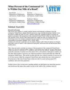
What Percent of the Continental US is Within One Mile of a Road?
There are places in the US where a road cannot be found for miles! The lesson asks learners to use random longitude and latitude coordinates within the US to collect data. They then determine the sample proportion and confidence interval...
Midnight Martian
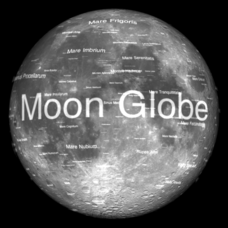
Moon Globe
Not just a simple globe of the moon, this interactive version allows you to choose lighting according to the location of the sun, views from different positions on Earth, and more! Satellite images and topographic data have been combined...
Curated OER
A Natural Connection to the Azores
Students use primary sources to examine whaling voyages, biology, and geography. In this geography lesson, students analyze ship logs and plot locations of animals and determine routes using latitude and longitude.
Curated OER
Geographical Features of the West
Students practice using latitude and longitude appropriately. In this geography skills lesson, students participate in a classroom activity where they identify latitude and longitude.
Curated OER
Geography and Its Five Themes
Geography is not limited to just learning about the Earth and its physical features.
Space Awareness
Let's Map the Earth
Before maps went mobile, people actually had to learn how to read maps. Pupils look at map elements in order to understand how to read them and locate specific locations. Finally, young cartographers discover how to make aerial maps.
Space Awareness
The Sun Compass of the Vikings
Evidence shows the Vikings likely navigated by using a simple sundial to find their course. Videos, a short story, and discussion help bring this time period to life as they study European history with a hands-on experiment. Scholars...
Curated OER
Latitude and Longitude
Students identify latitude, longitude, prime meridian, international date line, and equator. They compute the latitude and longitude of different objects.
Curated OER
You Can Find It!
Students locate different places including U.S. cities using longitude and latitude coordinates. In this longitude and latitude lesson plan, students locate 10 different locations.
Curated OER
Where in The World Am I?
Students explore the concept of absolution location. In this geography skills instructional activity, students discuss how to identify and locate latitude and longitude. Students play a game to reinforce the skills.
Curated OER
Globe Skills Lesson 11The Vietnam War
Students develop their globe and map skills, In this geography lesson, students examine the Vietnam War as they complete an activity that requires them to plot latitude and longitude.
Curated OER
Globe Skills Lesson 4 The Colonial Period
Students practice their map skills. In this Colonial geography lesson, students complete an activity that requires them to locate English colonial locations using latitude and longitude coordinates.
Curated OER
Globe Skills Lesson 2: Paving the Way for Columbus
Students explore the expedition of Christopher Columbus. In this geography skills lesson, students consider the technological advances that made Columbus's expedition possible as they complete a latitude and longitude activity.
Curated OER
Globe Skills Lesson 1 Some Early American Cultures
Young scholars apply their knowledge of geography. In this geography skills lesson, students read brief selections regarding early Americans. Young scholars respond to the questions included in the self-guided map skills lesson.
Curated OER
Taming the Mighty Dragon
Learners incorporate the five themes of geography to study the Yangtze river region. They analyze the possible effects of the three rivers gorge damn project on this area and role play a float the entire length of this dangerous river...
Curated OER
Globe Lesson 9 - Around the World - Grade 6+
For this geography skills worksheet, students read 5-travel scenarios and use their problem solving skills to respond to 9 short answer questions.
Curated OER
Globe Lesson 17 - Alaska and Hawaii - Grade 4-5
Students develop their globe skills. In this geography skills lesson, students explore the area added to the United States when the Alaskan territory was purchased from Russia.
Curated OER
Globe Skills Lesson 10 Apollo 11
Students develop their globe skills. In this geography skills lesson plan, students use a globe and a softball to replicate distance between the earth and its moon.


