Curated OER
Reading Around the World
Students use the internet to identify the seven continents. Using maps, they locate and identify major physical features of Earth. They are read different books by various authors on the Earth and answer questions related to it. They...
Curated OER
Mapping My Community
Ninth graders are introduced to GPS technology. They complete fieldwork as they visit a specific area of their community to identify and map types of land use in the surveyed area. They use the collected data to create a digital map.
Curated OER
Come One, Come All
Students analyze information from core map and other sources and construct routes from New York and Boston to Cincinnati as they might have existed in 1835.
Curated OER
East Asia Country Project
Get your young historians thinking about East Asian culture and history during this partner research project, in which they analyze a variety of East Asian aspects to prepare for a presentation. After an initial "what do we already know"...
Curated OER
What's In a Name?
Students explore the relationship between names and certain cultures and locations. In this identity lesson, students create family migration or immigration maps. Students read excerpts from When My Name was Keoko and Lost Names: Scenes...
Curated OER
The Railroads and Settlement of the Great Plains
Enhance your American literature unit with this resource, in which readers access the Nebraska Studies website and read about "Railroads and Settlement." They search for a photograph of some aspect of the railroad from the Prairie...
Curated OER
"The Drum"
Second graders read and discuss the folktale "The Drum" from India. They also answer story comprehension questions, complete an adjectives and verb worksheet, and label a map of India. Students sequence events from the story and make...
Curated OER
The Countries of Latin America
Fifth graders study the geography, culture, government and economy of Latin American countries. They work in groups to fill out a profile describing their Latin American country. They listen to a reading of Latin American folktales and...
Curated OER
The Mekong River
Junior geographers explore the region through which the Mekong flows, its pathway, the landscape, how people depend on the Mekong, and future uncertainties. They apply the five themes of geography to examine the region. They create a...
Curated OER
Maryland’s Chesapeake Bay Landscape Long Ago and Today
Combine a fantastic review of primary source analysis with a study of Captain John Smith's influence on the Chesapeake Bay region in the seventeenth century. Your young historians will use images, a primary source excerpt, and maps...
Curated OER
Understanding Growth of the Phoenix Area
Students study the growth of the Phoenix area using geographic images, maps, tables, and graphs. They study the idea of community.
Prince William Network
Migration Math Madness
A great way to incorporate math into life science, this lesson has learners measure migratory routes on a map and calculate the actual distance that shorebirds on the routes would cover. Learners compute the distance covered in both...
Curated OER
Flat Stanley
The geography of the United States is the focus of this lesson, as well as writing friendly letters. Your second graders read, "Flat Stanley," by Jeff Brown. They create their own Flat Stanley out of poster board, markers, crayons and...
Curated OER
Robbing the 'Hood?
Students investigate historical figures and how they play a role in tourism by reading and discussing the article "When Robin Hood Supped, Was it Yorkshire Pudding?" In groups, students investigate issues related in the article in...
Curated OER
Searching for Stars
Positive character traits in literature are explored in this character development and literacy lesson plan. Learners listen to Cinderella by Charles Perrault and Little Gold Star by Robert D. San Souci, followed by a discussion...
Environment Agency - Abu Dhabi
Plate Tectonics
Young scholars observe a presentation on plate tectonics, layers of the earth, and plate boundaries. They then use the Internet to research major plates and label them on a world map.
Curated OER
Linguistic Diversity Secondary
Don't be scared off by the title! Read this information packet with your class, or send them off on their own. After each section, you'll find a series of comprehension questions. Great preparation for state testing!
National Endowment for the Humanities
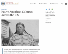
Native American Cultures Across the U.S.
Students examine how American Indians are represented in today's society. They read stories, analyze maps, and complete a chart and create an illustration about a specific tribe.
Curated OER
Following the Great Wall of China
Students conduct research on the history of the Great Wall of China. They explore websites, complete various interactive activities, read a history of the Great Wall, write an essay, and take an online quiz.
Curated OER
Coming of Age During Japanese Occupation: Richard E. Kim's Lost Names: Scenes from a Korean Boyhood
Explore the implications of the Japanese occupation of Korea during World War II. Learners read Lost Names: Scenes from a Korean Boyhood, participate in classroom discussions about the novel and keep journals in which they respond to...
Curated OER
Geography: Analyzing the Local Environment
Students, in groups, explore the school grounds and organize their findings according to the five themes of geography. They take notes and sketch the grounds. Students divide the school and grounds into regions based on use.
Curated OER
Where Is Japan? How Far Is That?
First graders use literature and hands-on activities with maps and globes to explain distance and tools used to measure distance. They select tools to measure various objects in the classroom, then apply those concepts to their map...
Curated OER
Urban Geo Worksheet
In this urban geography worksheet, students respond to 20 short answer questions about urban geography after they have read a related article. The article is not included.
Curated OER
Planet Earth
Students explore and analyze data from different maps in order to explain geographic diversity among the continents. Student groups research continents' physical features and examine how they contribute to quality of life for inhabitants.


