Curated OER
Athabaskan Migration & Bering Strait
Students study Athabaskan migration patterns and the Bering Strait Land Bridge theory. They investigate the importance of the expansion of trade and compare the differences between American Indian oral tradition accounts of origin and...
Curated OER
Environmental Justice
Students explore the concept of environmental stewardship. In this Gulf Oil Spill lesson plan, students discuss how environmental pollution affects those how live in poverty at a higher rate than those with more affluence. Students read...
Curated OER
From North to South...Quebec's Forest Regions
Learners identify and describe the different regions of Canada. With a focus on the forest regions, they use an atlas to locate the ecozones. They identify the characterstics of the climate and vegetation and the relationship between...
Curated OER
More Than One Grain of Rice
Students explore mathematics, geography and agriculture by studying world rice production. In this production of rice instructional activity, students read One Grain of Rice and use a worksheet grid to calculate how much rice was...
Curated OER
Geography and Ecology of the Inuit
Students examine environment and ecology of the Arctic region, and explore history and traditions of the Inuit.
Curated OER
Patterns of Settlement in Early Alabama
Fourth graders study the settlement of Alabama. They collect data from the U.S. census website and answer questions regarding settlement patterns in the counties of Alabama in 1820. They write a paagraph describing where they would have...
Curated OER
Different Perspectives of Oregon's Forest Economic Geography
Young scholars locate the many forests located in Oregon. In groups, they use the internet to research employment data on wood products made in the state. They discuss how looking at information presented in a different way can change...
Curated OER
Geography Overview
Second graders look at the United States often over the next few months. Help them to see how the United States has changed as territories have become states. They may be surprised to know the areas of our country that were territories...
Curated OER
Past v. Present: Using Geography & Anthropology
Students examine artifacts and documents from their Canadian community. They analyze early Canadian history and make predictions about the future of the country.
Curated OER
Focused Learning Lesson: World Geography
Students examine the impact that humans have had on the environment and the difficulties the environment can cause. They also examine major physical changes as a result of human action or natural causes.
Curated OER
Dirty Water: A Case Study
Students identify the causes of arsenic contamination. They list the world organizations involved in ensuring sanitary water supplies. Students describe various methods to mitigate arsenic contamination.
Curated OER
What is the Population Distribution of Cartoon Characters Living On the Pages of Your Newspaper?
Students read various cartoons in their local newspaper and calculate the population demographics, spatial distribution and grouping of the characters. Using this information, they create a population distribution map and share them with...
Curated OER
Diary of a Worm Secret Agents
Second graders explore the geography of Washington D.C. and President Bush's hometown of Crawford, Texas. They read the book, Diary of a Worm, determine the best route to go to Texas from Washington D.C., and throw a birthday party for...
Curated OER
Mapmakers' Perspective
Young scholars examine several maps and consider mapmakers' perspective in early depictions of North America.They determine how the spherical shape of the earth makes any north-south and east-west orientation a matter of perspective. For...
Curated OER
Learning About the Equator, The Seven Continents and the Four Oceans
Students use a globe or map to locate the equator, oceans and continents. Using the internet, they spend time surfing through predetermined websites on continents and oceans. They write facts on different parts of the globe on index...
Curated OER
Human Migration in the United States
Students investigate the factors involved in human migration in the United States. Students analyze maps of different regions in the United States to determine how a variety of factors influence human settlement and development.
Curated OER
Earth and Space Science: Exploring Earthquakes
Students explore earthquakes. In this earthquake lesson, students research earthquakes and identify where they take place. Students use map skills to track down earthquake locations. There are internet sites suggested in this lesson.
Curated OER
Native Americans and Topography at Rose Bay
Students visit a wetland ecosystem. While they are there, students explore how to read topography maps of Rose Bay.
Curated OER
Marvelouw Mongolia
Students are able to: tell basic information about Mangolia: locate it on a world map, locate its capital, name the countries surrounding Mongolia, read a Mongolian folk tale, and explore about the balalaika.
Curated OER
Arctic cleanup
Ninth graders examine pollution problems and how it affects the community. In this arctic cleanup lesson students study ocean currents and how they affect pollution.
Curated OER
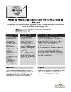
Maize to Maquiladoras: Movement from Mexico to Arizona
Students label maps of Arizona and Mexico of the products that moved from one place to another. In this Arizona and Mexico lesson plan, students also summarize the effects of the movement on life in Arizona.
Curated OER
Aboriginal Societies of Canada
Fourth graders study Aboriginal Societies in Canada and do an oral presentation to the class.
Curated OER
Watersheds, Watersheds Everywhere
Students identify the watershed in which their school is located. They use maps to locate their homes and school. They define and use the correct vocabulary.
Curated OER
Landforms And The Oregon Trail
Fourth graders investigate the historical context for the founding of The Oregon Trail. They conduct research to put together the events that led to the geographical route that was taken. The lesson plan also strengthens geography skills...


