Curated OER
World Map and Globe - Four Main Directions
Students study the four main directions on a map. In this map lesson, students locate the North and South pole, and learn the four cardinal directions. They use the compass rose on a map to help with the directions. (Map is not included...
Curated OER
Where in the Latitude Are You? A Longitude Here.
Students distinguish between latitude and longitude on the map. In this mapping lesson, students participate in mapping skills to recognize spatial relationships, and where to find natural resources on the map. Students create...
Curated OER
Where is Kansas?
Students explore U.S. Geography by analyzing a map. In this state vs. country lesson, students utilize a U.S. map and locate the state of Kansas before researching the history and customs of the state. Students collaborate as a class to...
Curated OER
Wales: An Interdisciplinary Unit
Students practice basic map and geographic skills as they compare Oregon to Wales. Students color map of Wales and Oregon using color codes to distinguish between land, water, and bordering nations or states, listen to stories and...
Curated OER
Where is the Trail? The Journey of Lewis and Clark
Learners explore the trail followed by Lewis and Clark on their journey across the United States. In this United States History lesson, students complete several activities to establish the Lewis and Clark Expedition, including a class...
Curated OER
Our City
Second graders familiarize themselves with the town they live in by practicing their imagination, library research and writing skills.
Curated OER
Landmarks of the Underground Railroad
Students explore Civil Rights by reading several books in class. In this Underground Railroad lesson, students discuss The Story of Henry Box Brown and identify the location and functionality of the Underground Railroad. Students answer...
Curated OER
The Time Has Come: Poetry and Drama Use in the Geography Class
Students use drama and poetry in their Geography class. In groups, they role play an interviewer or the interviewee in various plays that were presented to them. In their role, they must locate and label where the countries mentioned...
Curated OER
Cardinal Directions
First graders study cardinal directions on maps. In this geography lesson, 1st graders determine and show where North, South, East, and West are on various maps.
Curated OER
The Water Nearby
Learners explore water located near where they live. In this map skills maritime lesson, students use Google Maps to find their school and the body of water closest to them. Learners research the body of water and answer questions about it.
Curated OER
Right Place, Right Time
Fourth graders complete mathematical word problems. They study the relationships among distance, speed, and time; and measure travel distances. They measure distances using a piece of string and a ruler and practice converting several...
Curated OER
A Shuttle's Eye View
Students explore the goals of the Shuttle Radar Topography Mission as a springboard to exploring the topographical features of their own state or region. They synthesize their understanding of landforms and topography by mapping their...
Curated OER
"History of My Family"
Students explore world geography by participating in a family history project. In this U.S.S.R. lesson, students read assigned text regarding the Stalinist era of Russia and the intolerance that thrived there. Students answer a list of...
Curated OER
World Map and Globe
Students explore symbols. In this beginning map lesson, students identify common picture symbols. Students place post-it notes with symbols drawn on them in the appropriate place on a map.
Curated OER
Mapping Roxaboxen
Fourth graders read Roxaboxen and draw a map of the Roxaboxen community. In this language arts and geography lesson, 4th graders use specifications given, adding features to the map as described in the book and creating a legend.
Curated OER
What do Maps Show?
Eighth graders practice the skill of reading maps. In this geography lesson, 8th graders participate in a classroom lecture on how to read a map.
Core Knowledge Foundation
Thanksgiving with the Pilgrims
Teach kindergartners about the First Thanksgiving with a series of lessons about the Pilgrims' journey to the New World. As they practice handwriting, CVC words, reading comprehension, and fun Thanksgiving songs, they learn about what...
Curated OER
Journey to Gettysburg
Students use latitude and longitude to map the path of the Battle of Gettysburg.
Roald Dahl
Matilda - The Reader of Books
The titular Matilda from Roald Dahl's famous novel adored books above all things. Discuss why it is important to read stories from across cultures and around the world using the first chapter from the ever-loved story Matilda.
Curated OER
Create Your Own Country Project
Young scholars demonstrate their knowledge of geography with this fun, collaborative social studies project. Working in small groups, students develop their very own countries, writing descriptions...
Cassandra Reigel Whetstone
Farmer McPeepers and His Missing Milk Cows
Pair your reading of Farmer McPeepers and His Missing Milk Cows with the questions and activities provided here. Learners answer questions about the text, create story maps, put together brochures, relate math to the story, practice...
Global Oneness Project
Highways and Change
What is the cost of change? Roberto Guerra's photo essay "La Carretera: Life and Change Along Peru's Interoceanic Highway" asks viewers to consider the impacts of the 1,600 mile-long highway through Peru and Brazil that connects Pacific...
Curated OER
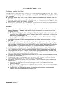
Geography And The Gulf War
Students develop maps, tables, graphs, charts, and diagrams to depict the geographic implications of current world events, and analyze major human conflicts to determine the role of physical and cultural geographic features in the...
Curated OER
GEOGRAPHY: SPACE CENTERS
Students examine the descriptive science dealing with the surface of Earth, its division into continents and countries, climate, natural resources, inhabitants and industries of the various divisions and analyze the political geography...


