Curated OER
Maryland’s Chesapeake Bay Landscape Long Ago and Today
Combine a fantastic review of primary source analysis with a study of Captain John Smith's influence on the Chesapeake Bay region in the seventeenth century. Your young historians will use images, a primary source excerpt, and maps...
Curated OER
Flat Stanley
The geography of the United States is the focus of this lesson, as well as writing friendly letters. Your second graders read, "Flat Stanley," by Jeff Brown. They create their own Flat Stanley out of poster board, markers, crayons and...
Curated OER
French and Family
Where is France? Interest young learners in exploring France, French language, and French culture. They identify similarities and differences between French and American families, speak the French words for family members, analyze maps,...
Curated OER
Are Butterflies Free?
Students use remote sensing to study monarch butterfly migration and human interaction to save the Oyamel forest (Mexico) for butterfly and human habitation.
Prince William Network
Migration Math Madness
A great way to incorporate math into life science, this lesson has learners measure migratory routes on a map and calculate the actual distance that shorebirds on the routes would cover. Learners compute the distance covered in both...
Curated OER
Rivers and Streams
In this rivers and streams worksheet, learners explore how rivers and streams react with the environment. Students also study where the major rivers flow in their local areas. Activities are provided that help learners visualize the...
Sea World
Saving the Wild: Conservation Around the World
Enhance your unit on conservation, ecosystems, or migration with a series of lessons about ways to save the wild around the world. Kids research types of conservation, such as recycling, and use their geography skills to map the...
Curated OER
Arkansas State Mineral: Quartz Mineral
The quartz crystals found in the mountains of Arkansas are among the purest and clearest in the world! This lesson has middle schoolers focus on this state mineral of Arkansas as they study the state's geography. A fun game is...
Curated OER
African American Women Before and After the Civil War: Slavery and Freedom
Students listen to data on African American women in Texas before the Civil War. In this Civil War lesson, students compare and contrast the lives of slave and free women, and discuss case studies, locating areas on a map. Students...
Curated OER
Is Portland, Oregon Experiencing Global Warming?
Students use data to determine if the climate in Portland has changed over the years. In this weather lesson students complete line graphs and study long wave radiation.
Curated OER
From Sheep to Rug
Ever wonder where wool comes from? How it is used to make a woven rug? Introduce the Native American craft of rug making to your preschool or kindergarten class with a discussion. Learners examine and discuss images of a Native American...
Curated OER
Australian Aboriginal Art and Storytelling
Young explorers investigate Australian Aboriginal culture by listening to traditional Dreamtime stories and examining dot paintings created by Aboriginal artists. In addition, they locate the country on maps, discuss the geography of...
National Endowment for the Humanities
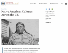
Native American Cultures Across the U.S.
Students examine how American Indians are represented in today's society. They read stories, analyze maps, and complete a chart and create an illustration about a specific tribe.
Curated OER
Robbing the 'Hood?
Students investigate historical figures and how they play a role in tourism by reading and discussing the article "When Robin Hood Supped, Was it Yorkshire Pudding?" In groups, students investigate issues related in the article in...
Curated OER
Searching for Stars
Positive character traits in literature are explored in this character development and literacy lesson plan. Learners listen to Cinderella by Charles Perrault and Little Gold Star by Robert D. San Souci, followed by a discussion...
Curated OER
Coming of Age During Japanese Occupation: Richard E. Kim's Lost Names: Scenes from a Korean Boyhood
Explore the implications of the Japanese occupation of Korea during World War II. Learners read Lost Names: Scenes from a Korean Boyhood, participate in classroom discussions about the novel and keep journals in which they respond to...
VIF Learning Center
Languages as Reflection of Cultures and Civilizations: French Speaking Countries
Expand your class's vision of the French-speaking world by conducting this research project. Pupils focus on building 21st-century skills while they look up information about a French country and put together presentations.
Smithsonian Institution
Braiding Rhythms: The Role of Bell Patterns in West African and Afro-Caribbean Music
Africans transported to the Caribbean as part of the transatlantic slave trade brought with them a rich tradition of music and dance. Four lessons teach young musicians the rumba clave rhythm, cascara rhythm, and the 6/8 bell patterns...
Curated OER
Geography: Islands and Alcatraz
Pupils, in groups, create maps of islands including map keys and compass roses. They compare and contrast their island communities with that of the island prison, Alcatraz. Students select from a series of projects, including writing...
Curated OER
ADULT ESOL LESSON PLAN--Environment and the World
Students locate and trace Florida on a United States map as well as their local counties and city of residence on a state map. In addition, they label all the directions north, south, east and west on each map.
Curated OER
Connections Between World Events, Geography and the Human Quest for Knowledge
Learners examine the relationship between innovations in geography and world events. Using maps, they report different information from a spatial perspective. They develop hypothesis about how man's quest for knowledge has impacted the...
Curated OER
Planet Earth
Students explore and analyze data from different maps in order to explain geographic diversity among the continents. Student groups research continents' physical features and examine how they contribute to quality of life for inhabitants.
Curated OER
A Thoreau Look at Our Environment
Sixth graders write journal entries o school site at least once during each season, including sketched and written observations of present environment. They can use sample topographical maps and student's own maps. Students can use...
Curated OER
Lesson 2: Mapping With Words
Students demonstrate an understanding of the personal relationship that Wabanaki peoples had with the land by analyzing selected Wabanaki place names. They practice map-reading and map-making skills.
Other popular searches
- Geography Map Skills Scale
- Geography Map Skills Europe
- Usa Geography Map Skills
- Geography Map Skills Us
- Canada Geography Map Skills
- Map Skills Geography Themes
- Geography Map Skills Ohio
- Map Skills Geography


