Curated OER
Mending the Rift
Students determine what factors identify a country's political borders. After reading an article, they investigate questions surrounding the Great Rift Valley. On a map, they trace the valley from Asia through Africa and research the...
Curated OER
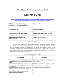
A Visit to Mexico City: An Introduction to World Communities
Third graders complete a variety of activities as they take an imaginary trip to Mexico City, complete with passports, maps, and Spanish dictionaries. They write postcards to send home and create items to sell at the market. The unit...
Curated OER
Westward Ho!
Second graders use a minimum of three maps of Kansas developed during the 1800's. They plot five major settlements that developed near water sources. Students brainstorm reason settlements may have developed near water sources.
Curated OER
The Conquest of the Aztec Civilization
Young scholars use the classroom atlases, the Internet or textbooks to draw a freehand map. They work in groups using the maps in the book The Broken Spears (Portilla) and The Conquest of New Spain (Diaz) to draw a freehand map...
Curated OER
Dante's Inferno
Students examine Dante's trip through Hell. In this literature lesson, students read The Inferno and then collaborate to discuss moral redemption and create their own maps of Hell based on the poem. Written descriptions are required to...
Curated OER
The Return of the Taliban
Students view a news program from Frontline. They discover who the Taliban are and identify their locations on maps. They compare and contrast the changes in Pakistan from 2004 to 2006.
Curated OER
Using Venn Diagrams to Compare Two Ecosystems
Students explore the distribution of two ecosystems on a global scale; and map the distribution of tropical and temperate rain forests throughout the world. They use a Venn Diagram to describe these ecosystems and the differences between...
Curated OER
The Dip Felt Around the World
Young scholars share their opinions about a story about a sudden decline in China's stock markets. After reading an article, they identify the global impact of China's falling stock markets. They create a cause and effect map about the...
Curated OER
A Flip of Life in the 13 Colonies
Fourth graders create a flip book illustrating the 13 original colonies. They study the growth and development of each of the three groups of the original colonies. They use maps to observe and interpret geographic information and...
Curated OER
What on Earth is a Biome?
Students explore organisms and their environments. They examine change over time
demonstrate an understanding of physical positions on Earth. They survey earth's diversity, write a report, fill in a data table created on the...
Curated OER
Louisiana Regional Foodways
Learners strengthen their research techniques in locating, selecting, and synthesizing information from a variety of texts, media, references and internet resources to study regional food way traditions in Louisiana. They assess the...
National First Ladies' Library
Brrrr! Expeditions to the North and South Poles
Students examine the first successful explorations of the North and South Poles, through a study of the four men who accomplished them. They present the fruits of their research on posters, or with PowerPoint presentations.
Curated OER
Rising Temperatures Threaten Penguins
Students examine the continent of Antarctica, then read a news article about the decline in the Antarctic penguin population. In this current events lesson plan, the teacher introduces the article with a discussion and vocabulary...
Curated OER
International Festival: Venezuela
Students become familiar with the Venezuelan culture and geography. In this Venezuelan Festival lesson, students compare and contrast themselves to the people of Venezuela. Students participate in activities to understand the culture...
Curated OER
Lake Tahoe Then and Now
Students investigate the differences in Lake Tahoe from the past to the present. In this geography instructional activity, students read the book Washoe Seasons of Life and identify the descriptions of the land and lake. Students create...
Curated OER
You're Invited to a Ceili: Exploring Irish Dance
Students recognize a Ceili as an Irish dance of celebration and investigate Ireland while studying the dance. In this Irish dance lesson, students search the geography of Ireland, read poetry, identify costumes, draw and perform a dance.
Curated OER
Louisiana
Third graders study factual information about Louisiana including the state flag, bird, tree, and important geographical points using the Internet and maps. They explain the different groups that settled the state in this mini-unit.
Curated OER
LAND USE ISSUES
Learners relate math with real life situations. They identify and plot points on a grid map. They identify and locate the Drop Box Sites.
Curated OER
Book: First Encounters Between Spain and the Americas: Two Worlds Meet
Students, after reading Chapter 1 in the book, "First Encounters Between Spain and the Americas: Two Worlds Meet," design and create a map of the Aztec Empire at the time of the first contract with the Spanish. They create the map from...
Curated OER
Bushy Run: A Decisive Battle of Pontiac's Rebellion
Young scholars study the battle at Bushy Run. In this Pontiac's Rebellion lesson plan, students examine an 1765 map of the Bushy Run battle as well as letters and a modern topographic map of the area in order to simulate the event and...
Learning to Give
Africa - The Great Southland
Applying the five themes of geography, preteen explorers develop a visual aid for younger learners in celebration African American History Month. They investigate the political, geographic, economic, and social aspects of the continent...
Curated OER
Regional Landforms and Native People
Third graders study the Native American tribes of Maidu and Miwok by studying Internet artifacts, culture, language, music, storytelling, architecture, food, clothing, crafts and geology.
Curated OER
El Nino
Students explain what El Nino is, where it is located and how it is created. They describe the weather changes caused by El Nino. They draw the patterns of El Nino on a world map. They predict economic effects El Nino has on the areas it...
Curated OER
Medieval African Kingdoms
Seventh graders examine the geography and political history of West Africa. They role-play as applicants to a company that transports customers to any historic time period. Working in teams, they create promotional products encouraging...
Other popular searches
- Geography Map Skills Scale
- Geography Map Skills Europe
- Usa Geography Map Skills
- Geography Map Skills Us
- Canada Geography Map Skills
- Map Skills Geography Themes
- Geography Map Skills Ohio
- Map Skills Geography


