University of New Mexico
New Mexico Land of Enchantment
Third graders research Native American Cultures surrounding New Mexico. They analyze the history and geography of the state. They play a guessing game that incorporates the indigenous plants and animals of New Mexico. In groups, learners...
Curated OER
Where In the World is the Dominican Republic?
Students begin the lesson by discussing how where they live affects how they live. As a class, they add examples to each category such as home types, clothing, jobs and food. Using those categories, they write about their life in the...
Curated OER
D-Day: June 6, 1944
Students examine the preparations for the invasion of France on June 6, 1944. After viewing a clip from "The War", they identify the demands and concerns of all military leaders for this invasion. They use maps to examine the...
Curated OER
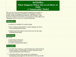
What Happens When Sea Level Rises or Falls
Students examine the impact of sea level on land formations. In this geography and map lesson, students construct a contour map model illustrating how much of the clay "coastline" is covered as water is added. Metric measurement is...
Curated OER
Sense of Place: No River Too Wide-Bridges
Fifth graders discover the history of their hometown Des Moines River. In this U.S. Geography lesson students speak with Iowans that tell stories of the settlers and early villages near the Des Moines River. Students document their...
Curated OER
Early Explorers
Fifth graders study early explorers. For this World history lesson, 5th graders draw an outline of a map labeling each part, build geographical features out of dough, and paint each of the land and water features.
Curated OER
Diversity: Origin Myths
Fifth graders analyze origin myths and the diversity of First Nations groups. In this history lesson, 5th graders review the geography of Canada and read various origin myths. Students illustrate one of the myths and research others in...
Curated OER
What Color is the Ocean?
Students view satellite pictures of the ocean, and discuss the presence of phytoplankton and the colors of the ocean. Students compare/contrast ocean satellite images with maps and globes, then color world maps to replicate the satellite...
Curated OER
Journeys...The Voices of Change
Young scholars trace the immigration patterns of their ancestors. They plot information on a world map, develop a timeline of target immigration patterns, research and write a report on immigration and participate in a class play.
Curated OER
Urban and Agricultural Settlements Why are They There?
Seventh graders identify types of human settlements, urban and agricultural, and determine geographic influence on why people settle where they did by use of maps and charts. They, in groups, identify the needs of a new settlement, which...
Curated OER
Projects For USA Units
Students study different regions of the United states through interdisciplinary activities. This lesson presents very creative, artistic ways for students to explore the variety of regions found in the United States.
Curated OER
Mapping the changes in Canada's population
High schoolers find and analyze data found in the census. They compare the population from 1996 to 2001. They explore the type of data they can find in the Census of Population.
Curated OER
Mapping the Village
Young scholars measure, weigh, and document the amount of trash and garbage generated by the school for one day. They brainstorm solutions for trash in the area and assist with the school-wide recycle program.
Curated OER
Interpreting Aerial Photographs
Students interpret aerial photographs. They view aerial photographs or satellite-produced images to locate and identify physical and human features. They study satellite images and label their images for bodies of water, clouds,...
Smithsonian Institution
The Sounds of an Island: Jamaican Music for the Classroom
Introduce young explorers to the music and history of Jamaican culture through game songs and dances. As a bonus, class members get to play simple songs transcribed for the recorder.
Boston University
Scramble for Africa
In this fantastic simulation, your young historians take on the roles of imperialistic European countries in the nineteenth century and then "scramble" to carve up the continent of Africa! This is a very hands-on activity that will help...
August House
The Contest Between the Sun and the Wind
Learn the moral of the story with a series of activities about Aesop's fables. Focusing on The Contest Between the Sun and the Wind, learners complete a graphic organizer to discuss who, what, how, and why the events occur. Additionally,...
Montana State University
Meet Mount Everest
Learning about one landform might seem boring to some, but using the resource provided practically guarantees scholar interest. The second in a sequential series of eight covering the topic of Mount Everest includes activities such as a...
August House
Anansi and the Pot of Beans
Anansi is a tricky character, but can he realize he's wrong and write an apology letter? Learners use Anansi and the Pot of Beans to practice writing, art, and figurative language. A series of activities are engaging for both advanced...
Alabama Department of Archives and History
Conflict in Alabama in the 1830s: Native Americans, Settlers, and Government
To better understand the Indian Removal Act of 1830, class members examine primary source documents including letters written by Alabama governors and the Cherokee chiefs. The lesson is part of a unit on the expansion of the United...
Curated OER
Mesoamerica
Students demonstrate knowledge of early Middle American civilizations. They study Mesoamerican i religions, governments, and achievements. They identify geographies of North and South America.
Curated OER
A Place Called Nepal
Learners investigate maps of Nepal and then create their own to disover how human activity is influenced by terrain and climate. Students participate in a trek across Nepal simulation to imagine the challenges people have to face...
Curated OER
Learning About the Equator, The Seven Continents and the Four Oceans
Students use a globe or map to locate the equator, oceans and continents. Using the internet, they spend time surfing through predetermined websites on continents and oceans. They write facts on different parts of the globe on index...
Curated OER
Hawaii
Fourth graders become knowledgeable about Hawaii the state and Hawaii the island. They also work on reading maps of the islands. They come to know the customs, climates and other fun little facts. They also come to know the eight islands.
Other popular searches
- Geography Map Skills Scale
- Geography Map Skills Europe
- Usa Geography Map Skills
- Geography Map Skills Us
- Canada Geography Map Skills
- Map Skills Geography Themes
- Geography Map Skills Ohio
- Map Skills Geography


