Curated OER
The Secret Garden
Students research the culture and geography of India and England while reading "The Secret Garden". Using this information, they write at least three predictions about what they believe might happen in the story. Using the Internet,...
Curated OER
Country: Austria
Students access a variety of Austria themed websites. They locate information about history, geography, climate, people and culture. They view a live webcam of different parts of Austria and read about famous personalities from Austria.
Curated OER
The Desert Alphabet Book
Students use a book to discover an interesting fact from the desert using each letter of the alphabet. Using a United States map, they identify the meanings of symbols and locate deserts within the U.S. In groups, they participate in...
Curated OER
Athabaskan Migration & Bering Strait
Pupils study Athabaskan migration patterns and the Bering Strait Land Bridge theory. They investigate the importance of the expansion of trade and compare the differences between American Indian oral tradition accounts of origin and...
Curated OER
Terrestrial Ecozones, Population Density and Species at Risk
Tenth graders navigate and use the online Atlas of Canada. They explain the cause and effect relationship between human settlement and the natural environment and wildlife species. They utilize a worksheet imbedded in this plan.
Curated OER
Location of Cities 201
Young scholars work in pairs to locate the ancient cities on a world atlas using the longitude and latitude measurements. They examine the physical and human futures that explain their locations.
Curated OER
A Geopoem About Alaska
Sixth graders conduct Internet research on the physical and human characteristics of Alaska. They compose and write geopoems about the state of Alaska, using a template.
Curated OER
Geography Overview
Second graders look at the United States often over the next few months. Help them to see how the United States has changed as territories have become states. They may be surprised to know the areas of our country that were territories...
Curated OER
Home: the Story of Maine "A Love for the Land": Where Are You? Who Are You?
Pupils investigate their neighborhood both as it is now and as it was 100 years ago. They take a walk around their neighborhood and fill out a worksheet before completing a worksheet.
Curated OER
From North to South...Quebec's Forest Regions
Students identify and describe the different regions of Canada. With a focus on the forest regions, they use an atlas to locate the ecozones. They identify the characterstics of the climate and vegetation and the relationship between...
Curated OER
The Three Gorges Dam- Should it be Completed?
Students research and analyze the geographic problem of whether or not the Three Gorges Dam should be completed. Students take a position on the issue, gather information related to their position, present their conclusions, and write a...
Curated OER
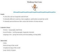
Walking that Line
Pupils attempt to describe and use longitude and latitude. They will identify different countries, their neighbors, and borders around the world. Included in the lesson the students identify natural features that control the borders of...
Curated OER
Africa: Names and Nations of Note
Students explore Africa. In this global studies instructional activity, students research the history of African nations, noting the impact of European colonization and other historical events. Students design posters about the nations...
Curated OER
Fall Around the World
What is autumn like in Shanghai? How much rain falls during September in Sydney? Is Moscow cold in October? Take a virtual trip around the world with a research assignment on autumn in different countries. After learners answer questions...
Curated OER
More Than One Grain of Rice
Students explore mathematics, geography and agriculture by studying world rice production. In this production of rice lesson, students read One Grain of Rice and use a worksheet grid to calculate how much rice was received. Students...
Curated OER
Home Sweet Home-Far From Home
Students observe slides of U.S. coastal geography. They study topography and vegetation maps for one region. They gather geographic facts on a guided worksheet. Students pretend to be colonists. They decide what kind of economic system...
Other popular searches
- Geography Map Skills Scale
- Geography Map Skills Europe
- Usa Geography Map Skills
- Geography Map Skills Us
- Canada Geography Map Skills
- Map Skills Geography Themes
- Geography Map Skills Ohio
- Map Skills Geography


