Curated OER
Australia Cities Map Quiz
In this online interactive geography quiz worksheet, students respond to 17 identification questions regarding Australian cities. Students have 3 minutes to finish the timed quiz.
Curated OER
Oceania Map Quiz
In this online interactive geography quiz learning exercise, students respond to 14 identification questions about Oceania. Students have 2 minutes to complete the quiz.
Curated OER
United States Map Quiz
In this online interactive geography quiz worksheet, learners respond to 50 identification questions about the shapes of countries shown. Students have 5 minutes to complete the quiz.
Curated OER
Midwestern States
In this United States geography instructional activity, students study the image of the Midwestern states. Student then label the states with the following choices: Missouri, Iowa, South Dakota, Minnesota, Nebraska, Illinois, North...
Curated OER
U.S. geography for Children: New York
In this geography activity, 5th graders study the state of New York. Students follow the given directions to complete 5 tasks on the state map that is given.
Curated OER
North America
In this map of North America worksheet, students study the map of North America and then write the names of the 11 countries on the provided lines.
Curated OER
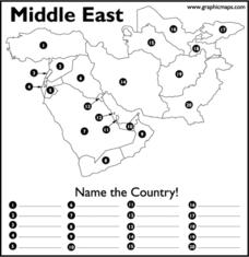
Middle East
In this map of the Middle East worksheet, students study the map of the Middle East and then write the names of the 20 countries on the provided lines.
Curated OER
Australia
In this map of Australia worksheet, learners research and study a map of Australia. Students label Australia's regions, major states and important landmarks.
Curated OER
Rhode Island State Map
In this geography of Rhode Island worksheet, students color and label a map with the major cities and physical features. Students also study a U.S. map to learn the location of the state of Rhode Island.
Curated OER
Canadian Provinces Quiz
In this online interactive geography quiz activity, students examine the map that includes 13 Canadian provinces. Students identify the names of the provinces in 3 minutes.
Curated OER
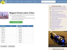
Great Lakes Cities Quiz
In this online interactive geography instructional activity, students examine a map of the Great Lakes region and identify the 20 noted cities on the map using a pull down menu within 4 minutes.
Curated OER
Biggest Mediterranean Islands
In this online interactive geography quiz worksheet, students examine the the a map and chart as they try to name all of the Mediterranean Islands represented in 4 minutes.
Curated OER
Seventh Grade Social Studies Test
In this Georgia social studies assessment activity, 7th graders respond to thirty multiple choice questions based on seventh grade social studies skills.
Curated OER
Seventh Grade Social Studies Quiz
For this Georgia social studies assessment activity, 7th graders respond to fifteen multiple choice questions based on seventh grade social studies skills.
Curated OER
River Clyde, Scotland Pictoral Map
In this River Clyde, Scotland geography worksheet, students study a detailed pictorial map. Students learn that the river is used for work and pleasure as they study locations on a labeled map. There are no questions.
Curated OER
The River Forth-- Pictorial Map of Scotland
In this River Forth in Scotland geography worksheet, students learn of important industries and settlements by studying the pictorial map. There are no questions to answer.
Curated OER
Northern Africa Map Quiz
In this online interactive geography quiz worksheet, students respond to 18 identification questions regarding the nations of Northern Africa.
Curated OER
Central Africa Map Quiz
In this online interactive geography quiz worksheet, students respond to 15 identification questions regarding Central African countries.
Curated OER
Atlantic Ocean Map Quiz
In this online interactive geography quiz worksheet, students respond to 7 identification questions regarding the Atlantic Ocean.
Curated OER
Pacific Ocean Map Quiz
In this online interactive geography quiz worksheet, students respond to 5 identification questions regarding the Pacific Ocean.
Curated OER
Canada Map Quiz
In this online interactive geography quiz instructional activity, students respond to 12 multiple choice questions regarding Canadian countries.
Curated OER
North American Lakes Map Quiz
In this online interactive geography quiz activity, students respond to 11 identification questions regarding North American lakes.
Curated OER
North American Mountain Ranges Map Quiz
In this online interactive geography quiz instructional activity, students respond to 7 identification questions regarding North American mountain ranges.
Curated OER
Google Earth
In this Google Earth worksheet, students access the Google Earth website and find the latitude, longitude, and elevation for their house and school. Then they do the same for a variety of world locations. This worksheet has 10 fill in...
Other popular searches
- Geography Map Skills Scale
- Geography Map Skills Europe
- Usa Geography Map Skills
- Geography Map Skills Us
- Canada Geography Map Skills
- Map Skills Geography Themes
- Geography Map Skills Ohio
- Map Skills Geography


