Curated OER
Tooling Around Arizona: Reading Arizona Maps
Students research Arizona maps. In this map lesson, students discuss map titles, scales, directions, elevation, and symbols. The class will examine topography, landforms, and rivers found on an Arizona map.
Oregon State
World Map of Plate Boundaries
Young geologists piece together the puzzle of plate tectonics in an earth science lesson. Given a physical map of the world, they search for land formations that indicate the location of different types of plate boundaries.
Curated OER
U.S. Geography- The Northeast
Students investigate the geography of the Northeast states. In this map skills lesson, students are shown a map of the Northeast states and identify the state names and borders. Students construct individual maps of the Northeast using...
Curated OER
Map It With Pixie
Fourth graders use the computer program 'Pixie' to create a topographic, detailed map for the state they live in. In this mapping skills lesson, 4th graders use Pixie to make a map of their state that includes topographic features, state...
Curated OER
Rivers Run Through It
Using a relief map of New York State, learners answer questions about the distance between different cities, identify bodies of water, and more. First, they discuss vocabulary related to the Hudson River area. Then, they complete a...
Curated OER
Magical Maps
Second graders discuss the importance of using maps and how they are used. After they listen to a folktale, they develop their own story line maps and write their own folktale to accompany a map. They also identify and locate the seven...
Curated OER
Mapping Perceptions of China
Students discuss what types of things are included on a map. They compare and contrast maps of China with a map they create and practice using different types of maps. They write analysis of their classmates maps.
Curated OER
Understanding: Geography
Students explore their neighborhoods. In this geography lesson, students make a map of their neighborhood. They must include a key, natural terrain, buildings and streets. They also write a descriptive paragraph about their neighborhood.
Curated OER
Map Work: How Far?
In this map scale worksheet, learners analyze a map of an area with several towns marked. Students use the scale (1 cm = 1 km) to answer 6 questions about the distances between towns.
Curated OER
Globe Skills Lesson 10 Apollo 11
Middle schoolers develop their globe skills. For this geography skills lesson, students use a globe and a softball to replicate distance between the earth and its moon.
Curated OER
Globe Skills Lesson 1 Some Early American Cultures
Learners apply their knowledge of geography. In this geography skills lesson, students read brief selections regarding early Americans. Learners respond to the questions included in the self-guided map skills lesson.
National Endowment for the Humanities
Lesson 3: On the Road with Marco Polo: From Hormuz to Kashgar
Young explorers examine the route that Marco Polo and his father traveled to reach China. They examine online maps of the Silk Road and harsh terrain of Afghanistan to determine challenges that may have been encountered during travel.
Curated OER
Getting to the Core of World and State Geography
Students create topography relief maps. In this geography skills lesson, students review geography core knowledge skills, design and make a state relief map, and compile a student atlas.
Curated OER
Organization of a Territory, Map Elements
Third graders compare printed and online maps and use proper geographic terminology to answer questions.
Curated OER
Geography Worksheet
In this geography skills worksheet, students respond to 14 short answer questions by using maps and atlases. The maps and atlases are not included.
Curated OER
Topographic Maps Worksheet
In this geography skills worksheet, students respond to 37 multi-part questions that require them to read and interpret topographic maps.
Curated OER
What do Maps Show?
Eighth graders practice the skill of reading maps. In this geography instructional activity, 8th graders participate in a classroom lecture on how to read a map.
Curated OER
BOLTSS Map
In this geography worksheet, students identify the six features always used on maps. They identify each of these features by the acronym BOLTSS. Students examine the Melbourne Cricket Ground shown and respond to the 4 questions that follow.
Curated OER
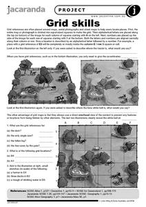
Grid Skills
In this geography activity, students use grid references on a map to locate places in the pictures given. They also identify another advantage of using a grid map, which they have an overhead view of the content to prevent any features...
Curated OER
Understanding Geography
Students create a map of their own neighborhood to show the relationships between the geography of the neighborhood and its economy and culture. They view and discuss an introductory video on how geographers study an area then go out...
Curated OER
Africa: Introduction, Geography and Mapping
Learners study the geography of Africa through the use of maps. They locate, distinguish, and describe the relationships among varying regional and global patterns of geographic phenomena such as landforms, climate, and natural resources.
Curated OER
The Roman Empire-Map Activity
For this Roman Empire worksheet, learners complete a map activity in which they label and color civilizations, countries and physical features as instructed. There are no maps included.
Curated OER
Map It!
Fourth graders demonstrate map making skills by using the computer to create maps of the geographic features, regions, and economy for their state.
Curated OER
Globe Skills Lesson 2: Paving the Way for Columbus
Learners explore the expedition of Christopher Columbus. In this geography skills lesson, students consider the technological advances that made Columbus's expedition possible as they complete a latitude and longitude activity.


