Curated OER
I Can Compass, Can You?
Students discover how to use geographic tools. In this compass lesson, students identify cardinal directions by appropriately using compasses along with a number of various maps.
Curated OER
The Ie Storm 1998: Maps and facts activity
Middle schoolers investigate the St. Lawrence River Valley, ice Storm of 1998. In this middle school mathematics lesson, students interpret ice storm data from tables and maps. Middle schoolers write about their own...
Curated OER
Hip Hop and Geography
Students study the various geographic regions of the U.S. and discuss how popular music is influenced by cultural/regional factors. Groups choose East Coast, West Coast, Midwest, or South in rap/hip hop music and create a PowerPoint or...
Curated OER
Latin American Relief Map
Learners, in groups, research, design and construct a relief map of a section of Latin America using papier-mache. They show major landforms, elevations and notable bodies of water. They present their maps to the class.
National Geographic
Types of Volcanic Eruptions
Blow the roof off your classroom with this multimedia science lesson plan on volcanic eruptions. A short online video teaches young geologists about shield and composite volcanoes and explores the examples of Kilauea and Mt....
Curated OER
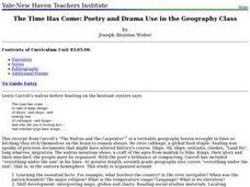
The Time Has Come: Poetry and Drama Use in the Geography Class
Middle schoolers use drama and poetry in their Geography class. In groups, they role play an interviewer or the interviewee in various plays that were presented to them. In their role, they must locate and label where the countries...
Curated OER
Learning About Location: Charting the Path of the George W. Elder
Students acquire a working knowledge of the geographical concepts: absolute location, relative location, longitude and latitude. They analyze primary sources that shows the physical and human characteristics of the places along the 1899...
Curated OER
US Policy In Somalia
Learners investigate the US policy for the country of Somalia. They conduct research using a variety of resources. They locate the country and then discuss major geographical features of the areas. Students discuss the present US...
Curated OER
Puerto Rico: The 51st State?
Young scholars research the history of Puerto Rico, its culture, and geography. In this Puerto Rico lesson, students find Puerto Rico on a map and find specific regions or cities. Young scholars discuss Puerto Rico's statehood and listen...
Curated OER
Maps that Teach
Students study maps to locate the states and capital on the US map. Students locate continents, major world physical features and historical monuments. Students locate the provinces and territories of Canada.
Curated OER
United States Geography and Topography
Fifth graders recognize the major regions of the US while reading a map. Students study the physical features of the US. Student research and report on states and their capitols.
Curated OER
Mapping the Border
Students create maps of the borderland region. They decorate their maps with colors, pictures, icons, scenes, words that reflect their understanding of the character and history of the borderland.
Curated OER
Edible Resource Maps
Third graders work in groups to create an edible resource map showing locations of at least five resources in the United States. Students research on the internet different regions and the resources that are found in those areas. They...
Curated OER
Tracking Satellites Using Latitude and Longitude
Students, viewing an Internet site, plot the path of several satellites using latitude and longitude over the course of an hour. They learn the four basic types of satellites and their purpose.
Theodore Roosevelt Association
Roosevelt's Legacy: Conservation
The legacy of Theodore Roosevelt carries through modern American politics, economics, foreign policy, and society. But his proudest and most profound efforts were in the world of conservation, and in preserving the natural beauty of...
Population Connection
The Human-Made Landscape
Agriculture, deforestation, and urbanization. How have human's changed the planet and how might we mitigate the effects of human activity on the planet? To answer these questions class members research the changes in human land use from...
Curated OER
Beyond Demographics
Students study the culture of the Dominican Republic. In this Peace Corps lesson, students watch, "Destination: Dominican Republic." Students also examine primary source materials on the nation and discuss their findings.
Curated OER
My Summer Vacation
Students study the United States geography using Google Earth. For this U.S. geography lesson, students create travel journals about five U.S. geographical locations. Students research the human and physical characteristics for each region.
Curated OER
Eastern Europe: Passport to Understanding
Seventh graders explore Eastern Europe. They analyze data on select countries. Students prepare a short oral presentation on the country they researched. They locate their country using an interactive map.
Curated OER
Our Class Is On the Map
Second graders review map keys, symbols, and the purpose of maps, then students design a poster size map of their classroom.
Curated OER
African Safari
Seventh graders examine different countries in Africa to research. They choose one to concentrate their research on using the five themes of geography. They design a multimedia presentation that will make up the African safari.
Curated OER
Study of New York City
Fourth graders read A Cricket in Times Square and examine the essence of living in New York City. They examine subway maps and other resources concerning NYC and then complete several writing activities about the city. They also create...
Curated OER
Making a Travel Brochure of a Louisiana Parish
Although the attachments for this travel brochure project are no longer linked, you can still use the idea here and create your own assignment sheet and rubric. Learners choose a parish in Louisiana (or a city in your state) to research,...


