Richmond Community Schools
Map Skills
Young geographers will need to use a variety of map skills to complete the tasks required on this worksheet. Examples of activities include using references to label a map of Mexico, identify Canadian territories and European...
Owl Teacher
Introduction to World of Geography Test
Assess your learners on the five themes of geography and the most important key terms and concepts from an introductory geography unit. Here you'll find an assessment with 15 fill-in-the-blank and 14 multiple-choice questions, sections...
Oregon State
World Map of Plate Boundaries
Young geologists piece together the puzzle of plate tectonics in an earth science lesson. Given a physical map of the world, they search for land formations that indicate the location of different types of plate boundaries.
Curated OER
Topographic Mapping Skills
For this geography worksheet, students read an excerpt about topographic maps and why they are useful for various jobs. They also respond to eleven questions that follow related to the excerpt and locating specific map points on the map...
Curated OER
The Roman Empire-Map Activity
For this Roman Empire worksheet, learners complete a map activity in which they label and color civilizations, countries and physical features as instructed. There are no maps included.
Curated OER
U.S. Geography for Children: The Northeast
For this map skills of the northeastern United States worksheet, students observe an outline map, locate and label the states, and designated landforms and bodies of water; and create symbols and a map key for sources of economy and...
Curated OER
U.S. Geography: California
In this map skills about the state of California worksheet, students locate and label specific places and areas and create a map key and symbolize the economy and areas of personal interest. Students answer 5 questions.
Curated OER
U.S. Geography for Children
In this U.S. map activity instructional activity, learners observe maps of the continental United States, Hawaii, and Alaska, locate and label landforms and bodies of water, and create symbols for natural resources and places of...
Curated OER
U.S. Geography for Children: Michigan
In this Michigan map activities worksheet, students observe an outline map of the state of Michigan, locate and label specific places and areas, and create a map key. Students complete 5 activities.
Curated OER
Mapping Exercise
In this mapping worksheet, students are given data of children exposed to health risks and their geographical location. Students plot each child's home and the risk factors using an (x, y) grid. They answer 2 questions about the...
Curated OER
U.S. Geography for Children: State Capitals
For this United States map skills worksheet, students locate and label specified states and their capitals, and create icons and a map key to show something for each state that is famous. Students answer 5 questions.
Curated OER
Texas: U. S. Geography for Children
In this Texas map worksheet, students locate and label key features of Texas on the map and create icons to symbolize the economy and culture of Texas.
Geophysical Institute
Latitude and Longitude with Google Earth
Travel the world from the comfort of your classroom with a lesson that features Google Earth. High schoolers follow a series of steps to locate places all over the earth with sets of coordinates. Additionally, they measure the distance...
Curated OER
Florida: U.S. Geography for Kids
In this Florida geography activity, students locate and label the important features of Florida and create icons for the economy and culture of Florida.
Curated OER
Geography: Flat Out Wird
In this maps worksheet, students answer short answer questions about comparing a map to a crumpled up piece of paper. Students answer 3 questions.
Curated OER
Topographic Maps Worksheet
In this geography skills worksheet, students respond to 37 multi-part questions that require them to read and interpret topographic maps.
Curated OER
Geographical Skills-- Map Scale
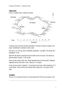
In this maps learning exercise, students study a simple map and the scale in kilometres. Students read the directions and answer one question. Students then look at a sketch map of a town and answer 2 questions. Students also read how to...
Curated OER
Map Keys
In this geography worksheet, students identify who a cartographer is and what they do specifically. They study an outline map of a fictitious island and then, respond to the three questions that follow. Finally, students add three more...
Curated OER
U.S. geography for Children: New York
In this geography worksheet, 5th graders study the state of New York. Students follow the given directions to complete 5 tasks on the state map that is given.
Curated OER
Geographic Terms Glossary
In this geography worksheet, students learn 60 common geographic terms. Students read the words that are arranged in alphabetical order along with the meanings. There are no questions to answer; this is a glossary.
Curated OER
Ancient Mesopotamia
In this geography worksheet, students read about ancient Mesopotamia and respond to five short answer questions that follow. They identify what part of the country was the heart of Mesopotamia. Then students compare the given map with a...
New York Times
New York Times: Crossword Puzzle: Weather
The New York Times Learning Network has developed interactive and printable crossword puzzles. The theme of this one is weather.


