Curated OER
States with Attitude, Latitude and Longitude Dude
Sixth graders identify states whose boundaries are formed by lines of latitude and longitude or natural borders such as rivers. They trace a map of the U.S., and fill in borders, rivers and lines of latitude and longitude.
Curated OER
Landforms and Resources of the United States and Canada
In this North American geography worksheet, students read about the physical features and resources of the United States and Canada. Students take notes and answer 3 short answer comprehension questions as they read the selection.
Curated OER
Living Swamps, Bayous and Forests
Third graders explore interesting environments by exploring Louisiana. In this wetland lesson, 3rd graders utilize the web to research the State of Louisiana, the bayous in the area, and the Gulf of Mexico. Students write a journal entry...
Curated OER
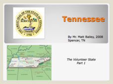
Tennessee: The Volunteer State Part 1
Explore the state of Tennessee, PowerPoint style! Regions, geographical features, and some amazing state facts are yours for the asking. Major cities are named and followed by related facts. This neat presentation on an interesting state...
Curated OER
Arkansas Geography/History Relief Map
Sixth graders research a number of sources including the Internet to find information about the regions of Arkansas while locating sites of national historic interest. They located sites on maps while working at assigned websites. They...
Curated OER
What in the World Is a Watershed?
Learners discover the role of a watershed. In this geography lesson, students are shown a diagram of a watershed and discuss the definition of a watershed. Learners demonstrate the role of a watershed by using an umbrella and spraying it...
Curated OER
4th Grade Social Studies
In this social studies activity, 4th graders answer multiple choice questions about colonies, the Revolutionary War, geography, and more. Students complete 25 questions.
Curated OER
State of Alabama
In this reading passages about the state of Alabama worksheet, students read about the state's geography, history, exploration, industry, and people and use the information to answer multiple choice and true and false questions. Students...
Curated OER
How To Find a Site
Fourth graders identify the three basic needs of humans. They identify on a map the best places to live and make a list of items that they can find on a map - streams, river, hills, plains, forests, etc.
Curated OER
Washington, D.C.
For this Washington, D.C. worksheet, students complete 6 pages of readings and questions about Washington, D.C. Included are general facts, geography, monuments, history, economy and people. There is a short text and 6 multiple choice...
Curated OER
Surveying the Land
Students explore the different kinds of maps and the purpose of each. In this Geography lesson, students work in small groups to create a map which includes the use of a map key.
Curated OER
Water Features - Lesson 2 - U.S. Political Map Grade 4-5
Students locate water features on maps. In this geography lesson, students complete worksheets that require them to identify water features on a U. S. political map.
Curated OER
Oklahoma
In this geography worksheet, students read a 2 page selection detailing the location, history and early statehood of Oklahoma. They answer 10 true or false questions based on the reading.
Curated OER
Geography: Map Making
Learners, working in groups, share notes and maps collected during a study of the Lewis and Clark Expedition. They draw large composite maps of the western United States on butcher paper including land formations, bodies of water, and...
Curated OER
The Great American Desert
In this American deserts learning exercise, students study the images and read the passages to learn about the 6 divisions in the American landscape: the Eastern lowlands, the Flood Plain, the Great Plains, the Rocky Mountains, and the...
Curated OER
Eager to Get to Ancient Egypt
Seventh graders explore the geography of Ancient Egypt, read a story and answer questions on a web site.
Curated OER
Globe Skills Lesson 5
In this map skills worksheet, learners read a text selection about locations during the American Revolution and then respond to 8 fill in the blank questions.
Curated OER
Where is the Water?
Students explore freshwater ecosystems. In this geography lesson, students brainstorm all the lakes and rivers they know then mark them on a map. Students will then mark all the major freshwater resources on each of the seven continents,...
Curated OER
Globe Skills Lesson 6 The Louisiana Purchase
Learners explore the Louisiana Purchase territory. In this geography skills lesson, students use map skills in order to plot and note latitude and longitude, measure scale distance, and locate landforms that were part of the Louisiana...
Curated OER
Lewis and Clark Expedition
Ninth graders examine the goals of the Lewis and Clark Expedition and identify the present day cities, towns, rivers, and regions that are on the route of the expedition. They complete an online WebQuest, recreating the route of the...
Curated OER
Mapping the Civil War
Young scholars identify the locations of pivotal American Civil War battles. In this map skills lesson plan, students label Fort Sumter, Antietam, Vicksburg, Gettysburg, and the Battle for Atlanta on an outline map. The map is not included.
Curated OER
State Your Mission
Students explore state history and geography that correspond with classroom lessons.
Curated OER
Six Dynamic Designs for Arts Integrated Curriculum
Students create a recipe for a certain aspect of a culture. They create a culture that has never existed before. They analyze either dance, history, geography, history or the future of space exploration. They compare and contrast...
Curated OER
Coasts and Reefs: Shallow Marine Processes
A more thorough presentation on coastal systems would be difficult to find! Detailed diagrams illuminate the offshore, shoreface, foreshore, and backshore zones of beach. The sources and movement of sediments along the coastline...


