Curated OER
Geography and Artifacts of Mexico
Students review the structure of government in Mexico and discuss how it is different than the United States. Using artifacts, they must label and identify the city or state in which the artifact originated. They use the artifact clues...
Curated OER
Assessing and Making Maps
Students evaluate maps using the TODALSIGs basic map analysis system, explained on the worksheet. They create a map of Alaska using TODALSIGs. Students brainstorm the elements of maps.
Curated OER
A Long Way from Home: A Hands-on Geography Lesson about World War II
Students build World War II directional signs. For this World War II lesson, students explore the geographic locations of the war as they analyze primary sources and conduct research regarding places of significance in the war. Students...
Curated OER
U.S. Archaeological Sites: Geography Practice
In this archaeological sites activity, students read about sites in the Unites States and use a map to complete a set of 7 short answer questions.
Curated OER
Recreate the Race
Learners research and find the route of the Alaskan dog sled race.In this Iditarod race instructional activity students find the checkpoints for the Iditarod on a map. Learners research information in pairs about each one of the...
Curated OER
United States Quiz Two
In this United States worksheet, learners answer short answer questions about which political party the Presidents belonged to and geography of the country. Students answer 20 short answer questions.
Curated OER
Geography: My Community as a Region
Students discuss the differences between formal, functional and perceptual regions in Alaska. They work in small groups to research community.
Disney
Where Do Brown Bears Live?
What do brown bears in Alaska's Katmai National Park need to survive? Pupils explore the unique habitats, diet, and survival needs of this animal. They predict the consequences of removing any integral part of the bear's survival,...
Curated OER
Geography: Alaska Geography Treasure Hunt
Young scholars locate features listed on the Treasure Hunt sheet.
Curated OER
Adapting to Survive
Students examine how the climate and environment affect people in Alaska. They identify the five regions of Alaska on a map, conduct Internet research, write a report on the climate differences in the five Alaskan regions, and write a...
Curated OER
The Oily "Grail"
Pupils discover the quest for a balance between oil exploration and a concern for the environment in Alaska. They synthesize their knowledge by debating the current length of the oil-drilling season.
Curated OER
Topographic Maps Worksheet
In this geography skills worksheet, students respond to 37 multi-part questions that require them to read and interpret topographic maps.
Curated OER
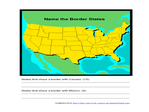
Identifying Border States of the U.S.
In this identifying border states of the U.S. worksheet, 3rd graders visually identify then write the names of the states that border Canada and Mexico; page 1 is a lesson, page 2 is the worksheet.
Curated OER
States in the USA Quiz
In this online interactive geography quiz activity, students respond to 50 identification questions about the states in the United States of America. Students have 4 minutes to complete the quiz.
Curated OER
Fish Now or Later
Students describe the effects of over-harvest on a salmon population. They explain the importance of salmon to many communities in Alaska. They manage harvest levels to maintain a sustainable population.
Curated OER
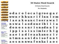
50 States Word Search
In this fifty states worksheet, students identify and locate all fifty states of the United States of America. There are 50 states located in the word search.
Curated OER
Learning About Location: Charting the Path of the George W. Elder
Students acquire a working knowledge of the geographical concepts: absolute location, relative location, longitude and latitude. They analyze primary sources that shows the physical and human characteristics of the places along the 1899...
Curated OER
General Knowledge Questions- All School Subjects Lower Intermediate
In this interactive general knowledge activity, students complete 24 multiple choice questions based on their knowledge in several subject areas. These subjects include science, geography, sports and music.
Curated OER
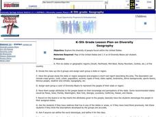
Diversity
Students work in groups to research and prepare an oral report about a region. In this regions lesson, students find out about the geography, population, state capitals, and landmarks. Students assign attributes to the people...
Agriculture in the Classroom
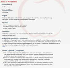
Wad-a-Watershed
What kind of impact do humans have on watersheds? Find out in a lesson that defines, explores, and promotes ways to protect our watersheds. The ultimate goal of the lesson is for learners to discover how a watershed is impacted by...
Polar Bears International
Top of the World
Learn about polar bears and the Arctic circle with a lesson about the countries and conditions of the region. After examining how the area differs from Antarctica, kids explore climates, animals, and geographical position...
Concord Consortium
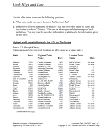
Look High and Low
From the highest high to the lowest low here's a resource that won't fall flat. Given data on the area and the highest and lowest elevations of each of the 50 states, learners decide which states are the least flat and the most flat. Of...
Simon & Schuster
Classroom Activities for The Call of the Wild by Jack London
Three activities are designed for readers of Jack London's The Call of the Wild. First, class members research and create posters that reflect the setting of the novel. Next, groups create posters with images that represent each chapter...
Curated OER
Biggest Cities in Each State Quiz
In this online interactive geography quiz worksheet, students examine the chart that includes the names of 50 U.S. states. Students identify the names of the two largest cities in each state in 8...


