Curated OER
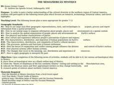
The Mesoamerican Mystique
Students gain a better understanding of the cultural diversity in the northern region of Central America. They engage in a lesson which focuses on research, archaeology, historical videos, and travel highlights.
Curated OER
Traveling Through North America
Students identify places and landmarks in North America, specifically Canada and the United States, by using and constructing maps. Six lessons on one page; includes test.
Curated OER
Use a Bar Graph
In this bar graph worksheet, students use a given bar graph to answer a set of 3 questions. Answers included on page 2.A reference web site is given for additional activities.
Curated OER
Hafta Do NAFTA?
Students examine the benefits and problems of U.S. participation in the North American Free Trade Agreement. In two groups, students represent the campaign team for a presidential candidate, one for and one against NAFTA, and research...
Curated OER
I AM a Researcher, "I"nca, "A"ztec, "M"aya
Students create and original multimedia presentation on the Incas, Mayans, or Aztecs. In this Meso-American civilization lesson, students research and then compare and contrast the civilizations of the Incas, Mayan and the Aztecs....
Curated OER
Getting to Know My World
Students participate in hands-on activities using maps and globes to identify geographical features. Students use map legends to identify direction. Students locate oceans, continents, countries, states and cities. Handouts and...
Curated OER
Seas, Gulfs and Bays
Students define gulf, bay, and sea. In this bodies of water mapping lesson, students locate seas, gulfs and bays and explain how they knew which body of water it was.
Curated OER
Gray Whales on the Move
Students study whale migration and their natural history. In this migration lesson students plot whale migration on a map and describe their ecosystems.
Curated OER
State to State Scavenger Hunt
In this states worksheet, students utilize the Internet to access one specific website to locate the answers to five fill in the blank statements about the states found on a United States map.
Curated OER
Langston Hughes
Students identify similarities between Hughes' poetry and music (jazz and the blues).
Curated OER
The Global Village and Trade
Pupils analyze maps of trade patterns between the United States and other nations and identify factors that may influence the production of goods.
Curated OER
Organizaton of American States Project
High schoolers discover the Organization of American States by researching currents issues in those countries. They create a PowerPoint presentation and share with the class.
Curated OER
The Dust Bowl and the Ogallala Aquifer
Students research the characteristics of the Great Plains as an agricultural area. They examine farming techniques from the past and how those farming techniques are used today. They investigate the present uses of the Ogallala Aquifer.
Curated OER
Push/Pull factors in Immigration
Students explore the push/pull factors experienced by immigrant families. They interview a parent and an American about their family's immigration history. Students write a summary of the interview and compare the push/pull factors of...
Curated OER
Mixing Up the Melting Pot
Students examine the cultures of indigenous peoples and how they have or have not assimilated into modern society. They create reports with recommendations on how the Nukak of Columbia could be assimilated into society.
Curated OER
Tiny Tortillas
Students read the rhyme "Tiny Tortillas" and then explain what the poem is about. They create a list of rhyming words from the poem. They compare and contrast the poem "Tiny Tortillas" with the poem "Patty Cake". They clap out the beat...
Curated OER
Keeping News Trustworthy
Students analyze media sources. In this media awareness lesson, students consider media outlets as businesses and discuss how they present information. Students keep media logs and analyze selected newspapers, magazines. or television...
Curated OER
USA Immigration by Country Quiz
In this online interactive geography quiz worksheet, students respond to 30 identification questions about countries U.S. citizens have immigrated from. Students have 5 minutes to complete the quiz.
Curated OER
Mapping the Border
Learners create maps of the borderland region. They decorate their maps with colors, pictures, icons, scenes, words that reflect their understanding of the character and history of the borderland.
Curated OER
Foods and Languages of the World
Students create their own ice cream sundae given various toppings from around the world. In this foods and languages of the world diversity lesson, students develop an understanding of diversity in culture, family structure, ability and...
Curated OER
THE MESOAMERICAN MYSTIQUE
Learners research, archeology, historical videos, and travel highlights in the northern region of Central America. They identify the various archaeological / historical sites along with a date of probable existence and the title of the...
Curated OER
El Dia de los Muertos (Day of the Dead)
Fifth graders describe ways in which people in the United States remember and honor the dead. They identify the similarities and differences between El Dia de los Muertos, Memorial Day, and Halloween.
Curated OER
A Brief History of Los Angeles
Students study the diverse cultures that make up the population of Los Angeles.
Curated OER
My Diary From Here To There: Understanding Mexican Culture Through Research and Diary Entries
Third graders explore the adventures of an immigrant as she comes to the United States. They discuss the difficulties the immigrants had and they research the Mexican culture and society. Students create a diary of their own.
Other popular searches
- Mexico Geography
- New Mexico Geography
- Mexico Geography Map
- Cultural Geography of Mexico
- Mexico Culture Geography
- The Geography of Mexico
- Physical Geography of Mexico
- Teaching Geography of Mexico
- Making Physical Maps Mexico


