Curated OER
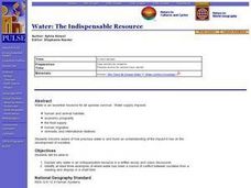
World Geography: Water: The Indispensable Resource
Learners are able to explain why water is an indispensable resource in a written essay and class discussion. They identify at least three examples of where water has been a source of conflict between societies from a reading and...
Curated OER
A River Mosaic#136
Students determine the meaning of culture as it applies to groups of people. They examine how immigration changes the cultural attribute of a geographic location. They design a Big Book that describes cultural mosaics.
Curated OER
Geography: Map Making
Pupils, working in groups, share notes and maps collected during a study of the Lewis and Clark Expedition. They draw large composite maps of the western United States on butcher paper including land formations, bodies of water, and key...
Curated OER
Geography: Mapping Neighborhoods
Young scholars examine their neighborhoods and draw maps reflecting land use. In addition, they make predictions about their community's future. Students also consider the impact of business and industry on their communities and...
Curated OER
Taming the Mighty Dragon
Students incorporate the five themes of geography to study the Yangtze river region. They analyze the possible effects of the three rivers gorge damn project on this area and role play a float the entire length of this dangerous river...
Curated OER
Kid Maps: Reading and Creating Maps with Human Characteristics
Students look at maps. In this map lesson, students listen to the book My Map Book by Sara Fanelli and they see the difference between human characteristics (buildings, etc.) and natural characteristics (rivers, etc.). They...
Curated OER
Eager to Get to Ancient Egypt
Seventh graders explore the geography of Ancient Egypt, read a story and answer questions on a web site.
Curated OER
The Human Face of Flagstaff
Students make a brochure for Flagstaff, Arizona. In this geography instructional activity, students look at a map of Arizona and the Flagstaff Chamber of Commerce sheet to find natural and human features of the city. They create a...
Curated OER
Canada, Our Neighbor to the North
Students obtain knowledge of Canadian geography and history. Students work in groups gathering information to create a brochure on Canada. Students discover how French and British history helped shape Canada as a nation.
Curated OER
Where is the Water?
Students explore freshwater ecosystems. In this geography lesson, students brainstorm all the lakes and rivers they know then mark them on a map. Students will then mark all the major freshwater resources on each of the seven continents,...
Curated OER
Mapping Roxaboxen
Fourth graders read Roxaboxen and draw a map of the Roxaboxen community. In this language arts and geography lesson, 4th graders use specifications given, adding features to the map as described in the book and creating a legend.
Curated OER
Water Features - Lesson 2 - U.S. Political Map Grade 4-5
Students locate water features on maps. In this geography lesson plan, students complete worksheets that require them to identify water features on a U. S. political map.
Curated OER
What's Holding Up the Water?
Students read about the history and locate dams in Arizona. In this Arizona dams lesson plan, students write a summary about what they read focusing on word choice, ideas, conventions, and geography content.
Curated OER
Globe Skills Lesson 6 The Louisiana Purchase
Students explore the Louisiana Purchase territory. In this geography skills lesson, students use map skills in order to plot and note latitude and longitude, measure scale distance, and locate landforms that were part of the Louisiana...
Curated OER
What if the Mormons had not come to Utah?
Fourth graders use critical thinking, evaluation, and geography skills to find alternative locations that Brigham Young could have taken the Mormons to settle.
Curated OER
There's a Watershed in my Backyard!
Students explain what the term watershed is by creating a model. In this science, geography lesson, students demonstrate how the water moves in a watershed. Additionally, students learn about point source and nonpoint source pollution....
Curated OER
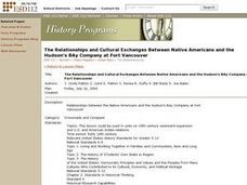
The Relationships and Cultural Exchanges Between Native Americans and the Hudson's Bay Company at Fort Vancouver
Students are introduced to the geography of the Columbia River basin and its history. Using the internet, they research the relationships between the Native Americans and the Hudson Bay Company. They also discuss the effects on the...
Curated OER
Diggin' The Past
Students explore the culture of Ancient Egypt. In this ancient civilizations lesson, students are divided into groups to research how aspects of culture were influenced by the Nile River. Students create a slide show that describes how...
Curated OER
Put Me in My Place: Using Alphanumeric Grids to Locate Places
Students practice locating points on a large wall grid and create and label a neighborhood map. In this geography lesson, students spell and discuss places as the teacher places them on the map. They discuss the concept of an...
Curated OER
Globe Lesson 17 - Alaska and Hawaii - Grade 4-5
Students develop their globe skills. In this geography skills lesson, students explore the area added to the United States when the Alaskan territory was purchased from Russia.
Curated OER
Fighting Disease
Seventh graders explore the concept of medical intervention in African nations. In this geography activity, 7th graders research primary and secondary sources in search of information regarding Guinea worm disease. Students use their...
Curated OER
The Carter Center’s Work in Sub-Saharan Africa
Students explore the state of Sub-Saharan Africa. In this geography skills lesson, students examine the work of the Carter Center in Africa as they investigate the strengths and weaknesses of linguistic, tribal, and religious...
Curated OER
Science Inquiry Lesson: Mapping Project
Students explore the methods of creating maps. They create a map of Animas River Park using a compass and measuring tape, develop a single map from the team map sections, and devise another map of the Animas River Park using a GPS unit.
Curated OER
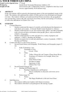
A Tour Through China
Students explore the culture, development, inventions, and geography of China in the seven lessons of this unit. The teachings of Confucius are examined and the celebrations for the Chinese New Year are inspected.
Other popular searches
- Ireland Geography Rivers
- Rivers and Lakes Geography
- Geography Rivers Year 3
- Geography Rivers Fieldwork
- Geography Rivers and Floods
- Geography Rivers Poems
- Geography Rivers of Canada
- Geography Rivers Thames
- Geography Rivers in Texas
- U. S. Geography Rivers
- U S Geography Rivers


