Curated OER
World Geography Quiz
In this world geography worksheet, students answer several questions based on world geography and landmarks. Students answer 10 multiple choice questions.
Curated OER
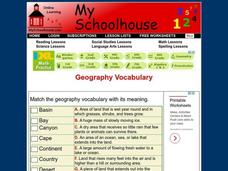
Geography Vocabulary
In this identifying geographic terms and their definitions online interactive worksheet, students match the vocabulary words with their definitions. Students match 24 answers.
Curated OER
Landforms of Illinois
Fifth and sixth graders are introduced to the primary landforms of Illinois and discover how they were created. Landform cards are made for each pupil. They use the twenty-questions format until they have identified each one. Then,...
Sharp School
Travel Brochure Project
Designing a travel brochure is a classic project that will help your class members develop a variety of skills, such as researching informational texts, designing creative visual products, and communicating what you have learned.
Curated OER
Asoka’s Empire Worksheet
Learning about ancient history can be enhanced by incorporating geography. The class labels six geographic features on a map of India and respond to seven short answer questions about Asoka's reign.
Curated OER
Exploring the Hudson in 1609
Learners follow the journey of Henry Hudson down the river with his name. Using journal entries and maps, they learn about its exploration. They use maps to identify stages of the journey, and practice converting distances into miles.
Indian Land Tenure Foundation
Maps and Homelands
You are never too young to learn about maps. To better understand the concept of a homeland, students work together to construct a map of their local area out of paper puzzle pieces. They'll put the maps together and then add details by...
K-State Research and Extensions
Water
How are maps like fish? They both have scales. The chapter includes six different activities at three different levels. Scholars complete activities using natural resources, learn how to read a map, see how to make a compass rosette,...
Curated OER
Geography and Its Five Themes
Geography is not limited to just learning about the Earth and its physical features.
Curated OER
Geography of the United States
Students examine the population growth of the United States. In this Geography lesson, students construct a map of the fifty states. Students create a graph of the population of the USA.
Curated OER
Year 3 Geography
In this social studies worksheet, students find the words that are related to the concepts found in Geography and the answers are found at the bottom of the page.
Scholastic
Perfect Postcards: Illinois
Connect the geography and history of Illinois using an art-centered lesson on the railroads. The railroad connected once-distant places, particularly in the Midwest. Using research, class members create postcards of fictional cross-state...
Curated OER
Geographic Landforms
Each slide is a simple notebook page with one landform in blue and its definition in red. There are 26 vocabulary terms in all, some you may want to use, and others easily hidden. It is recommended that you add photos or other graphic...
Curated OER
Where Does Water Come From?
Perfect for children in pre-K through 1st grade, this presentation provides simplified information about the water cycle. While no academic language is used, the water cycle is fully represented in clear and easy-to-follow slides. This...
Curated OER
Geography of South America
Student's identify geographic features of a South American map. They use the scale of the map to calculate distances between points. They identify examples of the five geographic themes on the map of South America.
Curated OER
Geography of Mesopotamia
Students write a letter. In this irrigation lesson plan, students review how humans and the environment can interact with each other, learn new vocabulary words having to do with Mesopotamia, learn about irrigation and view maps of...
Curated OER
Ancient River Valley Civilizations
Ziggurats, cuneiform writing, the Tower of Babel, hieroglyphics, pyramids, the Great Wall. Launch a unit on ancient cultures, with a presentation that introduces viewers to ancient Mesopotamia, Babylonia, Sumer, Egypt, Indus, and China....
NASA
Outline Maps
Don't miss this gold mine of blank maps for your next geography lesson! Regions include traditional continents such as Asia, Europe, and Africa, as well as other major world areas such as the Pacific Rim and the Middle East.
Curated OER
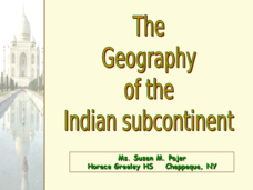
The Geography of the Indian Subcontinent
Gloriously adorned with a glimpse of the Taj Mahal, these slides detail important facts and characteristics of South Asian cultures, such as India, Pakistan, Afghanistan, and several other surrounding countries. Slides cover the...
Curated OER
The Geographic Question
Students are introduced to the characteristics of a river system. In groups, they discover how rivers are formed and how it flows. They discuss the relationship between the river system and people and develop ways to keep the river...
Curated OER
Trading Information
Students create a trading card about a state bordering the Mississippi River. Using traditional and internet research, students generate a list of interesting facts about their chosen state using the five themes of geography. They use...
Curated OER
FRED the FISH
Students engage in the study of the human impact on environmental systems (specifically rivers). This instructional activity enhances Students' exploration of a variety of themes or topics.
Curated OER
Louisiana Purchase
Students use maps to locate and describe the area purchased by the Louisiana Purchase. In groups, they write a letter to Thomas Jefferson in which they evaluate the topography, climate and geography of the land. They determine the land's...
Curated OER
America Will Be
Learners work together to research and create different types of maps of the United States to be used as part of a geography trivia game.Groups research North American annual rainfall, climate, mountain ranges major rivers and state...
Other popular searches
- Ireland Geography Rivers
- Rivers and Lakes Geography
- Geography Rivers Year 3
- Geography Rivers Fieldwork
- Geography Rivers and Floods
- Geography Rivers Poems
- Geography Rivers of Canada
- Geography Rivers Thames
- Geography Rivers in Texas
- U. S. Geography Rivers
- U S Geography Rivers


