Curated OER
Globe Skills Lesson 11The Vietnam War
Students develop their globe and map skills, In this geography lesson, students examine the Vietnam War as they complete an activity that requires them to plot latitude and longitude.
Curated OER
Regions of South America
Students explore facts about South America in the four lessons of this unit. Booklets are created from the materials produced as the class delves into the topic.
Curated OER
Police Action: The Korean War, 1950-1953
Students explore why the United States became involved in the war in Korea. They discuss the confict between Truman and MacArthur, culminating in the latter's dismissal from command. They identify on a world map foreign countires...
Curated OER
Africa Capitals Map Quiz
In this online interactive geography quiz worksheet, students examine the map that includes 53 African countries. Students match the names of the countries to the appropriate locations.
Curated OER
Where In the World Am I?
Learners identify their location in the world after studying latitude, longitude, relative location, and absolute location. They use assigned web site to find information to make a flipbook that answers questions about their location in...
Curated OER
Getting to Know My World
Students participate in hands-on activities using maps and globes to identify geographical features. Students use map legends to identify direction. Students locate oceans, continents, countries, states and cities. Handouts and...
Curated OER
Taming the Wild Aurochs
Fourth graders assess the development of animal husbandry, outline it in detail as well as arrange the steps in sequential order. In addition, they discuss how certain animals came to be domesticated, concentrate to research on one of...
Curated OER
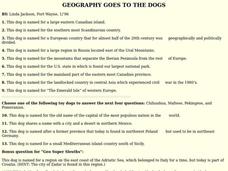
GEOGRAPHY GOES TO THE DOGS
Students use countries and dogs from around the world to answer the questions.
Curated OER
Air Pollution in Mexico City
A fantastic lesson on urban air pollution problems throughout the world is here for you. Learners understand that there are many factors involved in creating pollution, that there are many health effects brought on by air pollution, and...
Curated OER
Hemispheres: People and Place
Here is an astounding series of lessons, designed for high schoolers, on environmental policy. By studying water conservation in rural India, the role of the government, and the reaction of the people, learners begin to formulate...
Curated OER
The Republic of Sakha (Yukutia)
Young geographers learn about the extreme temperatures found in the Rebublic of Sakha, and study the hardships caused by these temperatures. They look at why people choose to live in such a remote and rugged area. This incredible,...
Curated OER
Big Dam Construction in India
This complete and full resource includes everything needed to conduct a lesson on the environmental impact of large dams in India. Background information, handouts, answer keys, and web links are all there to help you educate your class...
Curated OER
The Southeast Anatolia Project
This resource is amazing. It is a full project including teacher notes, handouts, procedure, and worksheets. It introduces learners to the GAP project, a social environmental group working to bring irrigation, assistance, and increased...
Curated OER
Southeast Asian Architecture
Seventh graders search online for current and historic images of Southeast Asian architecture. They compare architecture in Southeast Asia to North American, European, Russian/Eurasian, North African/Southwest Asian and South American...
Curated OER
NCTA Lesson Plan on China
Students identify China's geography, especially arable land, rainfall, crop growing areas, rivers, and mountains. Students select a technological advance to draw a diagram of the particular advance make transparencies of the diagram,...
Curated OER
Which Foods Come From Rainforests?
A very interesting and colorful presentation on the original sources of food is here for you. Learners discover where foods such as bananas, asparagus, potatoes, and oranges come from. They come from rainforests located all over the world!
Curated OER
Identifying Continents and Oceans
Students locate and identify the four major oceans and the seven continents on a world map. They use an unlabeled world map and compass rose to describe relative locations of the continents and oceans.
The New York Times
Decision Point: Understanding the U.S.’s Dilemma Over North Korea
Simulate the Situation Room and analyze the US's relationship with North Korea. The plan starts off with a quick review and an examination of a online timeline that updates as the situation continues. Next, the class reads an article and...
Curated OER
Maps that Teach
Students study maps to locate the states and capital on the US map. Students locate continents, major world physical features and historical monuments. Students locate the provinces and territories of Canada.
Curated OER
History and Government of the United States
In this U.S. worksheet, students take notes in a graphic organizer as they read several passages, then answer four comprehension questions.
Curated OER
The Lesson: Bio-fuels
Students explore the pros and cons of bio-fuel use. In this environmental stewardship lesson, students visit selected websites to discover what bio-fuels are and the effect they may have on the environment.
Curated OER
Disaster Strikes
Students examine the devastation caused by the tsunami of 2005. In this current events instructional activity, students consider the effects of natural disasters as they research tsunamis and the worldwide response to the December 26,...
Curated OER
Conditions in And Connections To Indonesia
Eleventh graders research an animal and its habitat, the conditions of that habitat and how its connections to the rest of the world are affecting that habitat.
Curated OER
How to Celebrate the 800th Anniversary of the Mogol Empire
Students research information on the Mongolian Empire from various readings and online videos of primary sources and create a poster for oral presentation. Students connect history with the current day, while incorporating geographical,...


