Curated OER
Florida: U.S. Geography for Kids
In this Florida geography instructional activity, students locate and label the important features of Florida and create icons for the economy and culture of Florida.
Curated OER
World Map PDF
In this social studies learning exercise, 1st graders practice creating the letter "J". They use the example in the lesson plan in order to draw the letters correctly.
Curated OER
Abigail Adams: Integrating Social Studies and Language Arts
Third graders increase reading strategies while learning about Abigail Adams and her role in history. For this Abigail Adams lesson, 3rd graders read about the American Revolution and Abigail Adams using all the balanced literacy...
Curated OER
World Geography: Global Interdependence
Students are able to discuss the theory of climate change. They identify examples of how climate change impacts the earth's geo-spheres. Students are able to use the example of climate change to describe the interdependence of the...
Curated OER
Exploring South Carolina
If you are having your students conduct a State study this presentation could be a nice example to show them. This resource provides general information about the geography, animals, and city life one may find in South Carolina. Web...
Curated OER
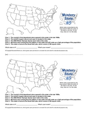
Mystery State # 5
Mystery state number five is none other than Utah! Quiz your kids on state knowledge while building deductive reasoning skills. They use each of the five clues to determine the name of the mystery state. A great warm up when studying...
Curated OER
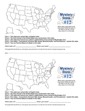
Mystery State #12
What's better than learning about US geography? Having fun while your doing it! After reviewing each of the five given clues, learners attempt to name the mystery state. A great way to reinforce geography skills and deductive reasoning...
Pimsleur
Book Report: Children Return to Their Roots
Based on the book Victoria Goes to Brazil (Children Return to their Roots) by Maria de Fatima Campos, this lesson will teach learners about family, geography, sports, music, and transportation. Learners read, summarize, and use the book...
Curated OER
Connecticut Map
In this state maps worksheet, students identify the state of Connecticut, and fill in the state capital, major cities, and other major attractions.
Curated OER
Colorado Map
In this state maps worksheet, students identify the state of Colorado, and fill in the state capital, major cities, and other attractions for the state.
Curated OER
North Carolina Map
In this state maps worksheet, students identify the state map of North Carolina. Students fill in the state capital, the major cities, and other state attractions.
Curated OER
Michigan Map
In this state maps worksheet, students identify the map of Michigan. Students then fill in the capital city, major cities, and other state attractions.
Curated OER
Maine Map
In this state maps learning exercise, students identify the map of Maine. Students fill in the capital city, major cities, and other state attractions.
Curated OER
Montana Map
In this state maps instructional activity, students identify the state map of Montana. Students fill in the capital city, the major cities, and other state attractions.
Curated OER
New Mexico Map
For this state maps worksheet, learners identify the state of New Mexico. Students fill in the state capital, major cities, and other state attractions.
Curated OER
Vermont Map
In this state maps activity, students identify the map of Vermont. Students fill in the state capital, the major cities, and other state attractions.
Curated OER
The Earth's BIG Features
Your students will enjoy the vivid pictures and interesting facts about world geography, in this presentation. Depicted are several major geographical features found around the world and a description of each.
Curated OER
Maps
If your students are just starting a unit on Geography this could be the introduction you're looking for. This PowerPoint presents a clear and organized overview of the different types of maps people use and why each is important. Tip:...
Curated OER
Diverse Societies in Africa
Early African society was shaped by environment and geography. Define the life ways of early African societies with this informative presentation. Topics are basic and only touch lightly on the complex nature of the subject matter.
Curated OER
Mystery State # 28
Using clues is a great way to increase deductive and logical reasoning skills. Boost thinking skills while quizzing kids about us geography. They use five clues to determine which state is in question.
Curated OER
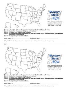
Mystery State # 24
Prepare those brains for a rousing day of learning with a fun geography activity. Your pupils use five different clues to determine the name of mystery state number 24. Where do all those potatoes come from? Idaho!
Curated OER
Geography of South America
Student's identify geographic features of a South American map. They use the scale of the map to calculate distances between points. They identify examples of the five geographic themes on the map of South America.
Scholastic
Perfect Postcards: Illinois
Connect the geography and history of Illinois using an art-centered lesson on the railroads. The railroad connected once-distant places, particularly in the Midwest. Using research, class members create postcards of fictional cross-state...
PBS
Arthur’s World Neighborhood: Bibliography for Kids
Support young learners as they expand their cultural awareness with this list of children's literature on countries from around the globe. Including both fictional and non-fictional texts. This resource will help students across the...
Other popular searches
- World Geography Studies
- Geography Studies the Sea
- Geography Studies Rocks
- Elementary Geography Studies
- Geography Studies Cd Rom
- Social Studies Geography
- Social Studies Us Geography
- Social Studies and Geography
- Social Studies Maps Geography


