Curated OER
Troical Atlantic Aerosols
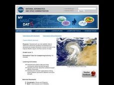
Students explore the effect aerosols have upon he weather and climate. They observe NASA satellite images to explore and draw conclusions about aerosol transport. From studying the images, students track the path of aerosols. They...
Curated OER
$$$eaweed
Learners compare and evaluate the world's different seaweeds. In this investigative lesson students study seaweed and the harvesting of it. They then interpret the data collected and graph the seaweed production.
Curated OER
Gale's Curriculum
Seventh graders develop an understanding of Southeastern Asian culture. They increase knowledge of world geography in relation to Southeast Asian countries. Students research a variety of Southeast Asian animals and habitats to be used...
Curated OER
Breaking the Ice: Who Controls the Northwest Passage?
Learners consider the global climate issue. In this Northwest Passage lesson plan, students examine who has sovereignty of the passage and discuss the importance of the Law of the Seas and its impact on the global climate issue. Learners...
Curated OER
Japanese Modernization and Imperialism
Students examine the period in which Japan ended its isolationism with the rest of the world. Using the internet, they identify the reasons why Japan occupied and annexed Korea along with the country's reasons for going to war with...
Curated OER
The Gulf Coast Region: Georgraphy, Demographics and the Effects of Hurricane Katrina
Students research Hurricane Katrina and create a Cause and Effect graphic organizer or a Chain of Events graphic organizer.
Curated OER
A Trip Back in Time
Second graders, through the following 10 lessons, develop an understanding of what life was like in Ancient Greece.
Curated OER
Let's Spice It With Pepper
Pupils identify and locate the areas in which pepper and spices orginated. On a map, they locate the areas and write the name of the spice that is found there. They use historical events to trace its route to the Americas. They answer...
Curated OER
Human Rights in the Philippines
Students examine the meaning of human rights under the United Nations system, in the U.S., and the Philippines. They conduct research, discuss the concepts in groups, and conduct a debate on the human rights situation post Marcos...
Curated OER
I Am A Rock, I Am An Island: Describing Landforms and Bodies of Water
Students identify common landforms and bodies of water from descriptions of distinguishing features. In this landforms and bodies of water lesson plan, students describe the features they see in the pictures given to them.
Curated OER
The Geographic Question
Students are introduced to the characteristics of a river system. In groups, they discover how rivers are formed and how it flows. They discuss the relationship between the river system and people and develop ways to keep the river...
Curated OER
Korean History Through Journaling
Students explore Korea and details about the Choson Kingdom. In this Korea lesson plan, students examine the geographical location of Korea. Students also take notes on a lecture about the Choson Kingdom and relations between Japan...
Curated OER
A Changing Planet
Students describe climate change and the future impact it could have on our physical environment. They identify the regions of the world that would encounter the most significant effects of a global warming.
Curated OER
The Great Lighthouse at Alexandria
Learners read and research about Alexandria's Great Lighthouse. In this Greek architecture lesson, students create a timeline of events in Alexandria, and design a lighthouse. Learners research lighthouses online and write a report.
Curated OER
Dark and Beautiful Caves
Young scholars research how caves form. They describe the major stone formations in caves by taking notes. They construct a clay model of a cave and mark each formation making it easy to identify in the legend.
Curated OER
Lusitania: Murder on the Atlantic
Students explore the pride of the Cunard line and a jewel in the British crown; a floating four star hotel. But during World War I, the RMS Lusitania carried more than well-to-do travelers luxuriating in her sumptuous appointments.
Curated OER
Traveling the Silk Road
Students take a virtual trip down the Silk Road. Using a map, they trace the location of the trade route and others that were developed later. They use different spices and goods to trace how they came to the Americas. They answer...
Curated OER
Mapping the Civil War
Students identify the locations of pivotal American Civil War battles. In this map skills lesson, students label Fort Sumter, Antietam, Vicksburg, Gettysburg, and the Battle for Atlanta on an outline map. The map is not included.
Curated OER
Discovery Atlantis
High schoolers explore Atlantis. In this geography lesson, students research selected websites to discover information about the lost continent of Atlantis. High schoolers use the fruits of their research to participate in a debate...
Curated OER
NFE General Knowledge Quiz
Eighth graders review various aspects of World History. In this World History lesson, 8th graders participate in a bingo game. Students complete a worksheet during bingo.
Curated OER
2005 Hidden Ocean Expedition What's Eating You?
Analyze data and make inferences about the trophic position of organisms in the Canada marine food web. After a review of the geography and formula, discuss results and write an essay to improve the understanding of Artic food webs.
Curated OER
China
Students explore the geography, culture and history of China. As a class, they discuss historical contributions to China, Confucius, and geographic features of the country. Pupils use the internet to answer questions about China.
Curated OER
Water and Land 207
Students examine maps of different projections, mathematically calculate distortions, and note the advantages and disadvantages of each map. They study the different maps and transfer the map to graph paper.
Curated OER
the New Explorers:Into the Depths
Students explore the self preservation mechanism that is inherent in the Great Lakes. They examine how scientists are studying Great Lakes, and what their predictions are for these national treasures.


