Curated OER
Westward Ho: The Difficulties of Emigrants Moving West
Learners research the journey west of 19th century emigrants. In this pioneer lesson, students read the letters and diaries of a fictitious family traveling on the Oregon Trail. They mark their route on a US map, create a chart showing...
Curated OER
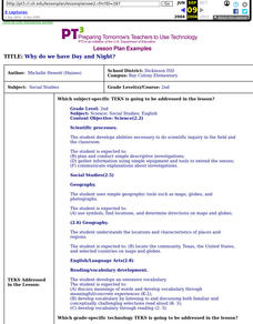
Why Do We Have Day And Night?
Second graders demonstrate knowledge and appropriate use of hardware components, software programs, and their connections. After a lecture/demo, student groups utilize raisins and apples to demonstrate day and night. They put togethre a...
Curated OER
Finding Their New World
First graders place stickers on maps indicating their understanding of the cardinal directions. They locate Jamestown, England, the Atlantic, and Virginia.
Curated OER
Maize to Maquiladoras: Movement from Mexico to Arizona
Fourth graders label maps of Arizona and Mexico to show the people, goods, and ideas that have moved between the two places. In this Arizona and Mexico lesson plan, 4th graders summarize the effects of the movement on Arizona life.
Curated OER
Desert Views - First Impressions: Travelers on the Gila Trail
Students draw animals and plants that are described to them as they read passages of people who traveled across the Gila Trail in the Southwest. In this Gila Trail lesson plan, students also write a letter describing a plant or animal in...
Curated OER
Me on the Map: Homes, Neighborhoods, and Communities
Students read a book about maps and identify the differences between a picture and a map. In this maps lesson plan, students also label maps of their home, neighborhood, and community.
Curated OER
Paint My Counties: Map Coloring the Counties of Arizona
Fourth graders identify the counties of Arizona. In this social studies lesson, 4th graders color a county map of Arizona using the fewest number of colors possible. Students write a persuasive paragraph.
Curated OER
Native Americans and Topography at Rose Bay
Students visit a wetland ecosystem. While they are there, students explore how to read topography maps of Rose Bay.
Curated OER
Surprise at Pearl Harbor
Students review the concept of courage and relate it to their daily life. As a class, they are introduced to the events of December 7, 1941 at Pearl Harbor. Using a map, they locate Hawai'i and label the islands. They use the internet to...
Curated OER
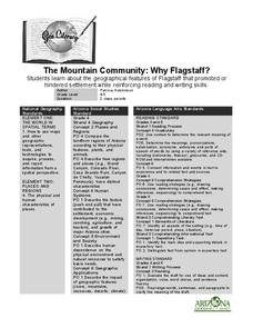
The Mountain Community: Why Flagstaff?
Students identify geographical features that hindered or promoted settlement in the city of Flagstaff, Arizona. In this settlement lesson plan, students write a summary of what they learned and identify geographical features on a map.
Curated OER
Fruits and Vegetables
Students make a variety of recipes that include fruits and vegetables. In this fruit and vegetables lesson plan, students make recipes, learn about the proper amounts of fruits and vegetables needed per day, describe how to sanitize...
Curated OER
I Am A Rock, I Am An Island: Describing Landforms and Bodies of Water
Students identify common landforms and bodies of water from descriptions of distinguishing features. In this landforms and bodies of water lesson plan, students describe the features they see in the pictures given to them.
Curated OER
George Washington Carver
Second graders participate in an investigation of George Washington Carver and his life. They conduct research using the provided text. Specifically, 2nd graders use the large print and pictures to strengthen reading comprehension. They...
Curated OER
Symbols from History: Mesopotamia Today
Students identify the various symbols different nations use to represent themselves. As a class, they discuss the recent events in Iraq and identify the needs of its people. They use print resources to research various Mesopotamian...
Curated OER
Cranes, Crosswalks, and Big Gulps
Students watch a video and answer questions based on wildlife jobs. In this wildlife lesson plan, students learn that biologists don't just play with animals but that there is a lot of study involved.
Curated OER
Study of New York City
Fourth graders read A Cricket in Times Square and examine the essence of living in New York City. They examine subway maps and other resources concerning NYC and then complete several writing activities about the city. They also create...
Curated OER
Charles Lindberghs's Flight to Paris
Students practice map skills. In this map skills lesson, students locate the cities of New York and Paris on a map. Students read about the flight made by Charles Lindbergh in May 1927 from New York to Paris. Students answer 8 questions...
Curated OER
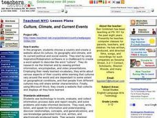
Culture, Climate, and Current Events
Students decide on a country to research as a class, keeping a list of the countries already being researched. Using the internet, they research the culture, climate and current events of the country. They end the lesson plan by...
Curated OER
Kids for Character Pledge
Students discuss character and values and discuss what it means to be a good citizen. In this character lesson plan, students also sign the Kids for Character pledge and pledge to be good citizens.
Curated OER
The Greatest Survival Story of All Time
Students use the Internet to read about an explorer's survival in the Antarctic. They try to find a better route for him to have taken.
Curated OER
Haiti: Exploration and Colonization
Tenth graders discuss what their prior knowledge of the exploration of the Americas/Caribbean and the history of the island of Haiti. They trace Columbus' journey from Spain to Hispaniola and locate Haiti in the Caribbean and read the...
Curated OER
Continents of the Globe
Students identify the continents on the globe. In this map skills lesson, students define the term "continent" and identify the seven continents on the globe.
Curated OER
Country Mouse, City Mouse?
Students recognize the characteristics of a rural area. They analyze land use to determine whether the map is of a rural (country) area or an urban (city) area.


