Curated OER
Weather Or Not
Students use the internet to find pen pals to share in their weather experiment. Individually, they research the high and low temperatures for cities within the United States and email the results to their pen pal. They also develop a...
Curated OER
Regions of the USA
Fourth graders research the physical characteristics of the four regions of the United States. In this geography lesson, 4th graders research the four regions and use a quilt square organizer to record notes. Students complete the quilt...
Curated OER
Tissue Paper Geography
Pupils explore geographic features of the desert and apply their understanding of the topography of the desert by creating a tissue paper painting.
Curated OER
Unit of Study Mural
Students make a mural after reading about the art of Diego Rivera. In this mural lesson plan, students read a book about Diego Rivera, discuss him and his artwork, and make their own class mural.
Curated OER
Transportation
Engage in an 8-day study of different modes of transportation. Your students explore the concept of location and define the physical characteristics of places, such as, land forms, bodies of water, natural resources, and weather.
Peace Corps
Weather and Water in Ghana
Students investigate the climate of their region. Students research statistics and conduct interviews. Students take a virtual tour of Ghana and discuss its climate. Students consider water conservation and the role it plays in both...
Curated OER
Mexico
Learners complete a unit about the geography and culture of Mexico. They compare and contrast the weather of their own city and Mexico, read books about Mexico, count in Spanish, color in a flag of Mexico and the Mexican Coat of Arms,...
Curated OER
Discovering the Physical Geography of Washington
Pupils develop a mental map of the state of Washington and draw it on paper. Using the Virtual Atlas, they identify the physical features of the state and draw them on their map. They also examine the populations and diversity of the...
Curated OER
50 States: New England States
Students discover where certain states are located and what the look like. They look for their information on a web site. Each student is assigned a state which they must research then present to the entire class.
Curated OER
Will There Be a White Christmas This Year?
Young scholars examine historical weather data, and create map and color key that illustrates the likelihood of a white Christmas in different locations across the United States.
Curated OER
Exploring our National Parks
Students utilize maps/Atlases to find key spatial information, locate U.S. National Parks, characterize the geography of a specific region, and create a National Park brochure.
NASA
Geographical Influences
"If global warming is real, why is it so cold?" Distinguishing the difference between weather and climate is important when it comes to understanding our planet. In these activities, young scientists look at the climate patterns in a...
Weebly
Ancient China
From China's physical geography and earliest beginnings of civilization to the Qin and Han dynasties, here is a nicely designed worksheet on ancient China, which includes a graphic organizer and timeline to summarize the reading...
Curated OER
Highs and Lows
Students use email to chart weather patterns and then graph their findings. In this weather patterns lesson, students chart their weather for a week at the school. Students then use email to find temperatures at a variety of locations....
Curated OER
Geological Forces and Topography
Learners discuss and research the Earth's geological processes. In this geology lesson, students study maps of Utah and the United States to learn about geological features. Learners then complete the research cards for each area of...
Curated OER
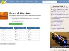
Hottest US Cities Quiz
In this online interactive geography quiz activity, students respond to 20 identification questions about the hottest cities in the United States. Students have 4 minutes to finish the timed quiz.
Curated OER
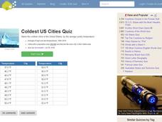
Coldest US Cities Quiz
In this online interactive geography quiz worksheet, students respond to 20 identification questions about the coldest cities in the United States. Students have 4 minutes to complete the quiz.
Curated OER
Geography: Water, Water Everywhere
Students discuss flooding and its causes. They view a Powerpoint presentation about floods and prevention methods. After creating a model with clay and pans, they investigate river behavior in various terrains with different amounts of...
National Park Service
It Was a Very Good Year
Waterton-Glacier International Peace Park includes whitebark pines that are over 1,200 years old, meaning they have been there since before medieval times. The second lesson of five details how to read tree rings for climate change and...
Curated OER
My Home of North Dakota
Discuss the people, history and geography of North Dakota using this resource. Learners use a variety of sources to do research on North Dakota and present their findings in a PowerPoint presentation. They answer questions involving...
Curated OER
Where Is That Place?
Students choose a school in their state to compare their weather to. They also describe the differences between country, state, and a city. They can make flashcards to help them remember the important terms and concepts.
Curated OER
Thematic Unit on Cats
Students discover in which climates the cats of the world live in. They review the different climates of the world and use maps and globes to help them locate continents.
Curated OER
Social Studies - Guessing Game
Focus on a particular geographic location with this resource. Learners use their social studies textbook to look up information about a specific place. They write down a list of facts and read them to the class. Classmates guess which...
Curated OER
Life in a Hurricane Zone
Students investigate the social effects of hurricanes. In this social studies instructional activity, students assume the persona of residents of the Dominican Republic and write diary entries and letters regarding the devastation caused...


