Curated OER
See You Later, Alligator
Students explore the historical and social significance of animals as cultural symbols in various countries around the world, as well as the impact that humans have made on the population and natural habitats of these animals.
Curated OER
Where Is Xinjinag?
Students geographically recognize the territory of Xinjiang Province by identifying the physical landscape and important cities. They see how human rights issues have affected the global, political, and economic arena in Xinjiang.
Curated OER
Health, Pollution, and Safety: Why Should We Care?
Students examine the impact of reducing the carbon dioxide emissions. They identify ways alternative fuels can lessen the effect of emissions on communities. Working in teams they conduct research from various community and Internet...
Curated OER
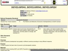
Developing, Developing, Developed!
Students differentiate among and explain various levels of economic development around the world. They see that levels of economic development vary greatly in different countries according to many different measures.
Curated OER
World Cup 2010: WebQuest and Activities
Students discover the history of the World Cup and the current host country, South Africa. In this athletics lesson, students utilize the Internet to research and complete a WebQuest about South Africa. Students discuss their prior...
Curated OER
History of Hong Kong
Eighth graders explore the sites and attractions of Hong Kong. In this Geography instructional activity, 8th graders research the different forms of transportation and major landmarks. Students create a travel brochure for Hong Kong.
Curated OER
The Commonwealth - Members and Structure
Learners research the member countries that make up the Commonwealth. They develop research skills using atlases. They define the word community. They complete an online geography quiz.
Curated OER
Could a World of Swimmers Raise Sea Level?
High schoolers determine the volume of water they displace. In this earth science instructional activity, students calculate the total water displaced by the world's population. They evaluate whether or not this value is enough to raise...
Curated OER
Tales From the Crypt
Eighth graders study the people of their community. In this Geography lesson, 8th graders research local history using maps and books. Students create a timeline of tombstones for deceased residents.
Curated OER
The Carter Center’s Work in Sub-Saharan Africa
Students explore the state of Sub-Saharan Africa. In this geography skills instructional activity, students examine the work of the Carter Center in Africa as they investigate the strengths and weaknesses of linguistic, tribal, and...
Curated OER
Get Smart
Learners study sustainability and smart growth. In this geography lesson students identify the benefits that are expected from smart growth.
Curated OER
Helping Hands: Promoting Gloval Awareness
Eleventh graders explore Canadian support for foreign aide. In groups, 11th graders discuss Canadian aide policies and express their opinion of each. Students brainstorm methods of contributing to developing nations. They complete...
Curated OER
Internal Spatial Structure of Cities
Students examine the internal spatial structure of cities. In groups, they analyze patterns of functions, structure and characteristics of settlement patterns. They also identify the population densities of land value of business...
Curated OER
Exploring Nations
Pupils, in groups, research countries in East and Southeast Asia. The group designs an oral presentation and PowerPoint slideshow to showcase research on landforms, political and economic issues, global interaction and special-purpose maps.
Curated OER
Oregon Forest Management Policy Decision Making
Fifth graders explore forest lands in Oregon and how the population affects forest management. They discuss benefits of retaining forests and logging. Given a mini-biography, 5th graders role play the forest management policies and...
Curated OER
World's Deadly Diseases
Students gain knowledge on the cause/effect of five major diseases. They clearly locate where major diseases are located throughout the world. Students obtain statistical information through research of the population of the world...
Curated OER
Prescription For Survival
Young scholars engage in a lesson that is focused upon the survival of populations located in third world countries. They conduct research using a variety of resources while focusing upon the delivery of healthcare with the help of...
Curated OER
On the Road Again": Moving People, Products, and Ideas
In this lesson plan learners learn how to identify modes of transportation and communication for moving people, products, and ideas from place to place. Students also study the advantages and disadvantages of different modes of...
Curated OER
The Fabric of Our World
Middle schoolers discuss cultural diversity, and examine how the community reflects the cultural background of the inhabitants. They read the book, People, take a community walk, create a rainbow chart, and research other states for...
Curated OER
LAND USE ISSUES
Learners relate math with real life situations. They identify and plot points on a grid map. They identify and locate the Drop Box Sites.
Curated OER
US City Quality of Life Analysis and Comparison
Students analyze US census data and criteria to compare and measure the quality of life in the country's fifty largest cities. After accessing the 2005 quality of life world report online, students conduct their study to compare three...
Curated OER
Sea Turtle Math
Students consider the future of endangered species. In this conservation instructional activity, students view a slide show and use mathematical data to construct a prediction for the survival of an endangered species. This instructional...
Curated OER
Exploring Arizona's Biotic Communities Lesson 1: Mapping Biotic Communities
As part of a unit on Arizona's biotic communities, young ecology learners create a map. They describe how humans and animals adapt in their habitat. They take notes and create graphic organizers from articles they read. Beautiful maps,...
Curated OER
Where Is Hoku?
Young scholars are introduced to map making and reading. Using maps, they identify the cardinal directions and discuss the importance of a legend. They analyze the human characteristics of the classroom and create overhead view maps of...


