Virginia Department of Education
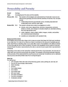
Permeability and Porosity
Covering both permeability and porosity, scholars perform a hands-on experiment testing various soil types. The material includes a pre-lesson worksheet to help focus pupils on the task at hand.
Curated OER
Science: What Happens to Create the Lode?
Students understand how mineral deposits are formed and why they are not evenly dispersed. They create and describe three different precipitates from four solutions simulating mineral ore deposit formation in sedimentary rock.
Curated OER
Investigating the Biosphere With Planetary Models
Students create a biosphere using the computer program SImEarth. They work in small groups to create "Daisyworld" in which they model aspects of the Gaia hypothesis. They form a question to answer and choose variables to investigate in...
Curated OER
Pangaea Puzzle
Students explore plate tectonics and the formations of the Earth's surface and why maps are distorted. In this Earth's surface lesson students complete a lab and answer questions.
Curated OER
work in pairs for the activities of this lesson which include researching and identifying butterflies, writing, and a brief oral presentation.
Students explore the concepts of rdioactive decay and dating. They generate a radioactive decay table, use their data to plot a decay graph, develop the concept of half-life, and then use the graph to find the age of a mummified seal in...
Curated OER
Ecology And the Conservation of Natural Resources
Students study Alfred Wegener's theory of continental drift and how the continents were connected in one large land mass called Pangaea. They examine plate tectonics and the theory that the earth's surface is composed of large moving...
Curated OER
Air, Air Everywhere! Lesson 2: Acid Rain
Middle school environmentalists record the pH of four different liquids, including two aerosol cleaning products. They liken the products to acid rain and speculate in writing which might affect the human respiratory system. Although...
Curated OER
Volcano Contour Models Activity and Tracing the Highs and Lows in San Francisco
Learners investigate how to draw topographic contours and read topographic maps.They examine the topography of San Francisco and contrast the elevation of different points within San Francisco.
Curated OER
How Does Your Soil Stack Up?
Students examine the soil in their local area and create a soil profile. They record observations in the field and the classroom. They create their own display of the soil profile as well.
Curated OER
Understanding Topographic Maps
Underclassmen create a cone-shaped landform and then draw a contour map for it. Then they examine a quadrangle (which was easily located with an online search), and relate it to what they experienced. The accompanying worksheet is...
Curated OER
Size and Shape
Young scholars observe different substances under the microscope. In this space science lesson, students identify the different features of SEM images. They formulate a conclusion about the images of Mars meteorites.
Curated OER
Design an Island
Young scholars explore islands. They create a two- or three-dimensional map of an island. They explain how the topography of an area influences the location of water sources, ecosystems, and human settlements. Lesson includes adaptations...
Curated OER
Edible Four-Layer Earth
This lesson is designed to come after students have studied about the four main layers of the earth. They may relate the size of the sections to known objects such as the mantle to the size of a grapefruit and the outer core to the size...
Curated OER
Earthquake Lesson Plans
With earthquakes a regular occurrence all over the world, including a recent one in Haiti, students can learn about these phenomena.
Curated OER
Date a Rock!
Students figure the number of half-lives since the sample solidified, and therefore the "age" of the sample rocks.
Curated OER
Investigating the Biosphere with Planetary Models
Young scholars model the biosphere and manipulate variables affecting change and plan their experiments with the help of others. They describe their question, hypothesis, and methods of investigation.
Curated OER
Jupiter's "Monstrous" Magnetosphere
Students explore Jupiter's magnetosphere. In this Jupiter lesson, students examine a diagram of the magnetic field that surrounds Jupiter.
Curated OER
Carving Mountains
Students explore geography by participating in an illustration activity. In this land-form lesson, students define vocabulary terms associated with glaciers and forests. Students utilize pens, cardboard and pottery clay to draw and...
Curated OER
The Fault Line
Pupils use cardboard models of the North American and Pacific plates and sand to investigate what happens when there is an earthquake or movement along the boundaries of the plates.
Curated OER
Giants of the Protozoa
Learners describe and define xenophyophores. In this protozoa lesson students divide into groups and complete a lab activity.
Curated OER
America Will Be
High schoolers work together to research and create different types of maps of the United States to be used as part of a geography trivia game.Groups research North American annual rainfall, climate, mountain ranges major rivers and...
Curated OER
Impressions in Clay
Students examine how fossils are created. They make impressions of different objects in clay and compare them to examples of fossils.
Curated OER
Design an Island
Students make a map of an imaginary island using the topographic symbols provided from a worksheet. Students place lakes, dwellins, reefs, etc. in areas where they would logically be located from understanding how the topography of an...
Curated OER
Science: Draining the Land - the Mississippi River
Young scholars use topographic maps to identify parts of rivers. In addition, they discover gradient and predict changes in the channels caused by variations in water flow. Other activities include sketching a river model with a new...
Other popular searches
- Geologic Time Scale Tests
- Geologic Time Scale Models
- Geologic Time Scale I
- Geologic Time Scale Lab
- Geologic Time Scale Unit
- Geologic Time Scale Biology
- Geologic Time Scale Posters
- Geologic Time Scale Colorado


