NOAA
Plate Tectonics I
Young geologists get a glimpse beneath the earth's surface in this plate tectonics investigation. After first learning about the different layers of the earth and the constant movement of its plates, young geologists work in small groups...
Curated OER
GPS Art
Learners design their own logo or picture and use a handheld GPS receiver to map it out. They write out a word or graphic on a field or playground, walk the path, and log GPS data. The results display their "art" on their GPS receiver...
Curated OER
Slinky and Waves
Young scholars watch a demonstration using a Slinky during a lecture on basic wave properties. Properties addressed in the demo include wave speed, wave length, amplitude, period, and frequency.
Curated OER
The Great MPA Debate
Students study the 'Marine Protected Areas' process. In this ocean lesson students work in groups, conduct research and present it to the class.
Curated OER
2004 Asian Earthquake and Tsunami Disaster Project
Students are employees of a unit of the United Nations, they are responsible for coordinating disaster relief after a major disaster (the 2004 Asian Earthquake and Tsunami) occurs. The agency needs to understand the situation in each...
Curated OER
Plate Tectonics Writing Assignment
Students complete a writing assignment focused on the use of data to support the theory of plate tectonics. They access data using the "Our Dynamic Planet" CDROM, capture images of the data plots, and incorporate them into their writing. T
Curated OER
Branches of Science Lesson Plans
Teachers can use branches of science lesson plans to get students excited about science careers.
Curated OER
What On Earth
Students explore earth science through concept mapping, discussion, and self-discovery.
Curated OER
Writing About the Indian Monsoon (Calibrated Peer Review):
Students develop an understanding of the atmospheric processes underlying the Indian Monsoon. They explore the use data to make a scientific argument. They listen to lecture on atmospheric circulation processes.
Curated OER
Earth System Science
Learners explore the Earth and its ability to support life. They discuss the geosphere and the water cycle and complete the Water Wonders activity. After completing the activity, they respond in their journals and reflect upon the...
Curated OER
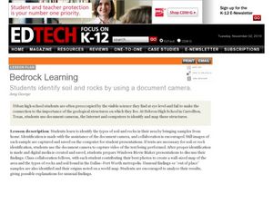
Bedrock Learning
Young scholars test and identify soil and rock samples. In this rock and soil instructional activity, students video themselves gathering samples. Young scholars test the samples and create graphs showing the results.
Curated OER
Building A Topographic Model
Students visualize, in three dimensions, features represented by contour lines on a topographic map. They see that the different elevations shown on a two dimensional topographic map can be used to build a 3-D model.
Curated OER
Water in the Texas Coastal Basins
Students, after researching a Texas coastal basin, map and graph the information they collect and then translate it into a short report to be presented to their classmates. They brainstorm unique ways to maintain Texas estuaries as well...
Curated OER
What is Biocomplexity?
Students dicuss different aspects of biocomplexity. They demonstrate synthesis of complex concepts by creating before and after posters expressing how the concepts of biocomplexity have ben internalized. Students define the term...
Curated OER
Writing about the climate
Learners research the contributing factors to the Earth's paleoclimate. They determine the relevant climate data and use it to construct a science argument. In the process, they access data, capture images of the data plots, and...
Curated OER
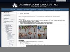
Four Seasons
First graders examine and describe the characteristics of the four seasons. Using a computer, they write one sentence about each of the four seasons and draws an illustration to accompany it. They present each drawing and sentence to the...
Curated OER
Bank On It! Antarctica
In this vocabulary worksheet, students read an informational paragraph about Antarctica. Students then fill in the 17 blanks with words from the word bank.
Curated OER
Photography and Composition
Students examine the techniques and principles of photographic composition using various scientific tools such as a camera, a digital computer scanner, and a computer.
Curated OER
Writing about the world's fisheries (Calibrated Peer Review)
Students summarize the findings of the Pew Ocean Commission report "America's Living Oceans," contrast it to an opposing viewpoint, and recommend a fisheries policy based on their understanding. It includes a scoresheet that was created...
Curated OER
Health, Pollution, and Safety: Why Should We Care?
Students examine the impact of reducing the carbon dioxide emissions. They identify ways alternative fuels can lessen the effect of emissions on communities. Working in teams they conduct research from various community and Internet...
Curated OER
Water: On the Surface and in the Ground
Learners explore the differences between surface water and ground water. They collect data using maps and graphs and investigate a Texas river basin and a nearby aquifer. They complete a written report including maps and data regarding...
Georgia Department of Education
Ga Virtual Learning: Geological Oceanography
This unit will focus on the geological characteristics of the world ocean, plate tectonics, and the mapping of the ocean floor.
Other
Dalhousie University: Department of Oceanography
Find out more about Grad studies, classes, seminars in the area of oceanography and also see some amazing pictures.
Georgia Department of Education
Ga Virtual Learning: Introduction to Oceanography
Students focus on the four branches of oceanography; chemical, geological, physical and marine oceanography, and how the scientific method contributes to ocean research and our understanding of marine science.


